2021年(令和3年)からJR飯田橋駅西口駅舎の1階に「史跡紹介解説板」、2階には「史跡眺望テラス」と「史跡紹介解説板」ができています(ここでは史跡紹介パネルとしてまとめています)。
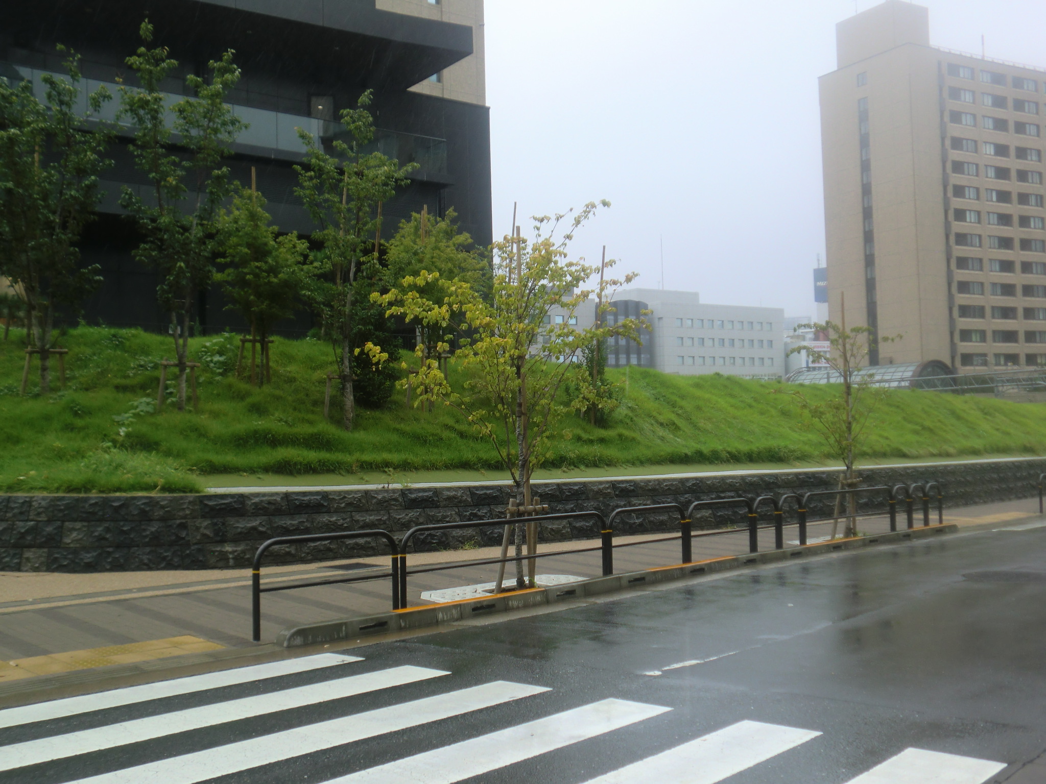
1階の西口改札外コンコースには「外堀を構築する見附石垣・土塁・堰の構造」を取り上げて、パネル[B]「外堀の土塁」は日本語と英語で解説しています。
外堀の土塁
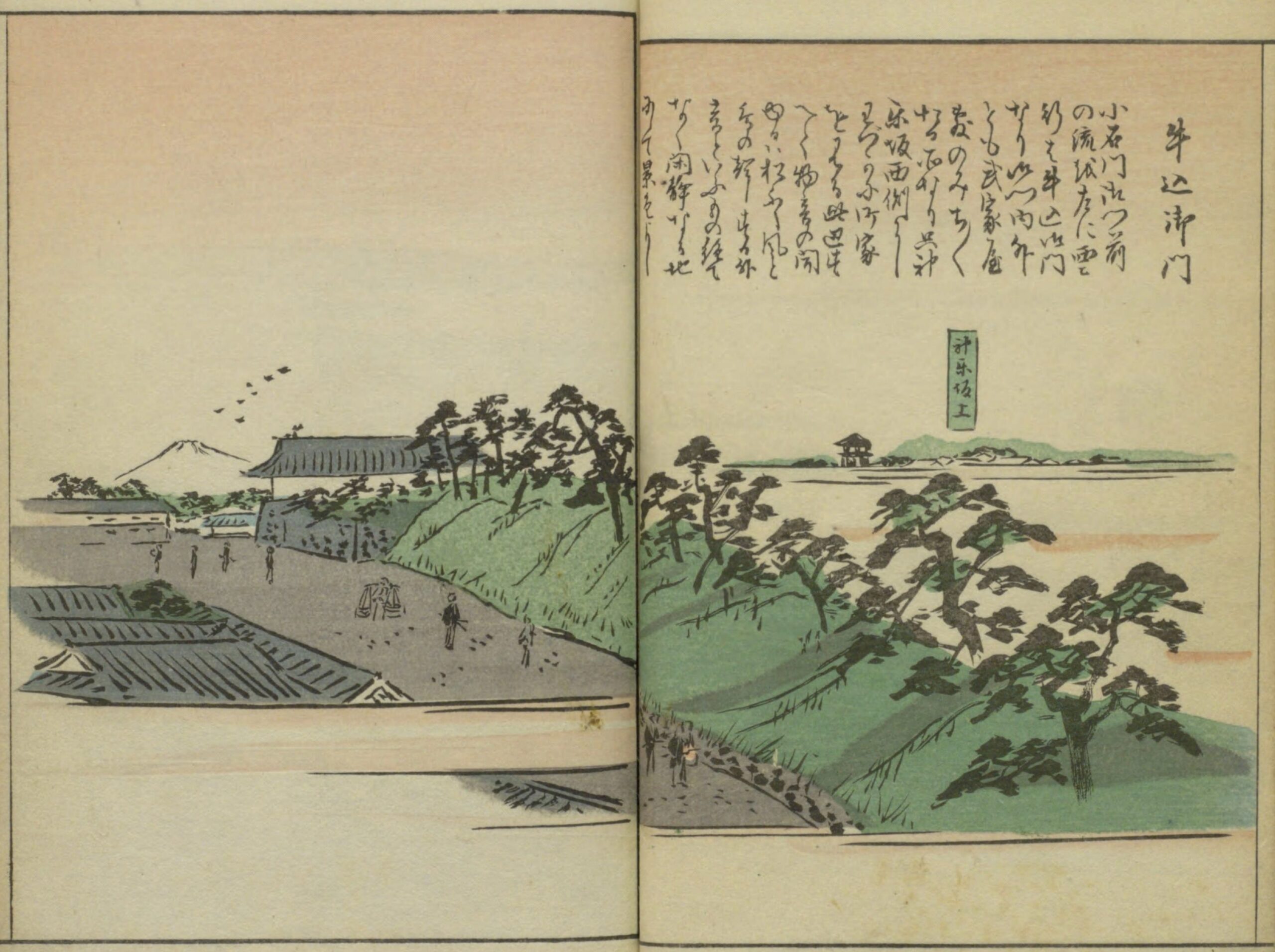
菊池貴一郎 江戸風景 誠文館 大正4年
NDL古典籍OCR-Lite-GUIでは
| 牛込御門 小石川御門前 の流を左に雲 行は牛込御門 なり御門内外 とも武家屋 敷のみちみち たる所なり只神 楽坂西側にし わづかに町家 を見る此辺す へて物音の間 ゆるは松ふし風と 鳥の起しする外 音といふもの絶て なく閑静なる地 にして景色よし |
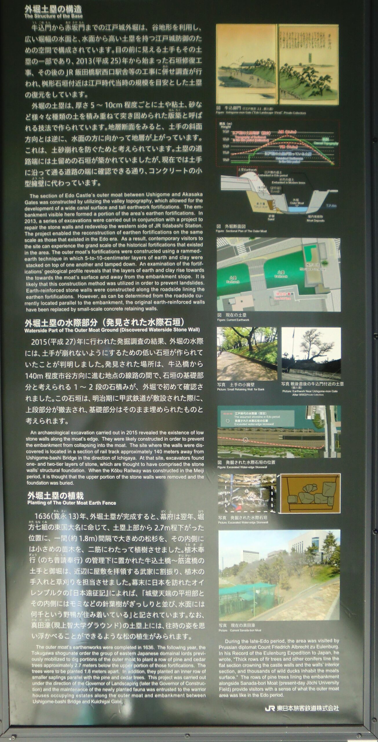
| 外堀の土塁 The Structure of the Outer Moat Ground 外堀土塁の構造 The Structure of the Base 牛込門から赤坂門までの江戸城外堀は、谷地形を利用し、広い堀幅の水面と、水面から高い土塁を持つ江戸城防御のための空間で構成されています。目の前に見える土手もその土塁の一部であり、2013(平成25)年から始まった石垣修復工事、その後のJR飯田橋駅西口駅舎等の工事に併せ調査が行われ、桝形石垣付近は江戸時代当時の規模を目安とした土塁の復元をしています。 外堀の土塁は、厚さ5~10cm程度ごとに土や粘土、砂など様々な種類の土を積み重ねて突き固められた版築と呼ばれる技法で作られています。地層断面をみると、土手の斜面方向とは逆に、水面の方に向かって地層が上がっています。これは、土砂崩れを防ぐためと考えられています。土塁の道路端には土留めの石垣が築かれていましたが、現在では土手に沿って通る道路の端に確認できる通り、コンクリートの小型擁壁に代わっています。 |
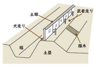
桝形 枡のような四角な形。城の一の門と二の門との間にある方形の広場。
版築 はんちく。板枠の中に土を入れて突き固め、層を重ねてつくる方法。板などで枠を作り、間に土と少量の石灰や凝固材を入れ、たたき棒などで、土を硬く突き固める。
土留め 法面や崖、盛土などの崩壊を防ぐため、土が低い土地に崩れてこないようにすること。
擁壁 土留めのための壁状の構造物
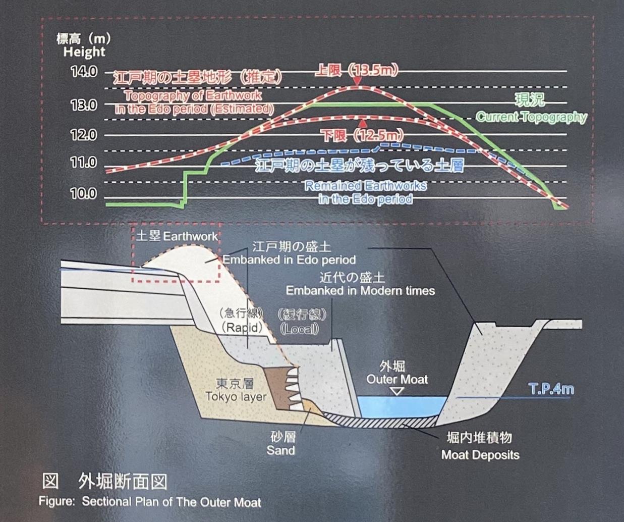
外堀断面図 [標高(m) 江戸期の土塁地形(推定) 上限(13.5m) 下限(12.5m) 現況 江戸期の土塁が残っている土層 土塁 江戸期の盛土 近代の盛土 (急行線)(緩行線)東京層 砂層 外堀 堀内堆積物 TP 4m]
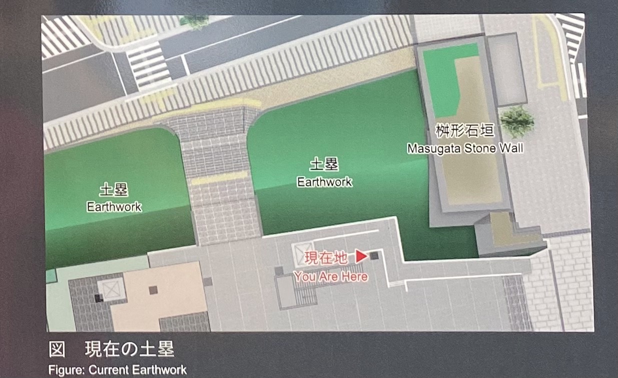
現在の土塁
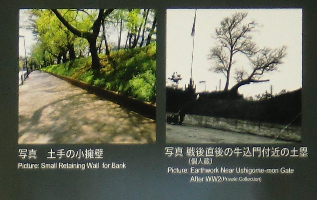
土手の小擁壁 戦後直後の牛込門付近の土塁
| The section of Edo Castle’s outer moat between Ushigome and Akasaka Gates was constructed by utilizing the valley topography, which allowed for the development of a wide canal surface and tall earthwork fortifications. The embankment visible here formed a portion of the area’s earthen fortifications. In 2013, a series of excavations were carried out in conjunction with a project to repair the stone walls and redevelop the western side of JR Iidabashi Station. The project enabled the reconstruction of earthen fortifications on the same scale as those that existed in the Edo era. As a result, contemporary visitors to the site can experience the grand scale of the historical fortifications that existed in the area. The outer moat’s fortifications were constructed using a rammed-earth technique in which 5-to-10-centimeter layers of earth and clay were stacked on top of one another and tamped down. An examination of the fortifications geological profile reveals that the layers of earth and clay rise towards the towards the moat’s surface and away from the embankment slope, It is likely that this construction method was utilized in order to prevent landslides. Earth-reinforced stone walls were constructed along the roadside lining the earthen fortifications. However, as can be determined from the roadside currently located parallel to the embankment, the original earth-reinforced walls have been replaced by small-scale concrete retaining walls. |
| 外堀土塁の水際部分(発見された水際石垣) Waterside Part of The Outer Moat Ground (Discovered Waterside Stone Wall 2015(平成27)年に行われた発掘調査の結果、外堀の水際には、土手が崩れないようにするための低い石垣が作られていたことが判明しました。発見された場所は、牛込橋から140m程度市谷方向に進む地点の線路の間で、石垣の基礎部分と考えられる 1〜2段の石積みが、外堀で初めて確認されました。この石垣は、明治期に甲武鉄道が敷設された際に、上段部分が撤去され、基礎部分はそのまま埋められたものと考えられます。 |
甲武鉄道 1889年(明治22年)大久保利和が開業。この鉄道は御茶ノ水から飯田町、新宿、国分寺、立川、八王子に至る。1906年(明治39年)10月1日、鉄道国有法で国有化され、中央本線の一部に。
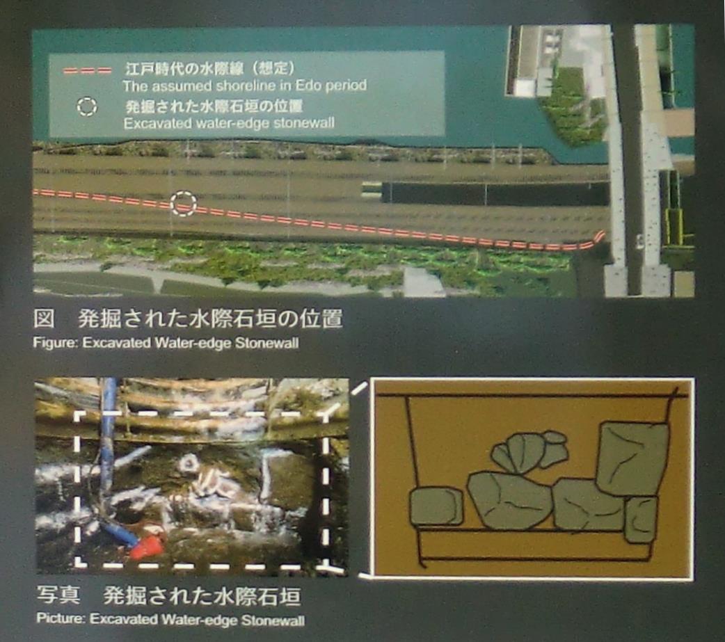
発掘された水際石垣
| An archaeological excavation carried out in 2015 revealed the existence of low stone walls along the moat’s edge. They were likely constructed in order to prevent the embankment from collapsing into the moat. The site where the walls were discovered is located in a section of rail track approximately 140 meters away from Ushigome-bashi Bridge in the direction of Ichigaya. At that site, excavators found one- and two-tier layers of stone, which are thought to have comprised the stone walls’ structural foundation. When the Kōbu Railway was constructed in the Meiji period, it is thought that the upper portion of the stone walls were removed and the foundation was buried. |
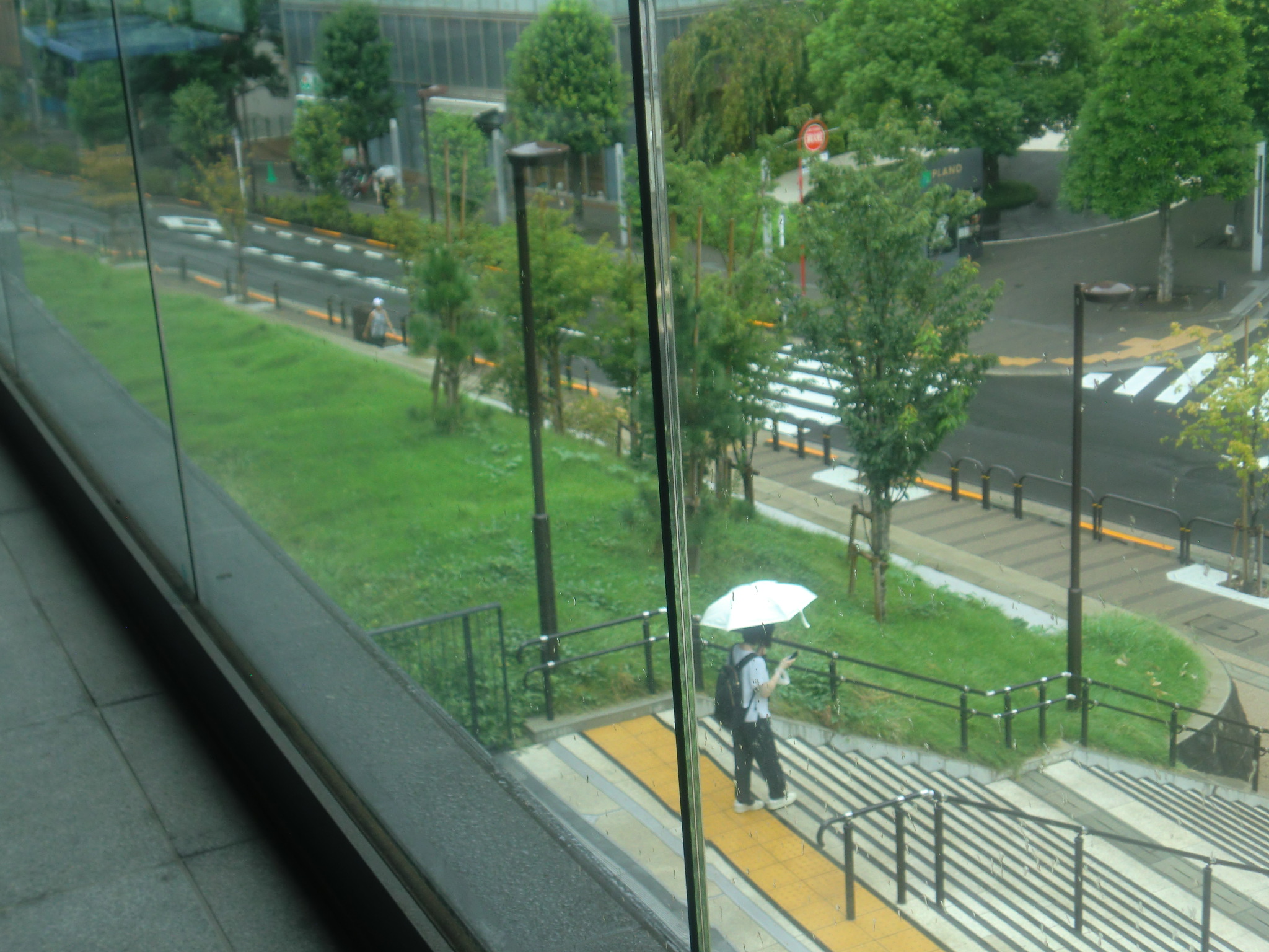
| 外堀土塁の植栽 Planting of The Outer Moat Earth Fence 1636(寛永13)年、外堀土塁が完成すると、幕府は翌年、堀方七組の東国大名に命じて、土塁上部から2.7m程下がった位置に、一間(約1.8m)間隔で大きめの松杉を、その内側には小さめの苗木を、二筋にわたって植樹させました。植木奉行(のち普請奉行)の管理下に置かれた牛込土橋~筋違橋の土手と堀は、近辺に屋敷を拝領する武家に割振り、植木の手入れと草刈りを担当させました。幕末に日本を訪れたオイレンブルクの『日本遠征記』によれば、「城壁天端の平坦部とその内側にはモミなどの針葉がぎっしりと並び、水面には何千という野鴨が住み着いている」と記されています。なお、真田濠(現上智大学グラウンド)の土塁上には、往時の姿を思い浮かべることができるような松の植生がみられます。 |
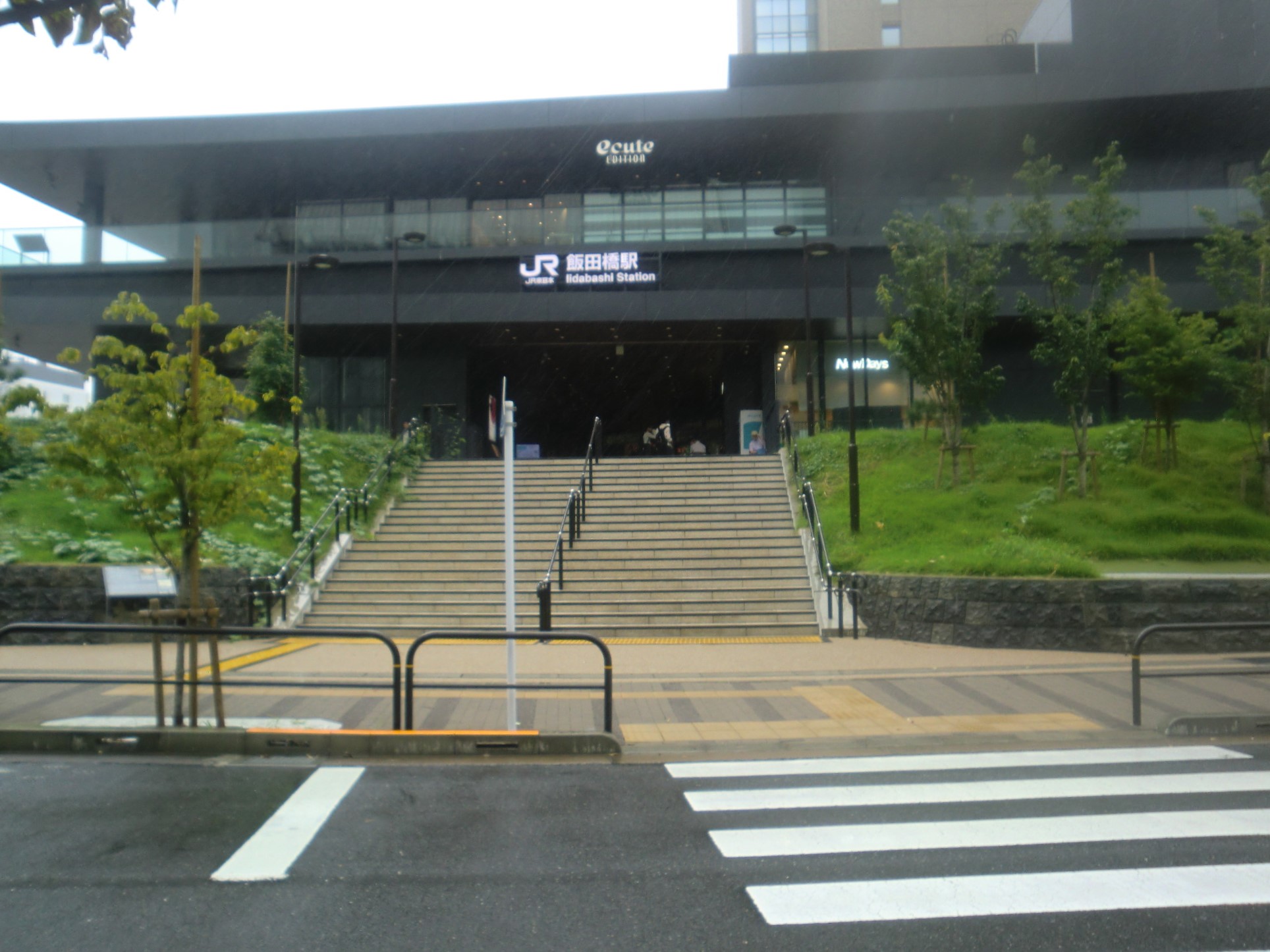
現在の飯田橋駅西口B
飯田橋駅西口Bの土塁の上部に松などの植林
飯田橋駅西口Bの2階から土塁を見る
堀方七組 関東・奥羽の大名52家を「堀方」7組に編成して江戸城西方の堀を構築させた。
松杉 しょうさん。松と杉。松の木と杉の木。
植木奉行 植木に関する用務を担当し、手代15人、同心51人を指揮。寛政3年(1791)廃止。
普請奉行 御所、城壁・堤防などの修理造築、上下水道等の土木工事、武家屋敷請取りなどの事もつかさどる職名。文久2年(1862)廃止。
オイレンブルクの『日本遠征記』 幕末、プロイセン使節団の遠征記。条約を結ぶためにドイツ地方の代表として日本にやってきた。
城壁天端… 『日本遠征記』によれば「外城の城壁や堀は内側の城のそれらとまったく似ている。この都市の一画は南西方面に著しく高くなっている。そして同様に、草のたくさん生えた傾斜地が水をたたえた堀に面する所で終っている。堀は所々大きな池となって広がる。見事な樹木が、蓮の生えた浅い池の上に枝を垂らし、その池には何千という野鴨が住み着き、また城壁の樅の木には、無数の鳥やその他の猛禽が巣くっている。これらの鳥は誰にも追われたりしない。その狩猟は将軍のみが持つ特権に属するものだからである」
| The outer moat’s earthenworks were completed in 1636. The following year, the Tokugawa shogunate order the group of eastern Japanese domainal lords previously mobilized to dig portions of the outer moat to plant a row of pine and cedar trees approximately 2.7 meters below the upper portion of those fortifications. The trees were to be planted 1.8 meters apart. In addition, they planted an inner row of smaller saplings parallel with the pine and cedar trees. This project was carried out under the direction of the Governor of Landscaping (later the Governor of Construction) and the maintenance of the newly planted fauna was entrusted to the warrior houses occupying estates along the outer moat and embankment between Ushigome-bashi Bridge and Kuichigai Gate. During the late-Edo period, the area was visited by Prussian diplomat Count Friedrich Albrecht zu Eulenburg. In his Record of the Eulenburg Expedition to Japan, he wrote, “Thick rows of fir trees and other conifers line the flat section crowning the castle walls and the walls’ interior section, and thousands of wild ducks inhabit the moats surface.” The rows of pine trees lining the embankment alongside Sanada-bori Moat (present-day Jōchi University Field) provide visitors with a sense of what the outer moat area was like in the Edo period. |
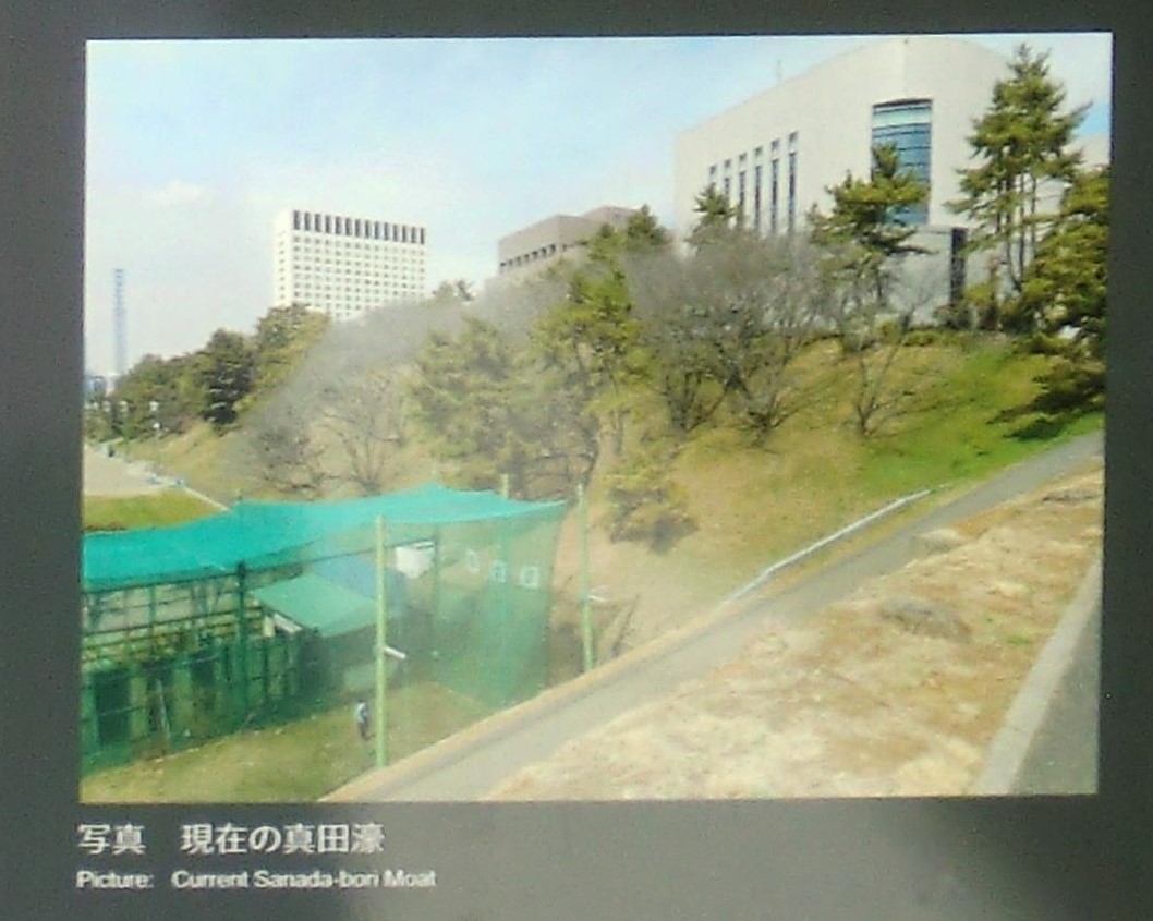
現在の真田濠