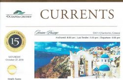
ケファロニア島について。Currentsから

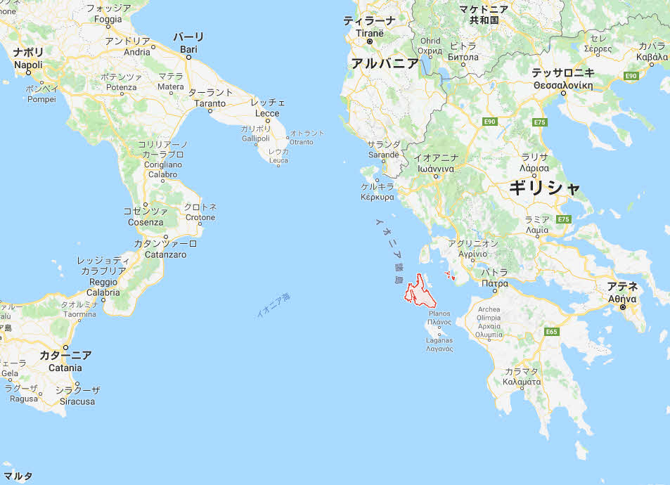
 イオニア海のケファロニア(Kefalonia、Cephalonia)島は、驚くほど美しく、石灰岩がつくった切り立った崖、斜面にはオリーブの木が点在する段々畑があります。島の頂点はアイノス山で、標高は1774メートル。広い地域はよく茂った亜熱帯植物でおおわれ、偉大な山や海が織りなす景色は島中で見えます。
 ケファロニア島の多くの場所は、激動する歴史を反映し、王や支配者は絶えず変わりました。中世ではシチリアのノルマン王が島を支配し、その後、イタリアの領主だったモレアス専制公は300年ほど支配しました。 1478年には、トルコがこの島を征服し、20年後にはベニスに敗北しました。そして、短時間ですが、英国も支配しています。最後に1864年、ケファロニア島はギリシャに戻りました。 1823年、バイロン卿は数か月をこの島で過ごし、人々の不朽の精神、自然の美しさと豊かな歴史に魅了されました。
 ケファロニア島を訪れる人は、穏やかなアッソスの漁村や美しいアルゴストリの町などで時間を過ごしています。島のその他のハイライトには、ベニスの要塞、13世紀の城、壮観な洞窟などがあります。
 島の最大の町で活気のある州都アルゴストリは、半円形に並び、盛んな都市生活もあり、活発な歓楽地もあります。あらゆる趣味の店、ほっとするコーヒー、近所のバー、またビーチもあります。アルゴストリは1953年の地震で完全に崩壊しましたが、古いベニスの建築はまだあります。巨大壁がある旧クラニ街を見ることも、歩行者通りを歩くこともできます。機会があれば、地元のフィルハーモニー管弦楽団が伝統的なイオニアの歌を演奏するでしょう。遊歩道を歩き、波止場を散策することもできます。
 アルゴストリの多くの娯楽地は港から徒歩圏内です。古い建物の再建が今も行われているものもありますが、大部分はここ60年間に再建は終えています。市の中心はバリアヌ広場で、店舗、タベルナ、その他の商業地に囲まれています。広場の2ブロックほど南に主要ショッピング街、リトストロトがあります。これは歩行者専用の石畳の商店街です。市内には2つの素敵な小さな博物館があります。考古学博物館には、ミケーネン時代からローマ時代までの遺物があります。コルヤレニオス歴史民俗芸術博物館には、地震以前での島の展示が沢山あります。美しいデボセット橋は19世紀初頭に建築され、数年後には石橋で置き換えられました。ここは街で最も人気のある撮影スポットの1つです。また、地震後に再建されたドーリア式の灯台も撮影スポットです。
 地元の料理を試していないままアルゴストリを去ろうとするのはいけません。昼食のために心のこもったケファロニアっ子のミートパイを試し、島で生産する地元のワイン、ロボラを飲みましょう。アルゴストリの主要な道のパン屋で丸いチーズパイを食べ、パンを手に取ったら地元のタイム・ハニーをつけるのを忘れずに。

⇦ もどる

The Ionian Island of Kefalonia, also known as Cephalonia, is strikingly beautiful, with jagged limestone cliffs and terraced slopes dotted with olive groves. The highest point on the island is Mount Ainos, rising to 5,914 feet (1774 meters). Large areas are covered by luxuriant subtropical vegetation, and all around the island, the scenery offers magnificent views of the mountains and the sea.
Many sites on Kefalonia reflect its tumultuous history of ever-changing kings and rulers. The Norman Kings of Sicily ruled the island during medieval times, followed by Italian overlords who ruled for three centuries under the principality of the Morea. In 1478, the Turks conquered the island only to be defeated 20 years later by the Vegetians. And, for a short time the British ruled here as well. Finally in 1864, Kefalonia was returned to Greece. In 1823 Lord Byron spent several months on the island, captivated by the enduring spirit of the people, the natural beauty of the land and its rich history.
Visitors to Kefalonia look to spend time in such places as the serene fishing village of Assos and the scenic town of Argostoli. Other highlights on the island include a Venetian Fortress, a 13th century castle and spectacular caves.
The biggest town of the island and the lively capital of the island is Argostoli, a town built amphitheatrically, with intense city life and active, full of various types of entertainments: shops for every taste, coffee to relax, bars and beaches nearby. Although Argostoli was totally ruined by an earthquake in 1953 there are still sites that depict the old Venetian architecture. You can see the old town Krani with the Cyclopean Walls, you can walk on the pedestrian street, where if you have the opportunity you may encounter the local philharmonic orchestra playing traditional Ionian songs; you can complete your promenade strolling through the dock.
Argostoli’s attractions are mostly within walking distance of the port. Though some are reconstructions of older buildings, for the most part, the capital has been reconstructed over the last 60 years. The meeting point in the city is Vallianos Square surrounded by shops, tavernas and other businesses. A couple blocks south of the square is the main shopping street, Lithostroto. which is a pedestrian-only cobblestone shopping mall. There are two nice small museums in the city. The Archaeological Museum has artifacts from Mycenean to Roman times. The Korgialeneio History and Folk Art Museum includes many displays showing the island prior to the earthquake. The picturesque De Bosset Bridge was built of wood in the early 19th century, but replaced a few years later with stone. It is one of the city’s most popular photo spots along with the Doric-style lighthouse rebuilt after the earthquake.
Don’t leave Argostoli without trying a few of their local specialties. Try a hearty Kefalonian meat pie for lunch, and wash it down with a glass of Robola, the local wine produced on the island. Drop by the bakery on Argostoli’s main thoroughfare for a round cheese pie, and pick up some bread to drizzle local thyme honey on.
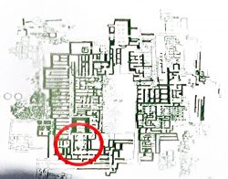
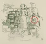
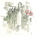
クノッソスの説明版(一部)


南正門
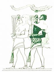
今日見ている「南正門」は、エバンスが修復したもので、これは「酌人」のフレスコ画をコピーしたものです(図1)。
壁画は、神酒の花瓶(リートン)を持つ男を描いています。そのテーマは、エバンスによれば、「南前門」に達した「行列のフレスコ画」と関連しています。
ピトス(大きな貯蔵瓶)は、前門の東側にあり、後宮殿期(紀元前1450年〜1100年)に属し、後で貯蔵に使用したようです。
SOUTH PROPYLAEUM
The ‘South Propylaeum’ as we see it today is a result of the restoration of Evans who put up a copy of the ‘Cup-Bearer’ fresco here (Fig.1).
The wall painting depicted a man holding a libation vase (rhyton). lts theme is connected with the “Procession Fresco” which, according to Evans, reached here the ‘South Propylaeum’.
The pithoi (large storage jars) on the east side of the Propylaeum belong to the Postpalatial Period (1450-1100 B.C.), and indicate that the area was later used for storage.
東門と「大階段」
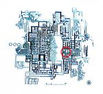
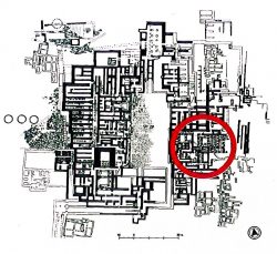
東門の大部分は、宮殿の残りの部分の上にある丘の側面に建てられているので、中央広場から見ることができません。宮殿の最も興味深い部分の1つですが、理由は 2つの階層が中央広場の下に保存されているからです。今日では、その大部分がコンクリートで再構築されています。
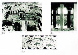
階層は「大階段」と呼ばれる階段のシステムによって互いに接続されています。階段は掘削中に元の位置にありました(図1,2)。階段は合計で4つあり、各2階層に2つずつあります。2つある下段は、発見したときと同じように保存されています。段差は広く、深く、緩やかな傾斜があり、簡単に上昇できます。階段は大きな光の井戸で照らされ、木製の柱の吹き抜けに囲まれています。
一連の廊下、広々としたホールと小さな部屋が あり、大階段に続きます。宮殿がクノッソス王の席であると信じたエバンスは、王室の居住区がこの場所だと仮定していました。
East wing, “Grand Staircase”
A large part of the East Wing cannot be seen from the Central Court as it is built into the side of the hill on top of which lies the rest of the Palace. It is one of the most interesting parts of the palace because two storeys are preserved below the levelof the Central Court. Today, a large part of it has been reconstructed in concrete.
The storeys are connected with one another by means of a system of stairs known as the “Grand Staircase”. The staircase was found during the excavation in its original position (Fig.1,2). There is a total of four flights of stairs, two for each storey.
The two lower flights are preserved as they were found. The steps are broad and deep, with a gentle incline that makes for an easy ascent. The staircase is lit by a large lightwell and surrounded by a colonnade of wooden columns.
A series of corridors, spacious halls and small rooms is connected to the Grand Staircase. Evans, who believed that the Palace was the seat of the king of Knossos hypothesized that the residential quarters of the Royal family lay in this part of the site.
「双斧の間」と「女王のメガロン」

双斧

双斧

ミノア時代の政治組織に関する考古学的情報はごく限定しています。それにもかかわらず、ミノス王に関して、また王権制度のエバンスの解釈に関して、神話的伝統は、宮殿やその空間に影響を与えてきました。「王家居住区(Royal Apartments)」はこの地域に位置しています。
「双斧の間」(Hall of the Double Axes)
「双斧の間」(図1)は、命名者はエバンスがですが、後ろにある光の井戸の壁面に刻印した二重の斧という絵のためです。彼はまた、それがクノッソスの王座か王の居住地であると考えました。
  中央領域は側面3面に開口部があり、したがって「ポリチロン」(出入口が複数ある状態)と呼ばれています。床に厚板があり、壁は石膏の厚板とフレスコ画で装飾されています。「ポリチロン」と光の井戸の間の領域は迎賓館として使用されました。木造の痕跡がここに見つかりました。エバンスはこの場所で木製の王座を再建しました。考古学的な発見によると、上層階の居住区の配置は1階の居住区と似ていました。

双斧の間


「女王のメガロン」
「双斧の間(Hall of the Axes)」の近くには、小さなホールがあり、同様に配置され、豊かに装飾されています(図2)。エバンスはそれが女王に属していたに違いないと思いました。イルカやダンスする女性が書いていたフレスコ画の断片が見つかりました。部屋は大きく復元され、井戸の絵画は壁に貼られています(図3)。部屋の終わりに、1列の低い隔壁が小空間を作り出しました。それは粘土の “風呂”の部分がそこに見つかったので、 “女王の浴室”だと考えられました。
 「女王のメガロン」に、廊下が準備と洗濯の場として解釈された部屋として加わります。

The “Hall of the Double Axes” and the “Queen’s Megaron”
Archaeological information concerning political organization during the Minoan period is very limited. Nevertheless, the mythological tradition concerning King Minos and Evans’s notions concerning the institution of kingship have influenced interpretations or the Palace and its spaces. The “Royal Apartments” have been located in this region.
THE “HALL OF THE DOUBLE AXES”
The “Hall of the Double Axes” (Fig.1) was so named by Evans due to the double-axe signs engraved on the walls of the light-well at its rear. He also thought that it was the place or residence of the king of Knossos.
The central area has openings on three sides and is therefore called a”polythyron” (system with multiple doorways). lt has a slab floor and its walls were embellished with gypsum slabs ard frescoes, The area between the “polythyron” and the lightwell was used as a reception hall. Traces of a wooden construction were found here. Evans reconstructed a wooden throne at this spot.
According to the archaeological finds the arrangement of the apartments on the upper foor was comparable with those on the ground floor.
The “QUEEN’S MEGARON”
Near the “Hall of the Double Axes” is a smaller hall, comparably arranged and richly decorated (Fig.2). Evans thought that it must have belonged to the Queen. Fragments of frescoes with dolphins and dancing ladies were found. The room is largely restored and copies of the well Paintings have been put up on the walls (Fig.3). At the end of the room,a low partition wall with one column created a small space. It was thought that it was the “queen’s Bathroom” since pieces of a clay “bath” were found there.
A corridor joins the “Queen’s Megaron” with rooms that have been interpreted as places of preparation and washing.

「教室」、「宝石工房」

教室

ここには、いわゆる「教室」があります。 エバンスによると、書記官は粘土板を書くように教えられました。エバンスはベンチの隣にあるしっくいから粘土をつくったと考えました(図1)。しかし、陶磁器や壁画の工房の可能性の方が高いと考えています。
「教室」の後ろには「宝石工房」があり、そこには未加工や半加工のラペス・ラセデモニウス(スパルタン玄武岩)や石の道具がありました。エヴァンスによると、主な工房は上階にあり、花瓶と大きな石のつぼが1階に落ちたといいます。

“SCHOOL ROOM”, “LAPIDARY’S WORKSHOP
Here is the so-called “School Room”, an area where, according to Evans, scribes were taught to write on clay tablets. He supposes that they kneaded the clay in the built mortar next to bench (fig.1). It is more likely, however, that was a workshop for ceramic or wall-painting,
Behind the “School Room” is the “Lapidary’s Workshop”, where blocks of unworked or semi-worked lapis lacedaemoniae (spartan basalt) and stone tools were brought to light.
According to Evans, the main workshop lay on the upper floor from which vases and a large stone amphora had fallen to ground floor.

「巨大瓶の倉庫」と「東の要塞」
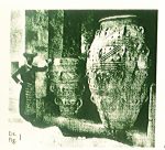
 あなたの前に見える巨大なピトイ(貯蔵瓶)は、エバンスがつけた名前「巨大瓶の倉庫」(図1)という場所にありました。この倉庫は、宮殿の古い部分の1つです。 ピトイは、大きさ、取っ手の数、ロープや円板を使ったレリーフ装飾の豊かさで区別されます。
 右側には、エバンスによって再建した階段があり、下に行くと宮殿の東の入り口になります。 入り口は強固な構造で「要塞」の印象を与えます(図2)。この点から、いわゆる「王家の大邸宅」という宮殿時代の重要な建物に簡単に到達できます。主要な考古学的サイトの外にありました。

The “Magazines of the giant pithoi” AND THE “EAST BASTION”
  The great pithoi (storage jars) you see before you, were found in a place named by Evans, the “Magazines of the Giant Pithoi” (Fig.1), These magazines are one of the older parts of the Palace. The pithoi are set apart by their size, number of handles and the richness of their relief decoration with ropes and discs.
  On the right you see a staircase which has been reconstructed by Evans and descends to the east entrance of the Palace. The entrance is a robust construction that gives the impression of a “bastion” (Fig.2). From this point it would have been easy to reach an important building of the palatial period, the so-called “Royal Villa” which lies outside the main archaeological site.

Currents イラクリオン

Currents 2018/10/26

Currents 2018/10/26

イラクリオンは、クレタ島で最大の都市で、ギリシャの主要な都市のひとつです。その発展は9世紀初めに始まりました(古代では、クノッソスは島の最も重要な中心であり、ゴーティンが続いています)。その後、イラクリオンは イスラム帝国、ベネチア共和国、オスマン帝国の支配下に入りました。その征服者は当初ハンダクかハンダクという名前を与え、それがカンディアに変わりました。 2004年のオリンピックでは、イラクリオン市がサッカー競技場を提供しました。考古学的な証拠によると、イラクリオンはおそらく、前9世紀、ゼウスの母、レアというギリシャの女神に敬意を表して命名されたものです。ほとんどの地中海都市と同様に、イラクリオンは長くて激動のある歴史があります。9世紀にサラセン人が正式に設立、961年、ビザンチン帝国はクレタ島に侵入し、1211年にはベネチア人にこの島を売却しました。わずか1000個の銀貨のためでした。イラクリオンはついにベネチア人の下で栄えました。市内全域で、ロッジア、ベネチアの壁、そしてモロシニの噴水などの記念物を見つけることができます。しかし、おそらくイラクリオンはクノッソス の4000年前の息を呑む美しいミノア遺跡とラシティ高原(Lassithi Plateau)に広がる有名な風車の玄関口として知られています。
 イラクリオンの最も有名な観光スポットの中には、「旧市街」を示す要塞壁があります。最初の要塞はアラブ人が建設し、その後ベネチア人が強化しました。七つの砦から、マーティンゴ砦だけが今も生き残っています。訪問者は街を見下ろす所に有名な作家のN・カザンザキスの墓を見つけるでしょう。街にはいる4つの門のうち、特徴的な翼の付いたサンマルクのライオンのあるチャニョポルタ門と南側の新門(1587年)だけが現在も存在します。モダンな施設の隣にある(ベネチアの)古港では、丸天井のタルサナードを見ることができます。ここは造船の場所でした。一方、西側にはクールス要塞があります。市内の中心部には、イラクリオンが大きな繁栄を見せていた中世で数多くの記念碑があります。港から、アウグストウ(8月)25日の通りを上ると、広場に達し、アギオス・ティトスの教会があります。隣にはベネチアのロッジアがあり、これは壮大で華やかなアーケードのブレゾンやトロフィーで飾られたベネチアの建物です。ベネチア時代の公爵夫人や他の貴族の会合場としての役割を果たしていました。
 イラクリオンの典型的な特徴は、ベネチアの噴水とトルコの噴水であり、街のいたるところに散在しています。最も有名なのはベネチア風のオルゾーニ噴水で、地元の住民や観光客のランドマークとしても知られています。その他の注目すべきベネチアの噴水は、コルナロス広場のベンボ泉、ロッジアの北西端に建てられたサグレド泉、港の近くにあるプリウリ泉です。今日のイラクリオンは、再生の速い流れと、過去とのつながりを維持しようとする深い願望もあり、この2つの間で生きています。この2本の糸は両方ともその性質を定義しています。過去100年だけでも大きな変化があり、この町では極めて簡単に追うことができます。建物や通りはクレタ島の変化する運命を反映しています。中世から確立された街の「旧市街地」は、街の中心部で素晴らしい散策の旅をお届けします。

⇦ もどる

Iraklion is the largest city of Crete and one of Greece’s major urban centers. Its development begun in the wake of the 9th century AD (in antiquity, Knossos was the island’s most important centre, followed by Gortyn). In later times, Iraklion came under Arabic, Venetian and Ottoman rule; its conquerors initially gave it the name Khandaq or Handak, which was corrupted to Candia. During the 2004 0lympic Games, the city of Iraklion provided one of the venues for the football tournament. Archaeological evidence shows that Iraklion probably arose during the 9th century B.C. and was named in tribute to the Greek goddess Rhea, mother of Zeus. And like most Mediterranean cities, Iraklion has a long and turbulent history. Officially founded by the Saracens in the 9th century, the Byzantine Empire invaded in 961 only to lose control to the Crusaders who sold Crete to the Venetians in 1211 for a thousand silver coins. Iraklion finally flourished under the Venetians. Throughout the city you’ll find stunning reminders of their influences the Loggia, Venetian Walls, and Fountain of Morosini are just a few must-see examples. But Iraklion is probably best known as the gateway to the breathtaking 4,000 year-old Minoan ruins at Knossos and to the famous windmills stretched across the Lassithi Plateau.
Among the most outstanding sights of Iraklion are the fortification walls that delimit the “old city”. The first fortifications were built by the Arabs and were later reinforced by the Venetians. From the seven bastions, only the Martinengo bastion survives to this day; there visitors will find the tomb of the renowned writer N Kazantzakis, overlooking the city. From the four gates to the city, only Chanioporta with the characteristic winged Lion of Saint Marc and the New Gate (1587) at the southern side survive today. In the old (Venetian) port, next to the modern facilities, one can see the vaulted tarsanades where ships used to be built, while the westem side is dominated by the Koule fortress. In the heart of the city there are many monurnents dating to the Middle Ages, a period in which Iraklion witnessed great prosperity. From the port, ascending 25 Avgoustou (August) street, one reaches a square where the church of Agios Titos is found, while next to it lies the Venetian Loggia, a magnificent, ornate arcaded Venetian building decorated with blazons, and trophies which served as a meeting Place for the Duke and other noblemen during the Venetian period.
A typical feature of Iraklion is its Venetian and Turkish fountains, scattered all around the city. The most famous one is the Venetian style orozini-fountain, also known as the Lions, a landmark for local inhabitants and visitors alike. Other noteworthy Venetian fountains are the Bembo fountain on Kornaros Square, the Sagredo fountain built in the northwestern corner of the Loggia, and Priuli fountain located near the port. Iraklion today is living between the fast moving currents of regeneration and a deep desire to maintain links with a past. Both these strands define its character. ln the last hundred years alone, we have seen huge changes which can be quite easily followed, in buildings and streets that reflect the changing fortunes of Crete. The “old town” areas of the city, established from mediaeval times, now offer visitors some fantastic walks in the heart of the city.

シャトルバス

ヘラクリオンへのシャトルバスサービス

 今日イラクリオンで ターミナルに到着するためには、港湾局が提供する無料のシャトルバスをご利用ください。投錨地同士をつなぐ歩行は禁止されています。シャトルバスは、午前8時から連続的に船から運行し、最後のバスは午後10時30分です。シャトルバスは先着順で運行されており、満席になると予定より早く出発します。シャトル間の間隔はおおよそのもので、オセアニアクルーズは、シャトルの予定で予期できない遅延や変更があっても、その責任を負いません。

⇦ もどる

SHUTTLE BUS SERVICE IN HERAKLION
Today in Heraklion guests may use complimentary shuttle buses provided by the locaI port authority to reach the terminal, walking is not permitted between berths. The shuttle buses will run continuously from the ship beginning at 8:00 am. with the last shuttle returning to the ship at 10:30 pm. Shuttle buses are operated on a first come, first served basis and may depart earlier than scheduled if filled to full capacity. lnterval between shuttles is approximate and Oceania Cruises are not liable for any unforeseen delays or changes to the shuttle schedule.

サントリーニのワイン醸造所とイア

  カラフルな地元のボートに乗り、 地上のアティニオス港に到着すると、そこにはエアコン付きの観光バスが待っています。

 ワイン醸造所を訪問すると、ワインがサントリーニで生産した方法について、有益な洞察を与え、ワイン醸造所のガイド付きツアーの終わる時には、サントリーニで最も有名なワインを試飲する機会が与えられるでしょう。

 続いて、島の最北端に行き、ユニークなイア村を体験します。カルデラの急な斜面にあり、あっと驚くほど小さな村で、多くの家屋は火山岩の間にあります。島にはかつては裕福な船員の大邸宅があり、そして鮮やかなパステルカラーの映像が浮かび上がってきます。狭い石畳の通りを散歩すると、多くの趣のある店舗に出会え、手作りの陶器、絵画、飾り石など、さまざまな珍しい収集品を提供します。崖の端に抱かれているようなカフェでは、ティラ島や火山の素晴らしい景色を楽しめます。船に帰る前にゆっくりと村を楽しむため自由時間があります。

注意:このツアーには、でこぼこのある地面や石畳の通りがあり、歩行がやや困難な場合もあります。急な上り坂があり、ティラ(フィラ)町の停留所からケーブルカーまで何歩か歩く必要があります。また、イア村には階段もいくつかあります。車椅子のお客様には適していません。移動の懸念がある人は、能力とスタミナの個人的なレベルを評価するように注意を払いましょう。帽子と平坦で快適な歩行用シューズをお勧めします。醸造所でワインを購入して家に持ち帰るお客様は、税関の規制により、ワインの配送に最大3ヶ月以上かかる場合もあります。

⇦ もどる

Traveling by colorful local boat , you will be transferred ashore to Athinios where your air-conditioned motor coach awaits you.

Your visit at the winery will provide an informative insight into how wines were once produced in Santorini and at the conclusion of your guided tour of the wine cellar, you’ll be given the opportunity to sample some of Santorini’s most renowned wines.

Continuing on, you will next make your way to the most northern tip of the island to experience the unique village of Oia.  A spectacular small village situated on a steep slope of the caldera, many of its homes are found nestled in niches hewn into the volcanic rock. Still evident today are the large island mansions that were once home to wealthy seafarers of the past, creating a vibrant picture with their spectrum of pastel colors. As you stroll down the narrow cobbled streets, you’ll encounter many quaint shops that offer a varied and unusual collection of hand-made ceramic art, paintings and semi-precious jewelry. Cafes that seem to cling to the edge of cliffs offer spectacular views of Thira and the volcano. Free time is provided for you to leisurely enjoy the village before returning to the ship.

Please note: This tour includes moderate walking at times on uneven ground and cobblestone streets. There is steep uphill walk and several steps from the parking stop in Thira town to the cable car. Also there are several steps in the town of Oia village. It is not considered suitable for wheelchair guests. Those with mobility concerns are cautioned to evaluate their personal level or ability and stamina. Hats and flat, comfortable walking shoes are recommended. Those guests making wine purchases at the winery due for shipment to their howes are advised that due to Customs regulations, wine deliveries can take up to 3 months or longer.

クノッソス遺跡を3Dで

クノッソス遺跡を3Dで。Knossos in 3D。4時間。8:30

 クノッソス遺跡で神話上のミノス王の宮殿やその他の遺跡を探索しましょう。3Dソフトウェアを使い、数千年前にこの構造群がどのようにして出現したのか、教えてくれます。
 桟橋から出発し、簡単な内陸への運転があり、クノッソス遺跡に到着します。クノッソスはクレタ島の州都で、古代ミノス文明の中心地です。紀元前7000年、最初にこの地域に人々が住み始め、考古学的発掘で徐々にその壮大さは明らかになりました。ここに建っていた宮殿は、伝説上のミノス王の権力の座として知られています。このユネスコ世界遺産の遺跡は、かつての栄光を反映しています。
 1900年から1931年まで、英国の考古学者のアーサー・エバンス卿は、クノッソス宮殿とその周辺の発掘を指図しました。発見した宝物の一部を直接見ることができるでしょう。ミノア文明の王室、神殿、王室の別荘、仕事場、宴会場、その他の保存記念物があります。
 遺跡の一部は現代的な素材を使って再建されています。この遺跡群は古代にはどんな形で出現したのかがわかります。構造の詳細を確認するには、3D拡張の仮想現実ソフトウェアを使って、付属の電子タブレットを使うだけです。タブレットのカメラを遺跡にむけると何世紀も前に建っていた構造が出てきます。
 クノッソスを徹底的に歩いた後で、イラクリオンに戻り、各自の目を使って観光します。ブティックを訪ねたり、17世紀のライオンズ広場のモロシニ泉などのハイライトを探してから、桟橋に戻ります。

注意。このガイド付のツアーでは、不均一な舗道や敷地を約1時間半歩くことが必要です。またおよそ15段を通り抜けます。車椅子のお客様にはツアーはご利用いただけません。移動の懸念を抱えるお客様には、自分のスタミナと能力の範囲で参加するようにお願いします。天候に適した服、サンキャップ、サングラス、平坦で快適なウォーキングシューズが推奨されています。

⇦ もどる

Knossos in 3D

Explore the excavated palace of the mythological king Minos and other ruins in Knossos using 3D software that shows how the structures appeared thousands of years ago.

After departing from the pier, you will enjoy a brief drive inland to Knossos, once the capital of ancient Minoan Crete. The area was first inhabited in the seventh millennium B.C., and its grandeur has been slowly revealed through archaeological excavation. The Palace that once stood here was known as the seat of power of the legendary King Minos, and the remains of this UNESCO World Heritage site reflect the glory of former times.

From 1900 to 1931, British archaeologist Sir Arthur Evans supervised the excavation of the Palace of Knossos and the surrounding area, and you will see firsthand some of the treasures that have been uncovered. There are royal quarters, shrines, a royal villa, workshops, banquet halls and other preserved monuments from the Minoan civilization.

Portions of the ruins have been reconstructed using modern materials to show how they appeared in ancient times. For a more in-depth view of the structures, simply use the provided electronic tablet with 3D augmented-reality software. Just point the tablet’s camera at a ruin, and you will see the structure as it originally stood centuries ago.

After a thorough walking tour of Knossos, you will returns to Heraklion to sightsee on your own. You might browse the boutiques or seek out highlights such as the 17th-century Morosini Fountain in Lions Square before returning to the pier.

Please note: The guided Portion of this tour involves approximately 1½ hours of walking over uneven pavement and grounds. There is also approx. 15 steps to negotiate. The tour is not available to wheelchair guests. Those guests with mobility concerns are
cautioned only to participate to the extent of their personal stamina and ability. Weather appropriate clothing; sun cap; sunglasses; and flat, comfortable walking shoes arc recommended.

10月24日夕食

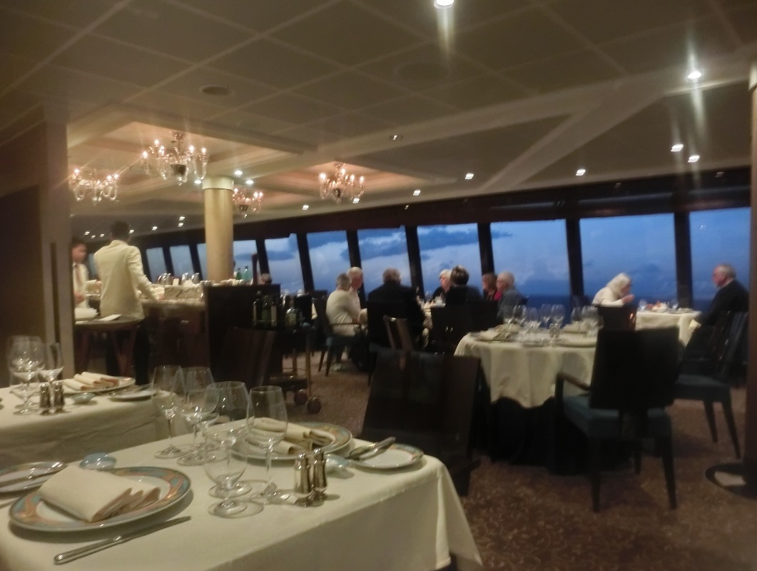
 船旅1日目の夕食は6階のグランドダイニングルームで取った。

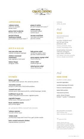
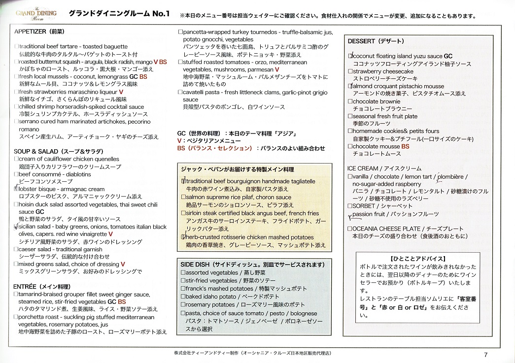
1日目の夕食(グランドダイニングルーム)

 上のメニューはOceania社のGrand-Dining-Dinner-Menuから取っている。社はグランドダイニングルームで毎日違うメニューを出しているが、私たちがお世話になったT&Tでは、その全部を日本語に直している。

 私たちの料理には、✓がついています。念のため、私はロブスターのビスクと牛肉の赤ワイン煮込み、妻はシチリア風野菜のサラダと鶏肉の香草焼き。ビスク(bisque)はフランス語のスープ。取った料理は全部、普通でした。

⇦ もどる

アフタヌーンティー

https://www.covingtontravel.com/2016/02/16804meet-oceania-cruises-sirena/

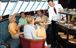
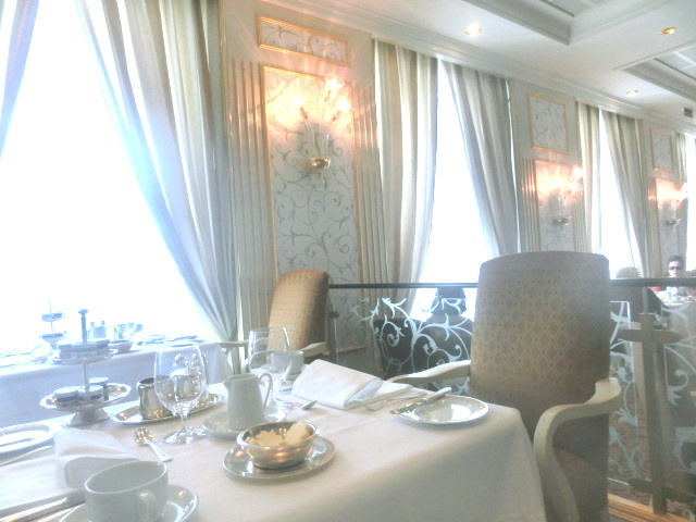
 午後4時、15階のホライズンで、弦楽四重奏団の演奏を聞きながら、アフタヌーンティーが始まる。最初はトワイニングの紅茶バックから1袋を選び、お湯を注ぐ。

 次はお菓子を選ぶ。フィンガーサンドイッチ、ケーキ、スコーン、タルトなどです。

 それ以外は、全く何も起こらない。あとは上品なバロックを聴くだけ。

https://jp.oceaniacruises.com/experience/dining/afternoon-tea/

 なんかなあ。1時間まで時間はあるけど、45分で切り上げました。

 本格的に行うと、執事が出てきて、しずしずと紅茶をいれるはず。ところが、これを米国式にやるので、雰囲気も格式も違うのでは、と考えられました。

⇦ もどる

サントリーニのCurrents


素晴らしいサントリーニ島は――紀元前1450年頃、世界で一番の狂暴な噴火で有名ですが――議論の余地はなく、ギリシャの島で一番ドラマチックな景観です。正式にはティラ島ですが、ラテン語のサントリーニ島という名前も残っています。ビーチは真っ黒で、無骨な景色、衝撃的なカルデラ(噴火口)などは、キクラデス諸島ではなくカナリア諸島に似ています。白亜の教会や崖上の家々は魅力的です。

白壁の村々は切り立った崖の上にあり、またエーゲ海は信じられないほど青く、カルデラは数千年前に崩壊した火山で形成されています。サントリーニ島は神々が生まれた土地だという神話がありますが、それも不思議ではありません。その州都フィラはカルデラの頂上にあり、村は和気藹々です。フィラへ移動するにはケーブルカー、ロバ、歩行の3つだけで、友好的なカフェや店舗、現代ギリシャの島の建築がある町は、石畳の迷路です。一方、イアの街は美しく、比類ない夕日で有名です。庭園、ブドウ園、教会、洞窟を探索しましょう。これらのビーチは雄大ですが、しかし、ゆったりとしています。赤、白、黒、金色と色鮮やかな光景は、世界で一番美しい岸辺です。自然と村の生活が調和した、この華麗な島を探索しましょう。

これは自然美を愛好する人の島でもあります。太陽を楽しむ人はそのビーチだけを好むのではありません。一番の景色は、カルデラに接する切り立った崖です。カルデラは島の中心が基本的に崩壊したときに形成されたもので、岩石、溶岩、軽石の崖の多彩な地層に地質学者は驚嘆します。カメラを持ち、準備をして、地球の動きを感じましょう(おそらく文字通りにそうなります。サントリーニ島の最新の大地震は1956年でした。最近では2009年6月26日に地震は起こっています。)

サントリーニ周辺にある湾は、実際に世界最大の噴火口であり、3500年前にテーラ火山(いまだに活火山です)の大噴火がありました。また、一部の人々は、この湾は伝説では失なった都市アトランティスを覆い隠すためだと考えています。ここには想像力を働かせるあらゆるものがあります。1956年に地震が発生し、その後、テラ市、現代のフィラ市は完全に再建されました。

サントリーニ島は食べ物の楽園でもあります。古くからの噴火による火山灰は島を肥沃にし、ここでの農産物の質は真の自然の奇跡です。 2000以上のレストランが60マイル(97キロ)の島に点在しています。食事は前菜(メゼデス)で始まります。白ナス、島特有のお菓子、ケイパー、チェリートマト、オオムギのラスク、ファバ豆のパティとディップ。挽肉はここの特産品で、 ムサカやナスやパティシオで包んだラムの挽肉、マカロニとベチャメルソースがある牛のひき肉を試してみてください。

サントリーニのブドウ園は実に見事で、多くの地元のワインは、アースティーコのブドウから得て、新鮮な白ワインになります。ナイケテイは新鮮でも、もっと強力です。驚くほど熟成した赤ワインでは、ブドウとしてマヴロトラガノを試してみてください。サントリーニ島のショッピングは楽しく麗々しく、店舗は賑わい、民芸品、手工芸品、皮革、布製品、ワインでいっぱいになります。イアの市場は本物のギリシャ産で、もっぱら地元の人がやってきます。フィラでは多くの土産物があり、豪華な小物を買うのに最適な場所です。

Spectacular Santorini– scene of one of the world’s most violent volcanic eruptions around 1450 BC — is inarguably the most scenically dramatic of all the Greek islands. Officially the island is Thira, yet the Latin name of Santorini persists. With its pitch-black beaches, rugged landscape and stunning caldera (volcanic crater), it’s more akin to one of the Canary islands than the Cyclades, though its whitewashed churches and clifftop houses score highly in the charm stakes.
White-washed villages cling to cliff sides over the unbelievably blue Aegean Sea on this caldera, the ring formed by a collapsed volcano thousands of years ago. No wonder myths claim Santorini as the birthplace of gods. Its capital, Fira, is a welcoming village nestled atop the caldera. Accessible only by cable car, donkey or plenty of walking the town is a cobbled labyrinth of friendly cafes, shops and contemporary Greek island architecture. The town of Oia is just as beautiful, hailed for its unmatched sunsets. Explore its gardens, vineyards, churches and caves. Beaches here are dramatic, yet relaxing. Colored shores of red, white, black and gold are easily amongst the world’s most beautiful. Explore this brilliant island where nature and village life mingle in harmony,
This is the island for lovers of natural beauty, though sun seekers may not fancy its beaches. Best views are from the cliffs bordering the caldera, which was formed when the center of the island basically collapsed into itself. Geologists marvel at the cliffs’ multi-hued strata of rock, lava and pumice, so take your camera and be prepared to feel the earth move (perhaps even literally — Santorini’s most recent major earthquake was in 1956, although there was one nearby as recently as June 26, 2009.
It’s worth remembering that the bay surrounding Santorini is actually the world’s largest volcanic crater, created 3500 years ago by a massive eruption of the Thera volcano (which is still active). The bay is also believed by some to conceal the legendary lost city of Atlantis. There’s plenty here to set your imagination working. even though the modern-day city of Thira, officially Fira, was completely rebuilt after an earthquake in 1956.
Santorini is foodie paradise. Volcanic ash from eruptions throughout antiquity have fertilized the island, so that the quality of produce here is a genuine wonder of nature. More than 2000 restaurants dot the 60 mile (97 kilometer) island. Meals start with mezethes, small appetizer plates. Sample white eggplant, a sweet variety unique to the island, capers, cherry tomatoes, barley rusks, and patties and dips made of fava beans. Minced meat is a specialty here. Try moussaka, minced lamb with eggplant or pastitsio, minced beef with macaroni and bechamel sauce.
Santorini’s vineyards are superb. Most local wine comes from the Assirtiko grape, a fresh white. Nykteri is just as fresh, but more potent. For a phenomenally aged red, try the Mavrotragano. Shopping is a fun, flashy affair in Santorini, Shops are boisterous and can be packed with folk art, handcrafts, leather, fabric goods and wine. In Oia, markets are authentically Greek and cater mostly to locals. Fira has more souvenirs and is the perfect place to buy a luxury trinket or two.

⇦ もどる

サントリーニの連絡船
午前8時から島に行きたいお客様は、目的地係の係員からリビエラのラウンジで、色付きの乗船券を入手します。ラウンジで待ち、その後 デッキ4にある出入口に向かいます。歩行困難な場合を除き、階段を使用して連絡船の乗降口に向かいます。注意。オセアニアの寄港地ツアーはすべて、アティニオス港に着岸します。個別の手配があるか、町を個別に訪れたいと思うお客様は全員フィラ町に着岸します。色付き券は個別のお客様全員に必要であり、その後、クルーズ管理者が構内アナウンスとして「乗船券使用可」と発表します。これは、大多数のお客様が降りた後で行われます。連絡船はその後、連続的に船と岸を結び、出発は約30分ごとです。

TENDER SERVICE IN SANTORINI
Guests wishing to go ashore from 8:00 am must obtain a colored tender ticket in the Riviera Lounge from a member of Destination Services. Please wait in the lounge until directed to the gangway on Deck 4. Unless you have difficulty walking, please use the stairs to gain access to the tender embarkation platform. Please Notes: All Oceania shore excursions will be tendered to Athinios port. All guests with independent arrangements or wishing to visit the town independently will be tendered to the town of Fira. Colored tender tickets are required for all independent guests until the time that the Cruise Director makes an “open tendering” announcement over the public address system. This will be done once the majority of guests have disembarked. Tenders will then operate on a continuous basis from the ship to shore and return; however the time between tenders is approximately every 30 minutes.

⇦ もどる

参考までに
ロバの道は歩行者が歩くのにはお勧めできません 。ロバに乗る観光客が使う道と同じ道であるからです。ロバは桟橋とフィラの間で行き来して、ロバの道には600段の階段があり、歩行者にとっては面倒で危険なもので、その道は滑りやすくて狭く、ロバと一緒に歩く場合には混雑する可能性があります。 また、この道には医療支援はありません。事故が発生した場合、誰も支援はできません。安全で快適なケーブルカーを使用してフィラまで行くことを強くお勧めします。

FOR YOUR INFORMATION
Guests are kindly informed that the donkey path is not recommended for pedestrian walking as it is the same path used by the tourists riding donkeys on the way up and down between the pier and Fira. There are 600 steps on the donkey path and it could become tiresome and dangerous for pedestrians. The steps on the path are slippery and narrow; and they will become crowded with donkeys. Also, there is no medical assistance provided on the path itself, so if an accident did occur, there would be no one to assist. We highly advise using the cable car to go up to Fira as it is safer and more comfortable.

⇦ もどる

10月25日夕食(トスカーナ)

 北イタリアの家庭料理です。

トスカーナで夕食

トスカーナで夕食

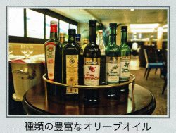
オリーブオイルの多さ

オリーブオイルの多さ

 最初はオリーブオイル10数本が出て、どれかいいか聞かれた。ただし、これがお薦めです、といっていたので、それにした。隣のアメリカ人も同じように聞かれて、全く同じオリーブオイルを選んでいた。同じなのです。

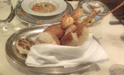
 その次は、パン。パンが串焼きになってでている。しかし、あまりおいしくはない。
 長く長く細長いパン。これは日本でも出ている。

トスカーナのパン

トスカーナのパン

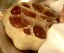
 他に、まるごとのニンニク球根が揚げてあり、上部分は捨てて、下部分を出している。へーっと思うが、米国式、それともイタリア式? 普通はアメリカ式なんでしょうね。

ニンニク球根

トスカーナ

トスカーナ

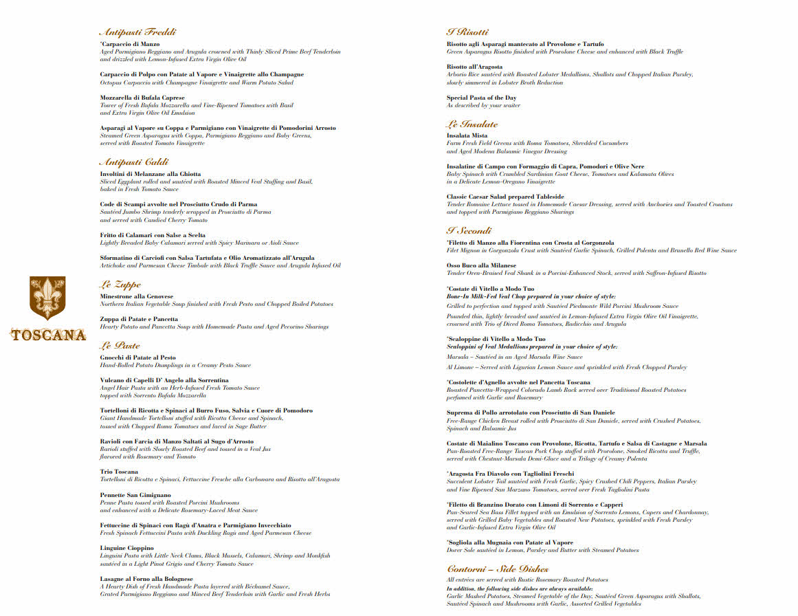
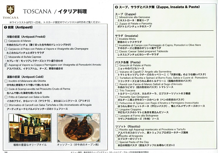
トスカーナのメニュー

トスカーナのメニュー

トスカーナのメニュー1

トスカーナのメニュー2

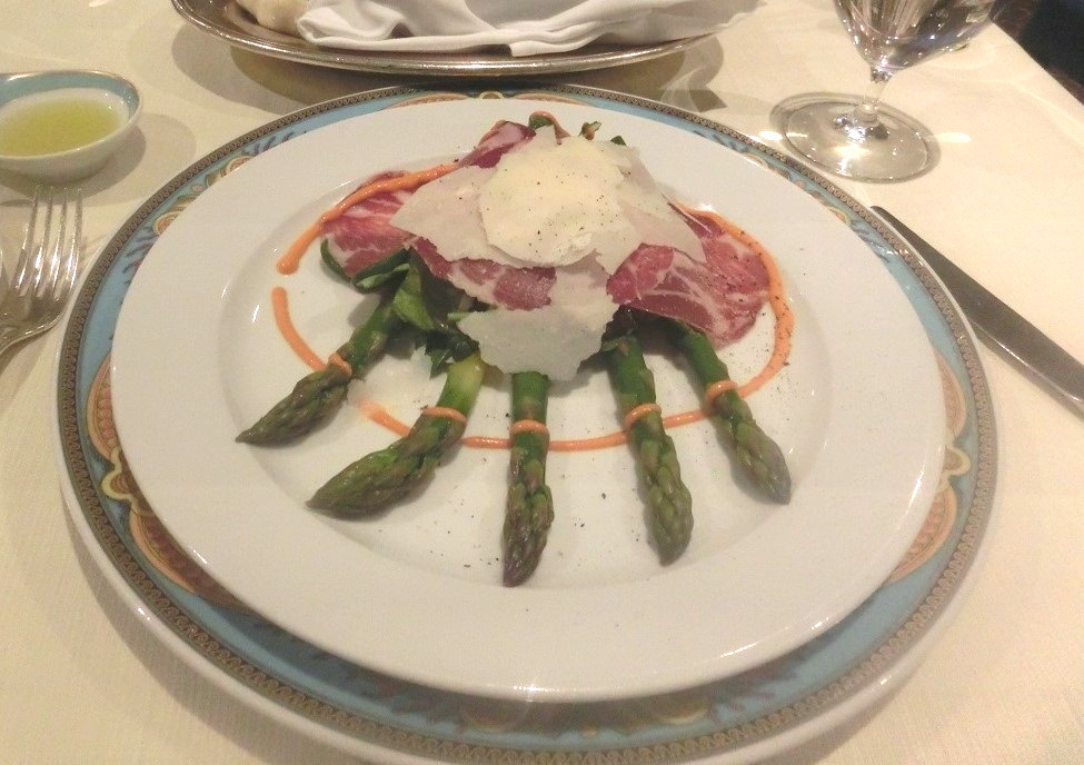
 前菜とメインを1つずつ食べる。

 アスパラガス、イタリアハム、チーズ、野菜の盛り合わせ。

アスパラガス、イタリアハム、チーズ、野菜の盛り合わせ。

アスパラガス、イタリアハム、チーズ、野菜の盛り合わせ。

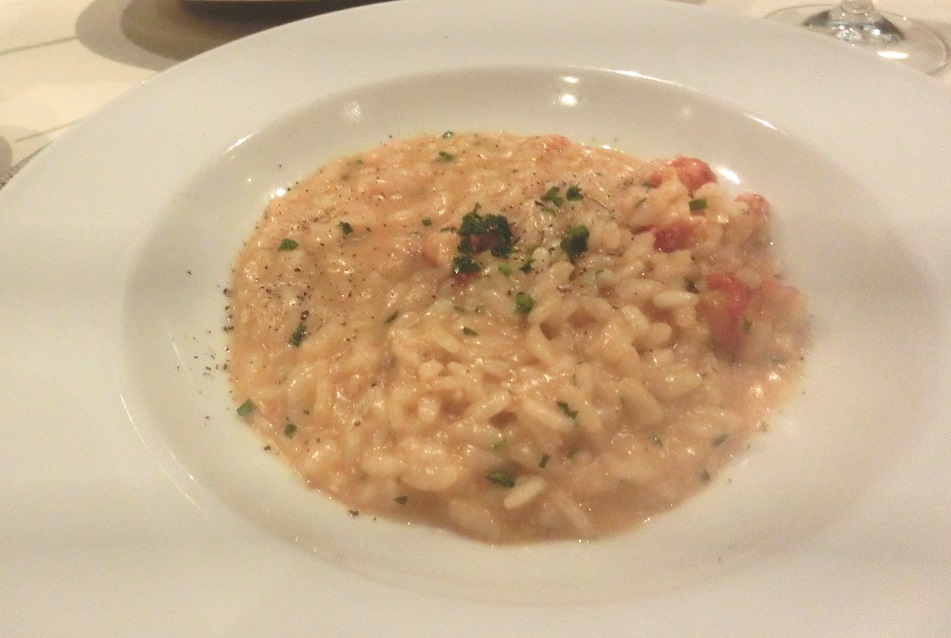
 ロブスターのリゾット

ロブスターのリゾット

ロブスターのリゾット

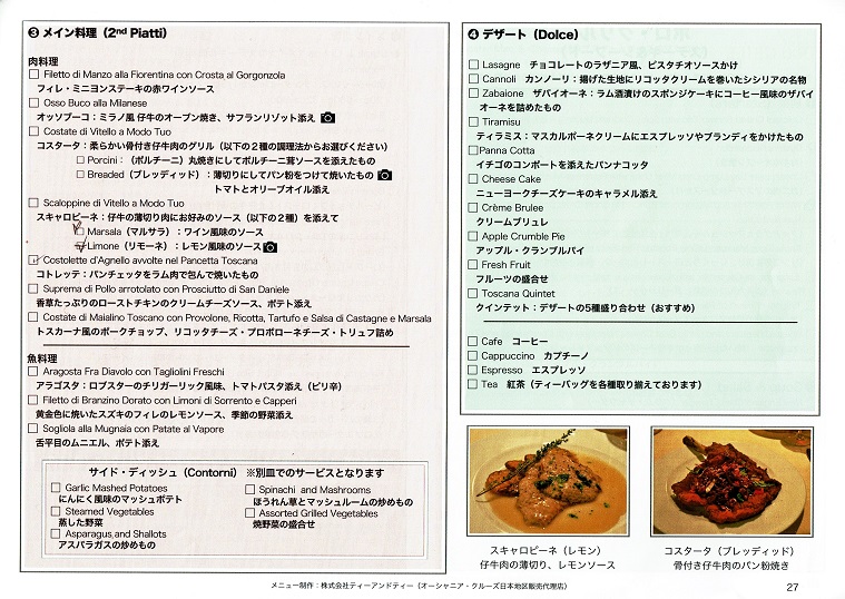
 スカロピーネ。仔牛の薄切り肉にワイン風味のソースを添えて。Scaloppine di Vitello a Modo Tuo. [Scaloppini of Veal Medallions prepared in sauteed in Aged Marsala Wine sauce]

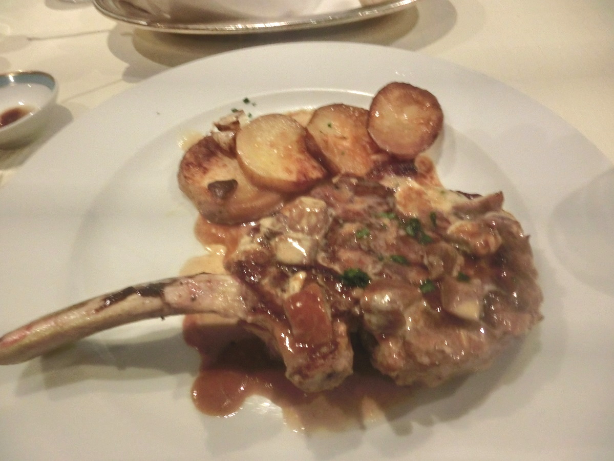
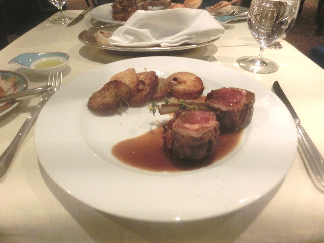
コストレッタ。ベーコン巻のコロラドラムチョップ。Costolette d’Agnello avvolte nel Pancetta Toscana. [Roasted Pancetta-Wrapped Colorado Lamb Rack served over Traditional Roasted Potatoes perfumed with Garlic and Rosemary]

コストレッタ。パンチェッタをラム肉で包んで焼いたもの

コストレッタ(あばら骨付き背肉)のコロラドラムチョップ。

 うーん、普通でした。

⇦ もどる

10/25船長の手紙| ロードス島はキャンセル

 お客様
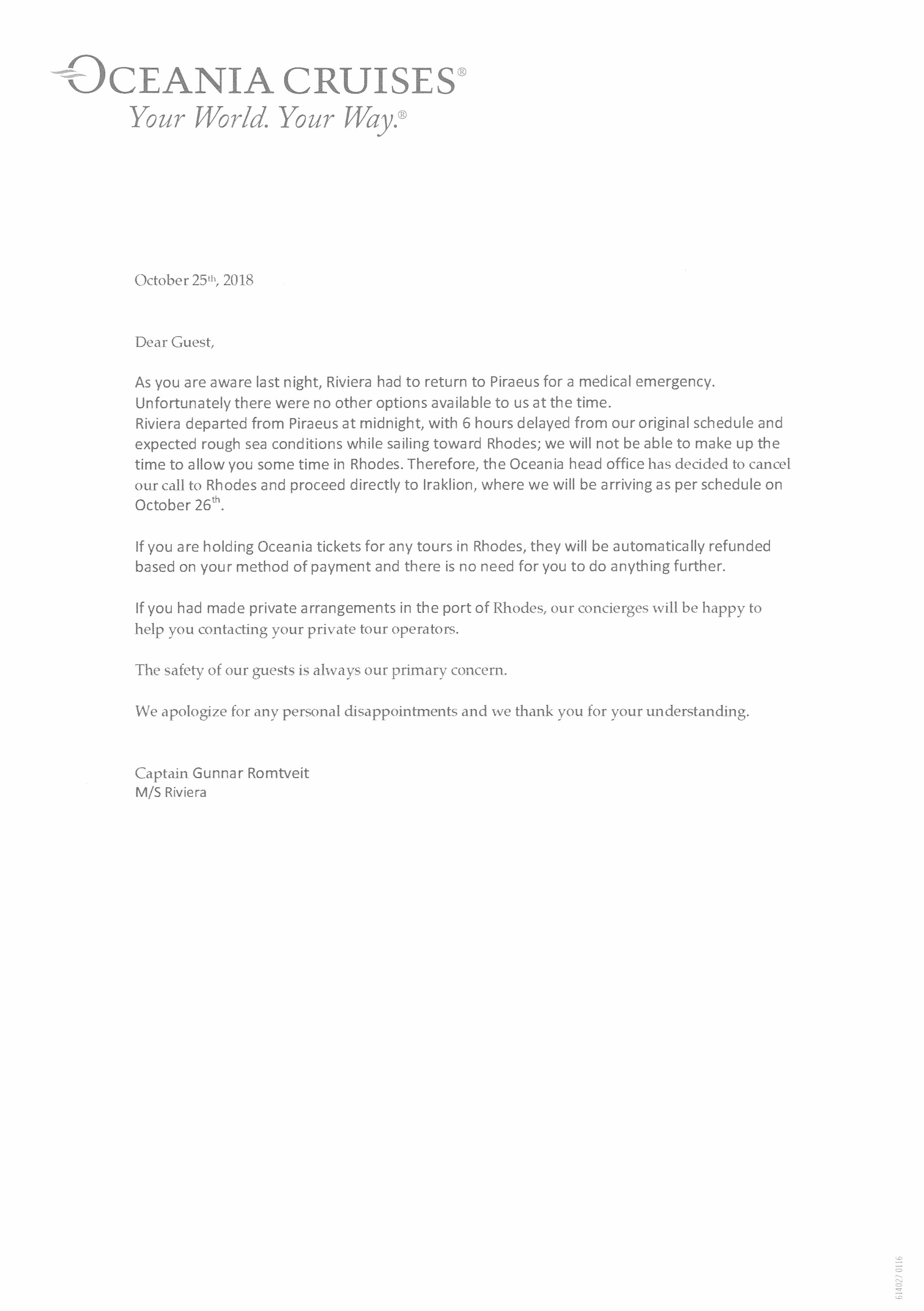
 わかっている通りですが、昨晩リビエラ号は医療緊急事態のためにピレウスに戻りました。残念ながら、当時利用できる選択肢はありませんでした。リビエラは真夜中にピレウスを出航し、当初の予定より6時間遅れ、またロードス島の航海では荒海を予想しています。 ロードス島で数時間の上陸はできません。 したがって、オセアニア事務局はロードス島への着港をキャンセルし、直接イラクリオンに進み、10月26日に予定通りに到着することにしました。
 ロードス島でのツアーのためオセアニアの券をお持ちの場合、お支払い方法に基づいて自動的に払い戻されます。何もする必要はありません。
 もしロードス港で私的な手配を済ませていた場合、コンシェルジュはツアー会社に連絡することをお手伝いします。
 私たちはお客様の安全を常に心がけています。
 個人的に見て至らない点もあるかと存じますが、ご理解いただきましてありがとうございます。

⇦ もどる


Dear Guest,

As you are aware last night, Riviera had to return to Piraeus for a medical emergency.
Unfortunately there were no other options available to us at the time.
Riviera departed from Piraeus at midnight, with 6 hours delayed from our original schedule and expected rough sea conditions while sailing toward Rhodes; we will not be able to make up the time to allow you some time in Rhodes. Therefore the Oceania head office has decided to cancel our call to Rhodes and proceed directly to lraklion, where we will be arriving as per schedule on October 26th.

If you are holding Oceania tickets for any tours in Rhodes, they will be automatically refunded based on your method of payment and there is no need for you to do anything further.

If you had made private arrangements in the port of Rhodes, our concierges will be happy to help you contacting your private tour operators.

The safety of our guests is always our primary concern.

We apologize for any personal disappointments and we thank you for your understanding.

入浴と就寝ー身障者の外国旅行

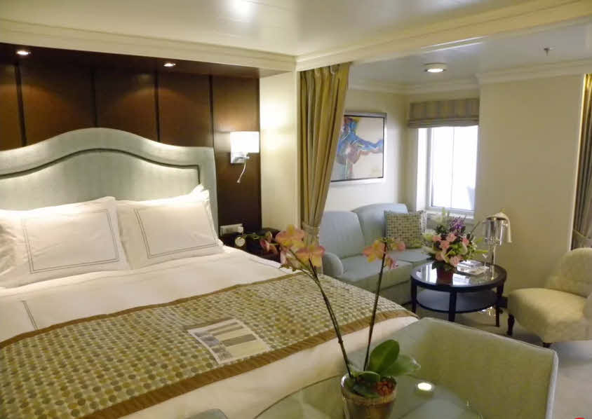
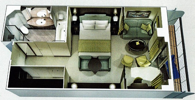
 私たちの滞在はペントハウスで、他のペントハウスと全く変わらない。

https://www.tripsavvy.com/oceania-cruises-riviera-cabins-and-suites-991376

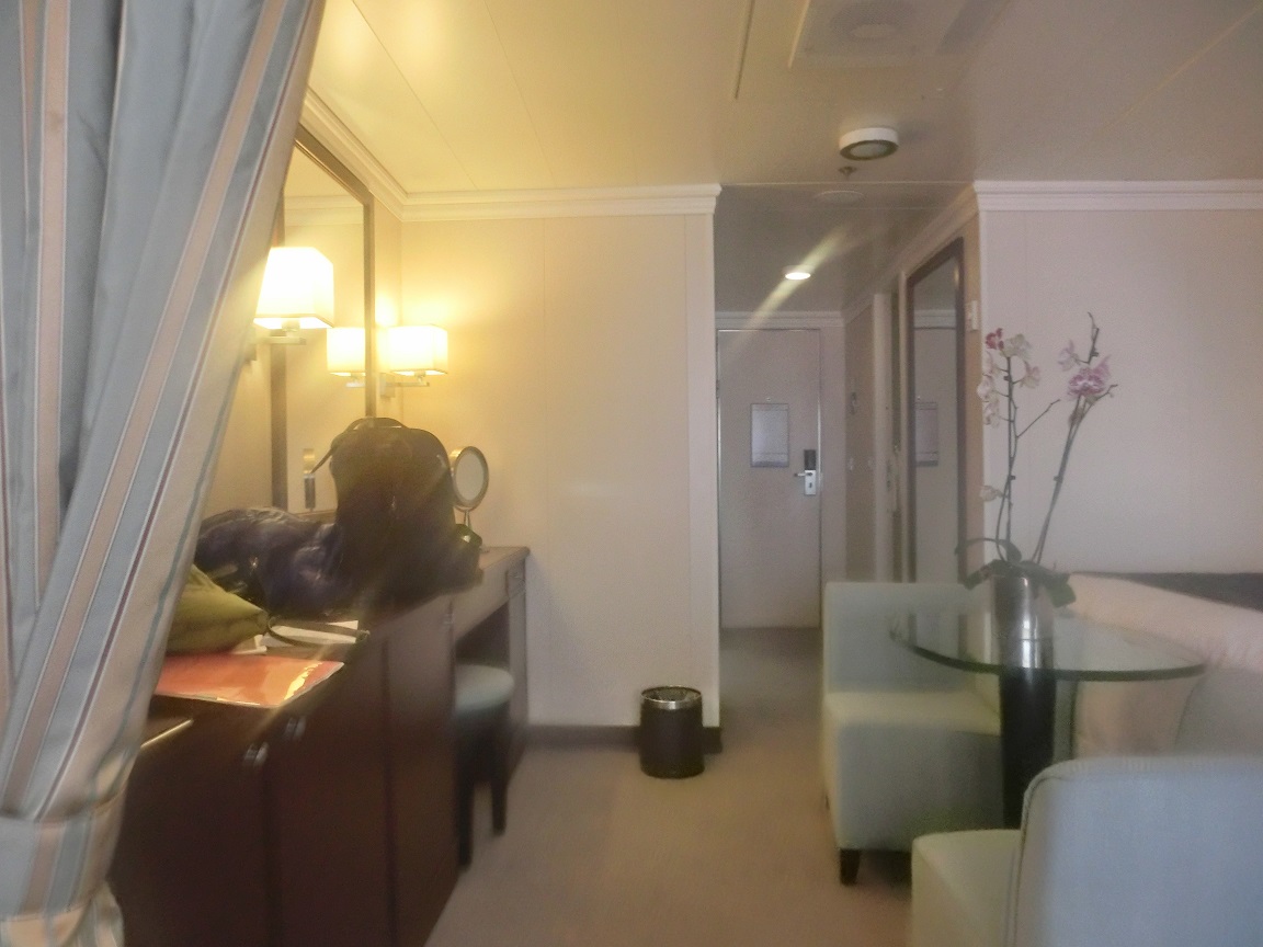
 上図と下図のカーテンはこれ以上横に大きくはならない。ただの飾りです。また、ベッドの前のテーブルの花は生きた花でした。蘭なので長持ちする。

内部の絵。会社のパンフから

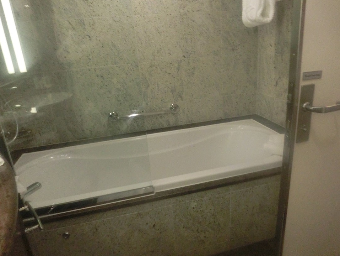
 バスは一見する限り問題なく動くと思えるが、ここに問題があった。

長すぎるバス

 風呂は長すぎるのだ。日本人がはいると、頭から足の爪まで真っ直ぐに潜るだけの長さがある。つまり、半身不随の私にとっては、万が一、横になると、立てない。手すりも手が届かない。浮力があって、初めて立てる。したがって、十分お湯を入れないとだめなのである。節水しょうと思っても、できない。

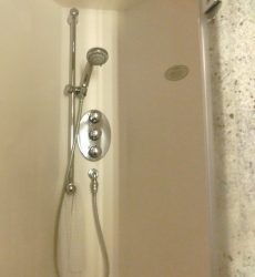
 シャワーも問題で、栓が3つあったのだが、私は下しか向けないので3つあるとわからなかった。上部の栓は天井からのシャワー、下部はシャワーヘッドからのシャワー、中部はお湯の温度を決めるものである。

 また、ベッドが高すぎると、のぼれない。今回はのぼれました。

⇦ もどる

オーシャニアのリビエラ(船内図)

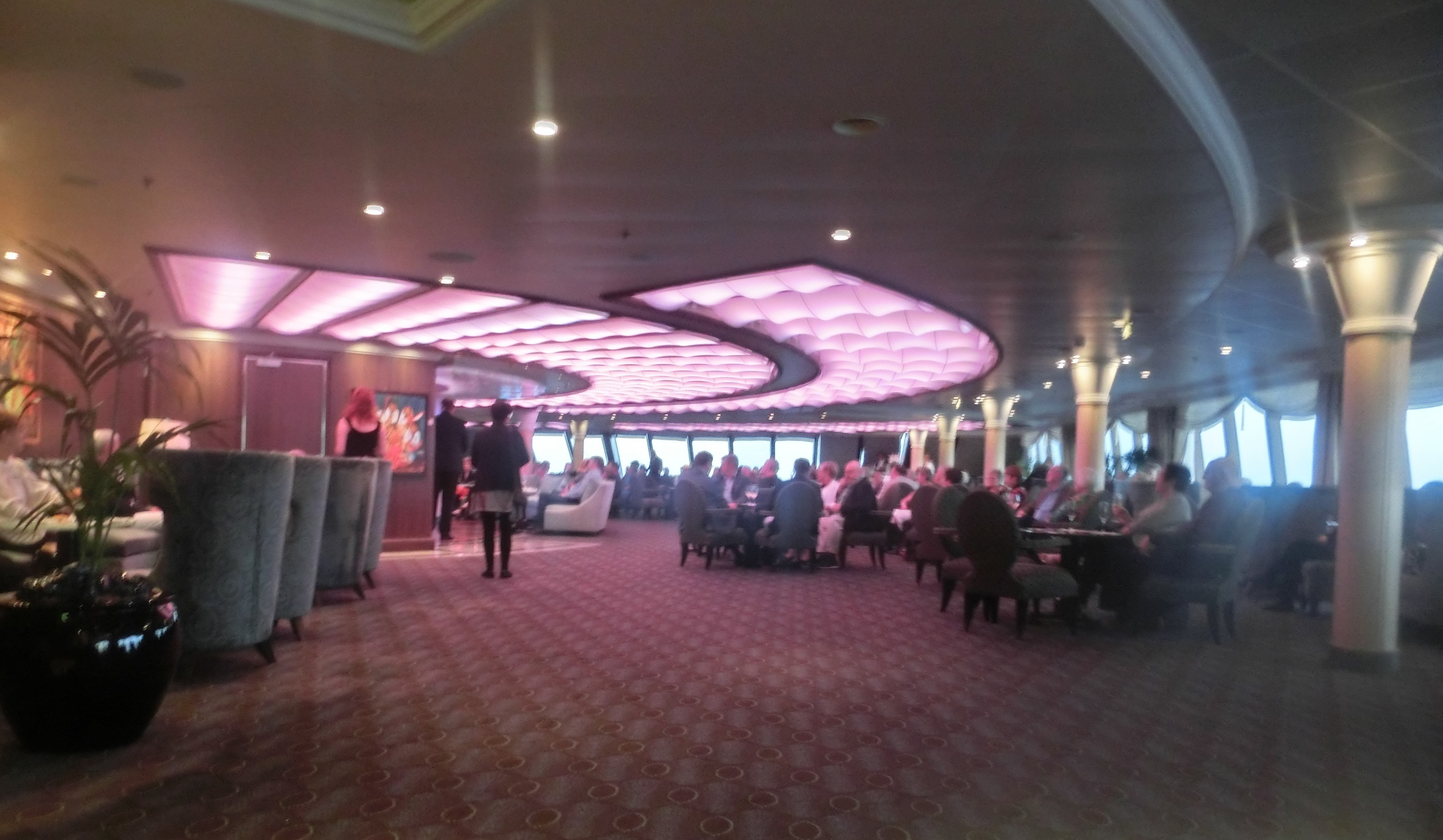
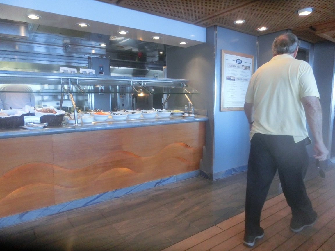
ホライズン

ホライズン。4時から1時間はアフタヌーンティー。夜はバー。

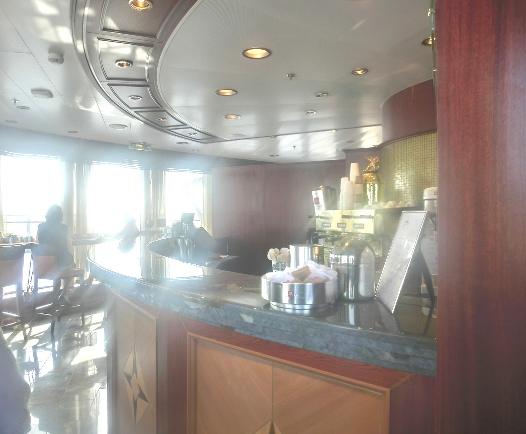
バリスタス

バリスタス。喫茶店。

バリスタス

バリスタスの隣にはお菓子

トスカーナ

トスカーナ。イタリアの家庭料理。

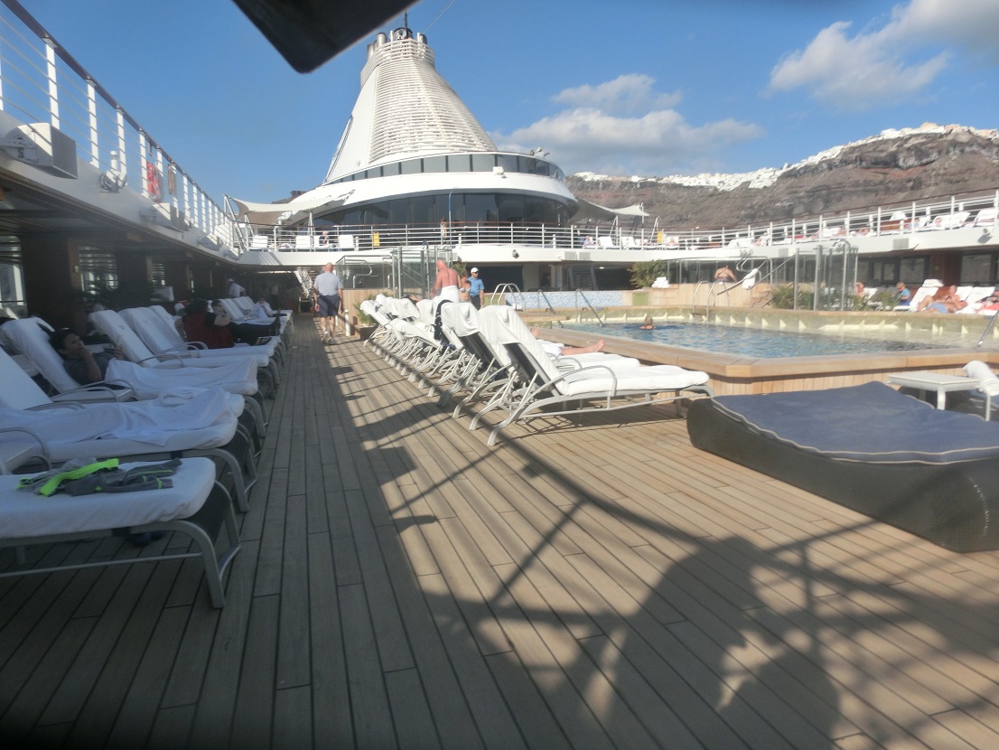
プール

プール

テラスカフェ

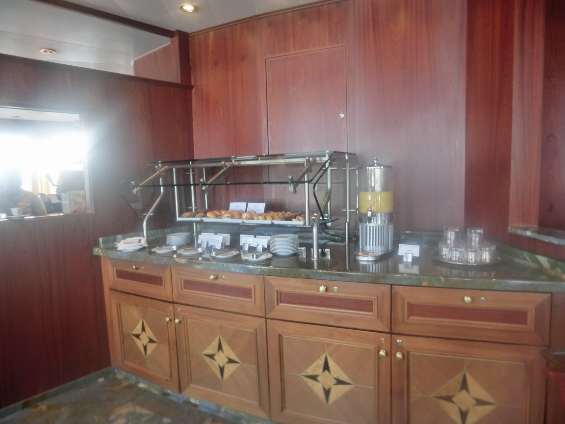
船内のテラスカフェ。朝昼晩のバイキング料理。

テラス カフェ

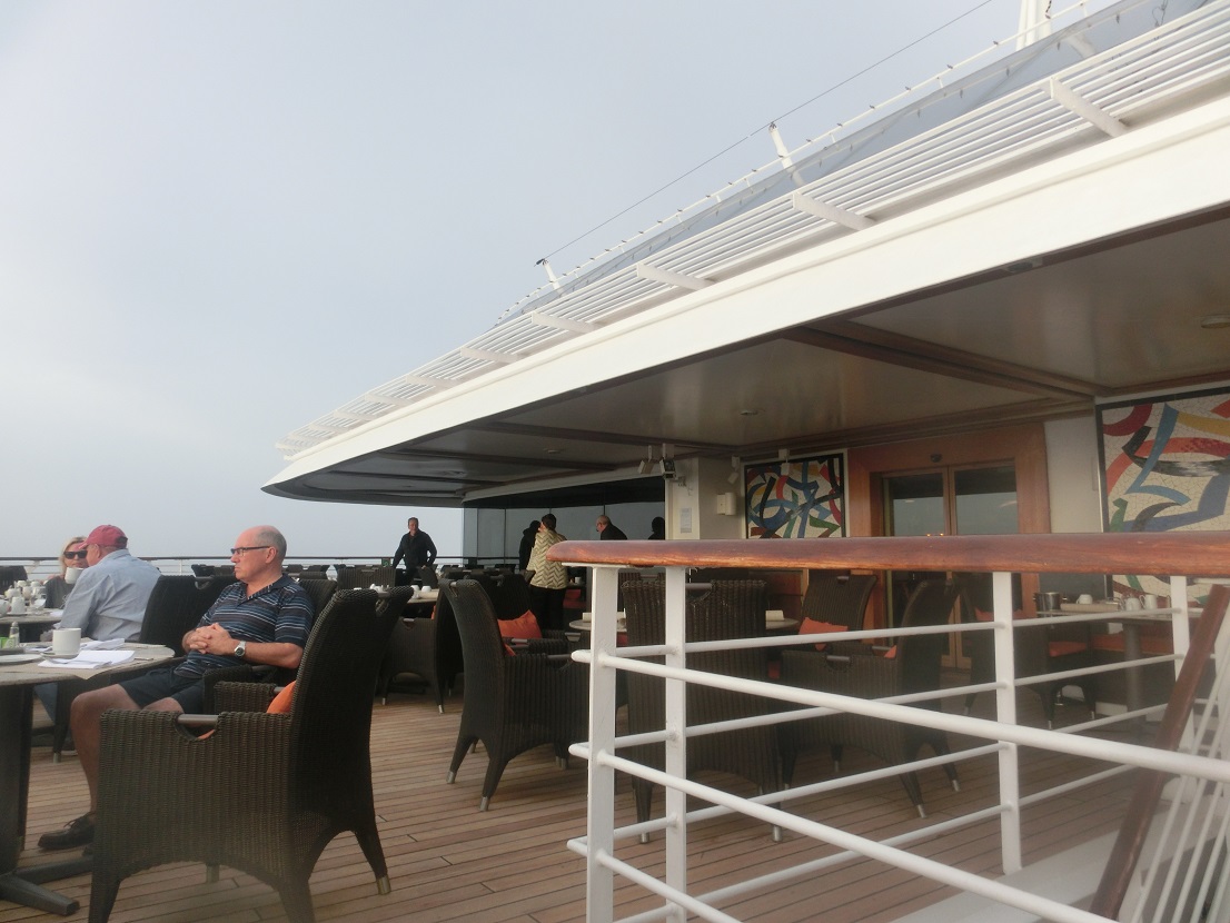
船外のテラス カフェ。

ウェーブズ グリル

ウェーブズ グリル。ハンバーガーとホットドッグなど。

エグゼクティブラウンジ

エグゼクティブラウンジ。

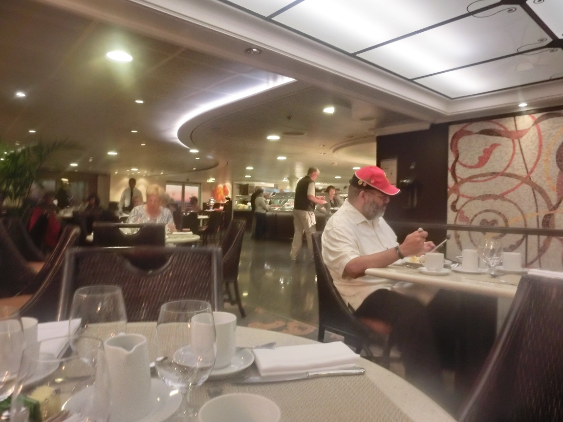
グランドダイニングルーム

グランドダイニングルーム。フルサービスの料理。

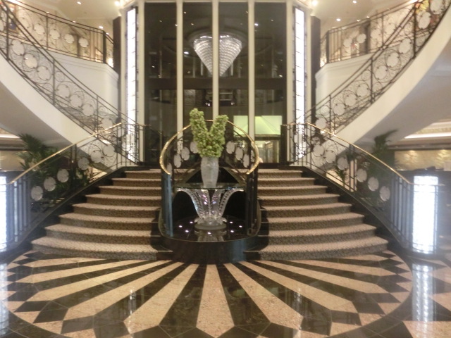
ロビー

ロビー

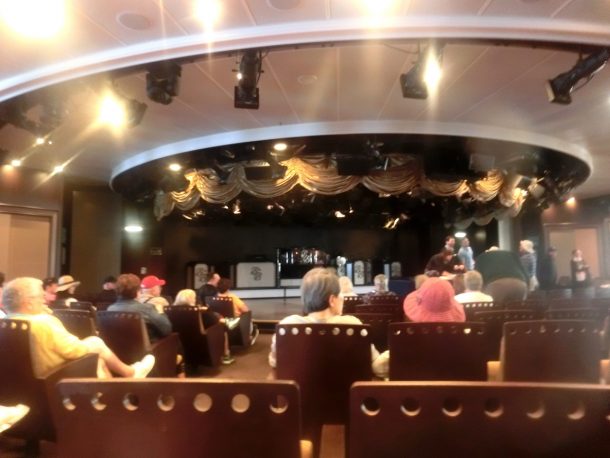
ステージ

ステージ。ショーで集まる場合もあり、また、寄港地ツアーの前でもここに集合。

オーストラリア・パース(2019.11.19)クォッカに

2019年
11/18(月)
 飛行機はANA。18日11:20発。20:30着。
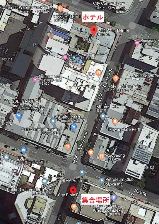
 ホテルはEuropean Hotel by Miss Maud(日本語ではミス モード スウェディッシュ ホテル、Miss Maud Swedish Hotel)で、11/18から23まで。

11/19(火)
 5時、起床。毎日、この日は6時45分だが、無料の「スモーガスボード」朝食を食べる。肉はソーセージとハム、卵ぐらい。その代わりに果物はキウイやホワイトドラゴンフルーツなどで、種類も量も多い。

 7時55分、「ロットネスト島ツアー HIS」(1.5時間の英語バスツアー付プラン、ランチなし)に参加。

【ツアー名】世界一幸福な動物 クォッカ(Quokka)に会いに行こう! H.I.S.
 インド洋の宝石 ロットネスト島(Rottnest Island)ツアー【英語/日本語】
 08:20 Pier StとHay Stの角で集合時間の5-10分程前にお待ち下さい。
Pier&Hay

Pier&Hay

 この場所はホテルの受付係に聞いてわかった。

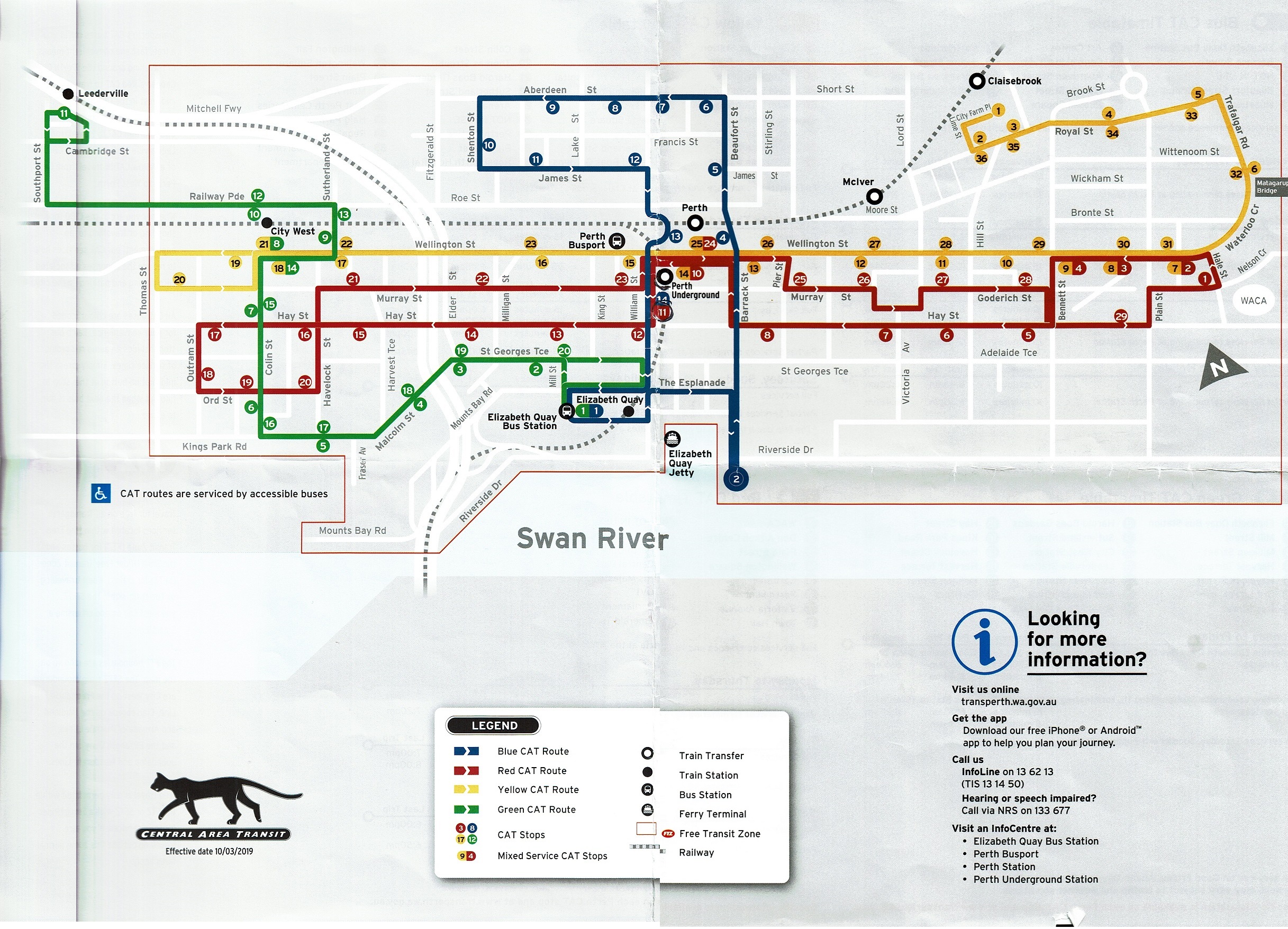
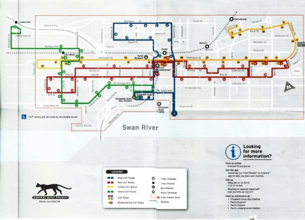
 08:30 バラックストリートジェッティ(Barrack Street Jetty)からフェリーで出航。正しくはエリザベス埠頭桟橋(Elizabeth Quay Jetty)。quayとは波止場、埠頭ふとう。Jettyとは桟橋。CAT(バス)の青(Barrack Square)で降りてもいい。

Elizabeth Quay Jetty

Elizabeth Quay Jetty (Google)

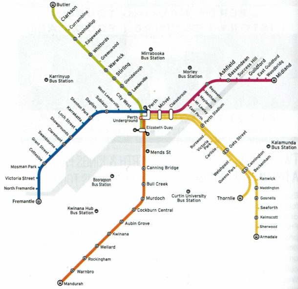
 下図はCATの路線図。

Central Area Transit

Central Area Transit。CATの地図はホテルで貰ったもので、最も正確。

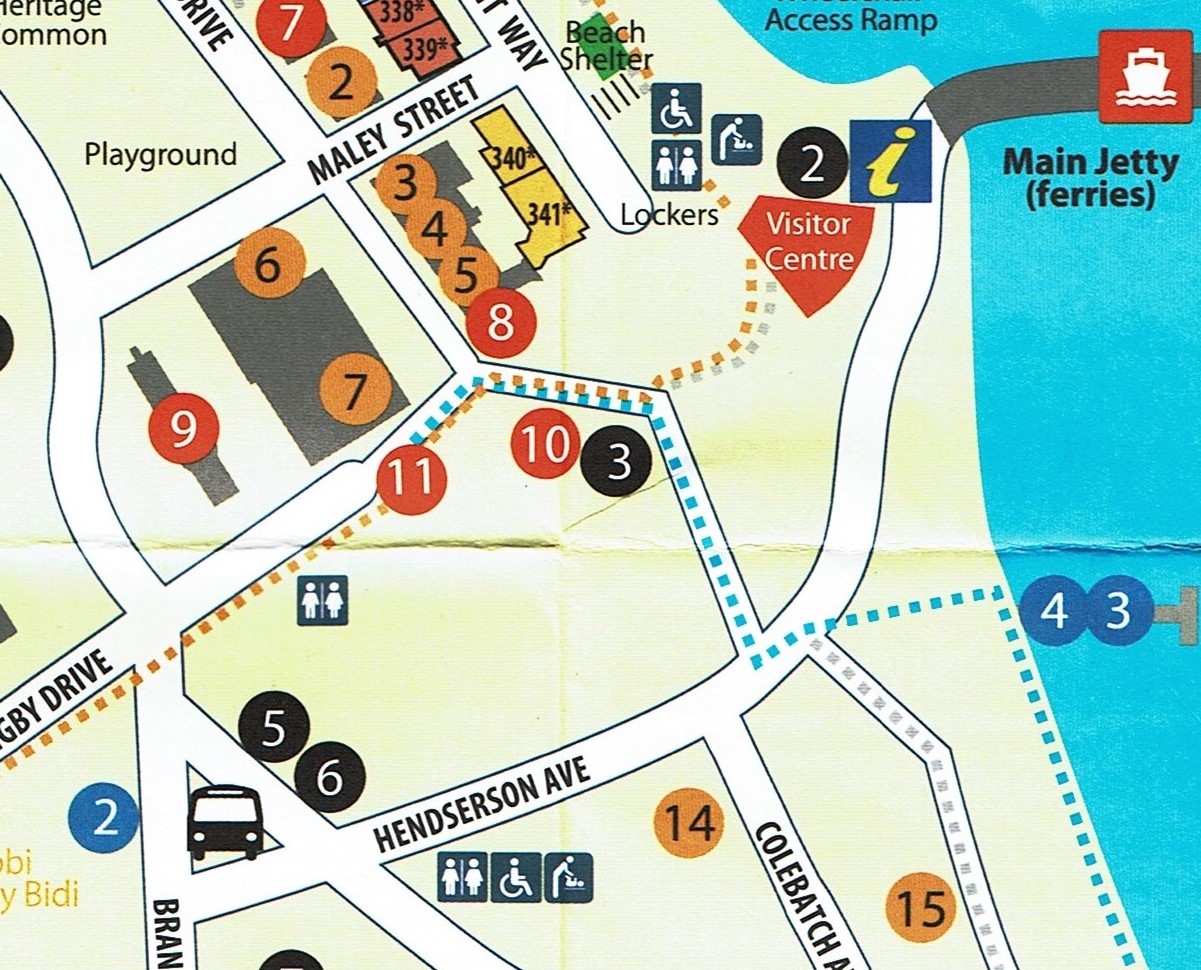
 10:30 ロットネスト島(Rottnest Island)に到着。主要桟橋(Main jetty)からHendserson Avenueまで歩いていくと、身障者の私では15分後に、右にバスが何台か見える。11:20、約1時間半の英語ツアーで、バスで出発。

Rottnest3

Rottnest island

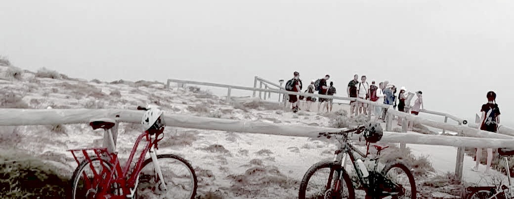
 島は純白で、大きな山頂も純白。砂そのものが白い。

Rottnest。Cape Vlamingh

Rottnest。Cape Vlamingh。島の最西端にあたる

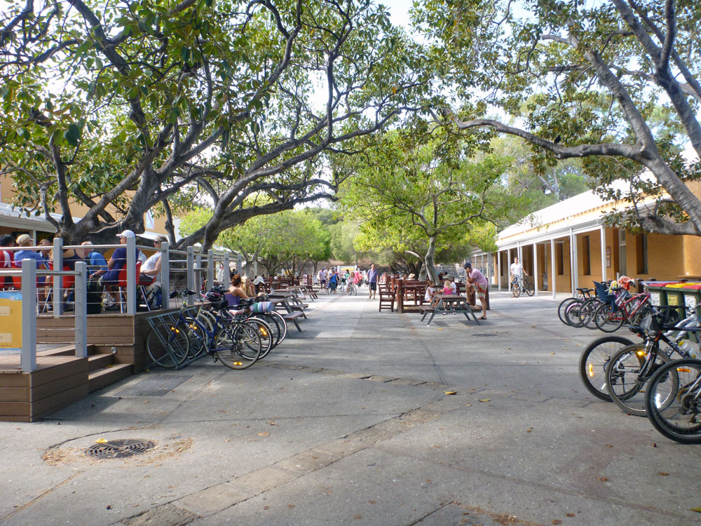
 13:10 昼食はFrankie’s on Rotto()で、妻はサラダ、私はパスタで。ここでクォッカが沢山いた。1匹か2匹が、普通の動物に比べて半分のスピードで、ゆっくりゆっくり、歩いてくる。このクォッカの動画は少し速すぎる。

 あまりもクォッカはいるので、びっくり。Simmo’s ice-cream()を食べ、妻は雑貨店(General store )に。さらに博物館()も見て、展示はものすごく小さいが、この島は石灰(limestone)の砂からできていたとわかる。

 ❸❹❺❻❼との間にはパラソル付きの椅子が沢山あった。

simmos-ice-cream

http://waytoomuchcoffee.com/icecream/simmos-ice-cream/

 17:00、ロットネスト島を出港し、パース市に向かう。18:30、バラックストリートジェッティに到着。そのジェッティからホテルまで帰る方法がわからない。妻がバスの運転手さんに聞き、「帰る方法もRottnest Expressを使うことができる」という。Rottnest Expressはこの事業を行う会社だ。結局、Rottnest Expressのバスで帰った。H.I.S.では帰る方法は不明のままなので、これはひどいと思う。

 19:00、ホテルから正面の中近東風バーガーを食べる。

オーストラリア・パース(2019.11.20)動物園

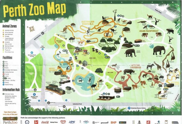
11/20(水)パース動物園

 6:00、起床。6:45、朝食。
 8:00、ホテルの受付係に「動物園に行く方法は?」と妻が尋ねると、「タクシーを呼びましょうか」との返事。8:55、タクシーに乗り、9:10頃、到着。

 私は車椅子を借り、A3の地図をもらった。

Perth Zoo Map

Perth Zoo Map

 ① 爬虫類との遭遇(Reptile Encounter)
 ② オーストラリア湿地帯(Australian wetlands)
    ペンギン(Penguin)
    カエル(Frogs)
    クビカシゲガメ(Western swamp tortoise)
    鳥(Birds)
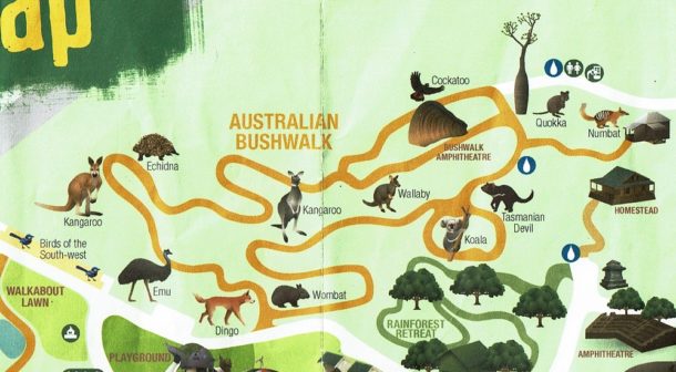
 ③ オーストラリアの逍遥(Australian Bushwalk)

オーストラリアの散策

オーストラリアの逍遥

    Emu(エミュー)
    Echidna(ハリモグラ)
    Dingo(ディンゴ)
    Wombat(ウォンバット)

    Kangaroo(カンガルー)
    Wallaby(ワラビー)
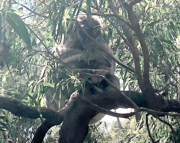
    Koala(コアラ)

Koala

Koala (母と子)

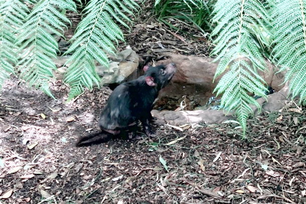
    Tasmanian devil(タスマニアデビル)皮膚はボロボロ。
    デビル顔面腫瘍性疾患?

Tasmanian devil

Tasmanian devil

    Quokka(クォッカ)
    Numbat(フクロアリクイ)
    Cockatoo(オウム)
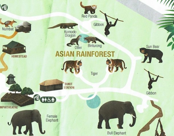
 ④ アジアの熱帯雨林(Asian Rainforest)

Asian Rainforest

Asian Rainforest

    虎(Tiger)
    ビントロング(Binturong)
    カワウソ(Otter)
    テナガザル(Gibbon)
    レッサーパンダ(Red Panda)

    コモドオオトカゲ(Komodo dragon)
    マレーグマ(Sun Bear)

 12:20 昼になり、巨大なポテトを食べた。突風が吹く。
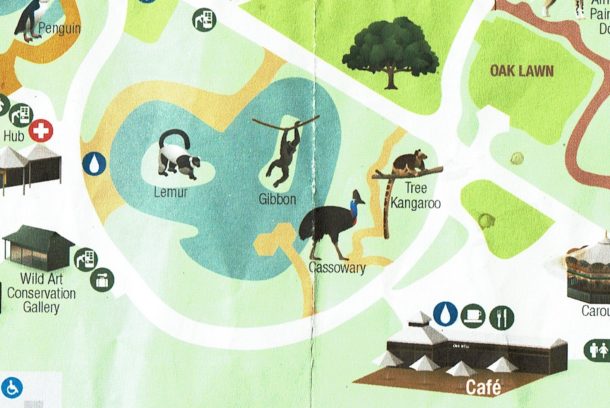
 ④ その他

others

others

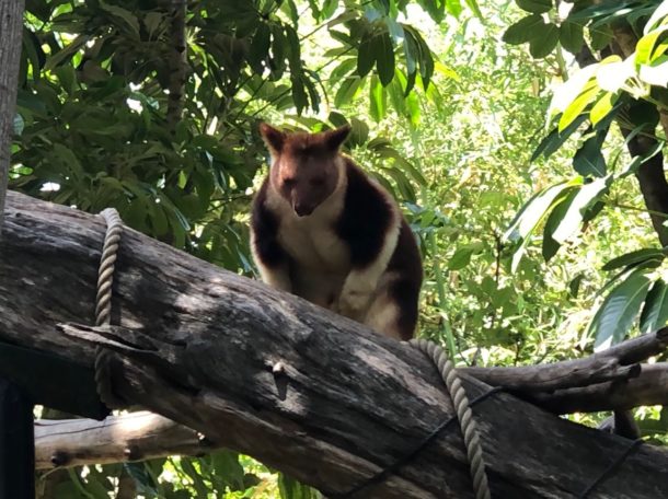
    キノボリカンガルー(Tree kangaroo)

Tree kangaroo

Tree kangaroo

    ヒクイドリ(Cassowary)


    キツネザル(Lemur)
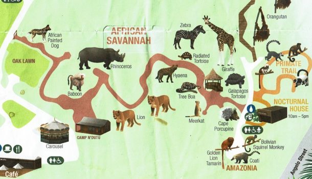
 ⑤ アフリカサバンナ(African savannah)

AFrican savannah

AFrican savannah

 今回は無視することに。日本と同じ動物が見られる。

14:00、売店を見て、14:30、動物園は終了。ホテルに戻る。
19:00。夕食はアウドバック ジャックス(Outback Jacks)に。「Outback」とは豪語で、奥地。砂漠の内陸部に広がる人口は少ない地帯。

 Jack’s Game Platter(ジャック式の獲物の盛り合わせ)を注文すると、肉6種がでた。後ろから前に向かって、CA=ラクダ(camel)、ウェルダン。WB=イノシシ(Wild Boar)、ウェルダン、次に白い筋。 K=カンガルー(Kangaroo)、レア。C=ワニ(crocodile)、ウェルダン、最も白い筋。E=エミュー(Emu)、ウェルダン。B=バッファロー(buffalo)、ウェルダン。以下はhttps://ameblo.jp/abaaba-part5/entry-12356049889.htmlに詳しい。


オーストラリア・パース(2019.11.21)ウェーブロック

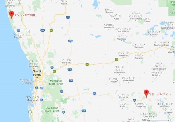
 11/21(木) セスナで観光。ウェーブ・ロック(Wave Rock)とピナクルズ(pinnacles)を見る。
 06:55、ホテルに係員がやってきて、私たち2人をジャンダコット空港に。
 07:30、空港でセスナに搭乗。セスナ(Cessna)は日本語では普通名詞らしく有名だが、英語では「セスナ・エアクラフト社」として固有名詞として使う以外はなく、「軽飛行機」の意味はない。「軽飛行機」は英語でlight aircraftか、ただのplane。さらにsesúnaになるともう全く通じない。
 最初はパース東方のウェーブ・ロックに向かう。

ウェーブロックとピナクルズ

ウェーブロックとピナクルズ

 08:30、ウェーブ・ロックの飛行場に到着。経過は1時間。車だとするとパースから4時間かかる。飛行機から降り立ってみると、塩湖や塩性湿地ばかりが目に入る。そうなる理由は「他の地域で降った雨が地中に染み込み、地下水となって流れる際、地中深くにある塩の層で塩が溶け出してその水が低地であるこの湖に流れます。水分は太陽光で蒸発し、かくしてこの湖は塩だらけになったというわけです。」(快適ちゃん


 08:40頃、ウェーブ・ロックにつく。

 27億年の昔から自然にできた花崗岩の高さ15mと長さ110mの崖。「崖」は不正確で、正確には、インゼルベルク(残丘)という。インゼルベルクは、周囲よりも岩盤が硬く、侵食もわずかで、飛び出した斜面(flared slopes)をもつ。
 さらに思っていたことと、見えるものとが違った。普通は砂や土や石や小石もあるが、ウェーブ・ロックは岩だけ。

wave

http://dirtydrifters.com.au/wave-rock-hyden-western-australia/

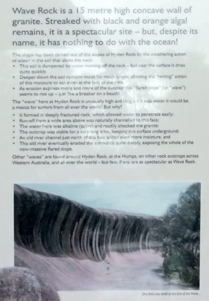
ウェーブロックは、高さ15メートルで凹の花崗岩の壁で、黒とオレンジの藻類があるが、しかし壮観な場所だ。なお、名前にもかかわらず、海とは無関係である。
ハイデンロックの斜面に化学的風化作用が働き、今の形になった。特に岩に接する土壌の内部にある水が大事だ。
・この土壌は、岩から流れ落ちてくる水で弱まるが、表面近くでは非常に速く乾燥する。
・土壌が深い所では、湿気が長く保たれ、この湿気には「腐敗」作用があり、岩の表面を浸食する。
・この侵食があり、露頭はますます露出し、この「飛び出した斜面(flares slope)」(つまり「波」)は上昇しているように見える。ちょうど岸辺の砕波のように。

ここハイデンロックの「波」は異常に高くてしかも長い。水だと仮定すると、世界中のサーファーのメッカになる。 でも、なぜ?
・「波」は深く破砕した岩の内部で形成して、そのため、容易に水が浸透する。
・上の広範囲から流出は、当然この表面に向って流れる。
・ここの水はアルカリ性(食塩水)で、花崗岩を容易に攻撃する。
・露頭は非常に長期間安定し、そのため、表面が地上にでることはない。
・この表面のすぐ北にある古い川の水路は、さらに水分を追加する。
・この古い川は最終的に周囲を非常に深く浸食し、今では巨大な「飛び出した斜面」の全体を露出する。

他の「波」には、西オーストラリア州のハイデンロック周辺、ハンプ地域、その他に岩の露頭があり、世界中にもあるが、ウェーブ・ロックほど壮観なものはまずない。
Wave Rock is a 15 metre high concave wall of granite. Streaked with black and orange algal remains, it is a spectacular site – but, despite its name, it has nothing to do with the ocean.
The shape has been carved out of ther slopes of Hyden Rock by the weathering action of water in the soil that abuts the rock
・This soil is dampered by water running off the rock but near the surface it dries quite quickly
・Deeper down the soil remains moist for much longer, allowing the “rotting” action of this moisture to eat away at the face of the rock.
・As erosion exposes more and more of the outcrop this “flares slope” (or “wave”) seems to rise up – just like a breaker on a beach.
The “wave” here at Hyden Rock is unusually high and long – if it was water it would be a mecca for surfers from all over the world! But why?
・It formed in deeply fractured rock, which allowed water to penetrate easily;
・Run-off from a wide area above was naturally channelled to this face;
・The water here was alkaline (saline) and readily attacked the granite;
・The outcrop was stable for a very long time, keeping this surface underground;
・An old river channel just north of this face added even more moisture, and
・This old river eventually eroded the surrounded quite deeply, exposing the whole of the now-massive flared slope.
Other “wave” are found around Hyden Rock, at the Humps, on other rock outcrops across Western Australia, and all other the world – but few, if any, are as spectacular as Wave Rock.


1928年にダム湖も建設。頂上には、階段で上ることもできる。


 「カバのあくび岩」(Hippo’s Yawn)は10分ほど離れている。


 10:00、約半時間のモーニングティー。英国のアフターヌーン・ティーとは全く違って、普通の休憩所。兼バーガーとお土産屋。

 10;30ごろ、またセスナに搭乗してピナクルズに。


オーストラリア・パース(2019.11.21)ピナクルズ

Pinnaclesの名刺

Pinnaclesの名刺

 11:00、漁村セルバンテス(Cervantes)に向けてセスナに載って出発。セルバンテスはピナクルズ(Pinnacles)の玄関口である。ここでピナクル(Pinnacle)を日本語訳すると、(屋上や塔上の)小尖塔せんとう、とがった峰、頂点、高所、絶頂などの言葉らしい。
 機内でランチを取る。
 12:30、着陸後、ピナクルズツアーの⾞に乗り換える。運転手として⾞内に男女2人が乗っていた。まだ若く見える中年女性がオーナーで、老年期にはいった男性は女性のメンター(mentor、指導者)だという。以下は入場券とパンフ。

Pinnacles

Pinnacles

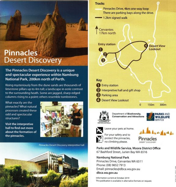
 この地図で、右手の茶色の実線は歩行者専用、白線は自動車と4WD専用の道路になっている。

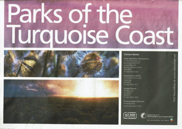
Parks of Perth

Parks of Perth

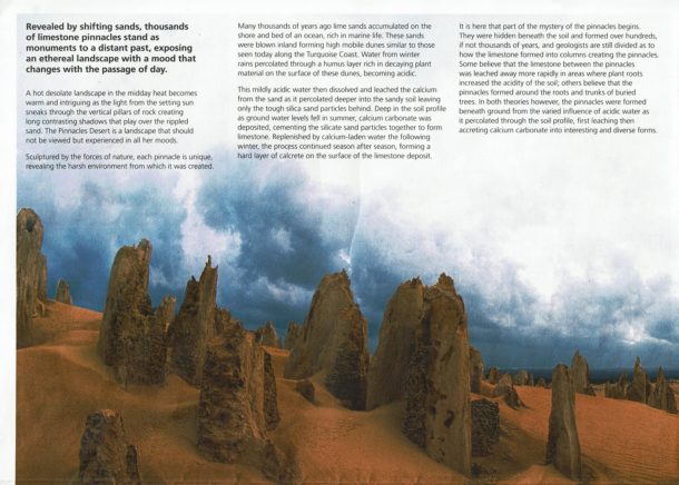
pinnacles Perth

pinnacles

 上の文章の訳は……

 変化する砂でも明らかだが、数千個の石灰のピナクルズは遠い過去を記念し、そのムードは天上の風景のように日の経過とともに変化する。
 真昼の灼熱で暑く荒涼とした風景から、やがては夕日が垂直になったピナクルズ岩を潜り抜ける。波打つ砂は長い影になり、暖かく興味をそそる風景になる。ピナクルズ砂漠は見る風景だけではなくあらゆるムードで経験する。
 自然の力で彫刻し、個々のピナクルズは独特で、過酷な環境を表している。
 何千年前に石灰の砂は、海洋生物が豊富な海岸や海底に堆積し、砂は内陸に吹き飛ばされ、小高く、可動性の砂丘を形成する。その砂丘は今日のターコイズ海岸沿いに見られる砂丘に似ている。冬になると、この砂丘の表面に腐敗した枯れた植物は、豊富な腐植層を通して浸透し、雨の水は酸性になる。
 その後、この弱酸性の水は溶け、砂からのカルシウムが浸出し、砂土がより深くまで浸透し、丈夫な珪砂粒子だけを残す。土壌が深い所で、夏に水位が下がると、炭酸カルシウムが堆積し、珪砂粒子が結合して石灰岩をつくる。次の冬、カルシウムを含んだ水が補充され、このプロセスは季節から季節へと続き、石灰石堆積物の表面にカルクリート(れきが炭酸カルシウムで膠結した堆積物。礫とは岩石が壊れてできた破片や粒子で、直径2mm以上のもの)の硬質層を形成する。
 これからは、ピナクルズの謎である。ピナクルズは土の下に隠され、数千年ではないが数百年にわたって形成する。なぜ石灰岩から柱状のピナクルズになるのか、地質学者の意見は一致しない。一説には、植物の根が土壌の付着性が増えた地域に、ピナクルズ間の石灰岩が急速に浸出したとする。 他の説では、埋もれた木の根と幹の周りにピナクルズが形成したという。 しかし、両方の理論で同じで、ピナクルズは、土壌を浸透する酸性水のさまざまな影響で地下に形成し、炭酸カルシウムを興味深い多様な形に、最初には浸出し、次には蓄積する。
 珪酸化砂を安定化する植生が、恐らく山火事で、除去されると、砂も吹き飛ばされ、ピナクルズを大気にさらす。ピナクルズは、風、雨、猛烈な太陽によって、さらに今日見られるように彫刻する。
 ユエド族は、この独特の風景について、神話に基づく説明をする。土地と結びついて昔の物語を伝えるものだ。
 ピナクルズの体験は完全に個人的で独特である。ある人にとっては興味深い岩の山であり、他の人にとってはスパイラルな、芸術的なものだ。つまり、見逃せないターコイズ海岸の経験なのだ。
Revealed by shifting sands, thousands of limestone pinnacles stand as monuments to a distant past,exposing an ethereal landscape with a mood that changes with the passage of day.A hot desolate landscape in the midday heat becomes warm and intriguing as the light from the setting sun sneaks through the vertical pillars of rock creating long contrasting shadows that play over the rippled sand.The Pinnacles Desert is a landscape that should not be viewed but experienced in all her moods.

Sculptured by the forces of nature,each pinnacle is unique,revealing the harsh environment from which it was created.

Many thousands of years ago lime sands accumulated on the shore and bed of an ocean,rich in marine life. These sands were blown inland forming high mobile dunes similar to those seen today along the Turquoise Coast. Water from winter rains percolated through a humus layer rich in decaying plant. material on the surface of these dunes, becoming acidic.

This mildly acidic water then dissolved and leached the calcium from the sand as it percolated deeper into the sandy soil leaving only the tough silica sand particles behind. Deep in the soil profile as around water levels fell in summer, calcium carbonate was deposited, cementing the silicate sand particles together to form limestone.Replenished by calcium-laden water the following winter,the process continued season after season, forming a hard layer of calcrete on the surface of the limestone deposit.

lt is here that part of the mystery of the pinnacles begins.They were hidden beneath the soil and formed over hundreds, if not thousands of years, and geologists are still divided as to how the limestone formed into columns creating the pinnacles. Some believe that the limestone between the pinnacles was leached away more rapidly in areas where plant roots increased the acidity of the soil; others believe that the pinnacles formed around the roots and trunks of buried trees. In both theories however, the pinnacles were formed beneath ground from the varied influence of acidic water as it percolated through the soil profile, first leaching then accreting calcium carbonate into interesting and diverse forms.

As the vegetation stabilizing the silicate sand was removed, probably by fire, the sand was blown away, exposing the pinnacles to the elements of the atmosphere. The pinnacles were sculptured further by wind, rain and the blistering sun into what we see today.

The Yued people have a more mythical explanation for this unique landscape that connects them to the land and carries the stories of their past.

The pinnacles experience is entirely personal and distinct.To some they are a pile of interesting rocks while others see them in a more spiritual or artistic light. Regardless, this is an experience of the Turquoise Coast that cannot be missed.


 これは他の人の投稿ビデオだが、ただただ大きく、ただただ巨大だった。一度でもこのビデオを見てほしい。

 14:00、ピナクルズからセスナでパースに。旅行社Veltraのハンプによれば「上空からしか見られない、デッドピナクルズを通過します」という。Dead pinnaclesってなあに? 「Fly over the Pinnacles & Dead Pinnacles (seen only from the air) to Perth」と英語でも同じように書いている。他に「a second collection of isolated structures, nestled amongst bush」(低木の中にある第2の孤立構造物)。写真はこれ? それとも写真はただのピナクルズ?

dead pinnacles?

Dead Pinnacles or Pinnacles?

 15:15、ジャンダコット空港に到着。16:05、ホテルに到着。

 夕食はホテル直営のレストランで。

オーストラリア・パース(2019.11.22)フリーマントル

 11/22(金)この日はフリーマントルに行こうと思っている。目的はフリーマントル・マーケットとフィッシュ&チップスで有名なレストランのシセレローズ(Cicerello’s Fremantle)である。
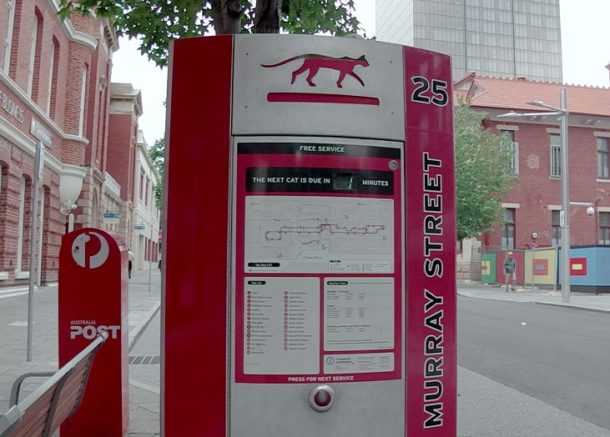
 8:45、CAT(Central Area Transit)バスに乗り、

Perth CAT bos

Perth CAT bos

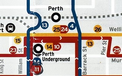
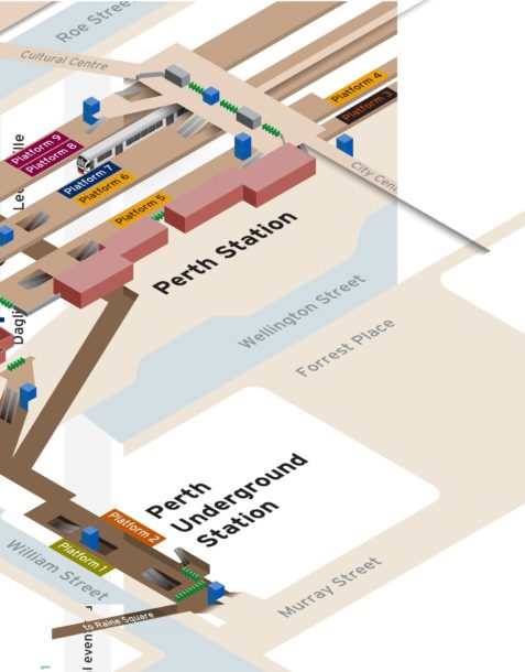
 9:05、で降り、9:10、パースアンダーグラウンド駅に入る。ところが、駅員に聞くと、このまま地下を通って、パース駅まで行かないとフリーマントル線には行かないといわれた。9:35、ようやくパース駅にたどり着く。

 下図でわかるように、パース駅とアンダーグラウンド駅は地下で接続し、アンダーグラウンド駅ではマンデュラ線とバトラー線の2線だけが、パース駅はフリーマントル線などの4線だけがつながる。フリーマントル線は西に向かって発車する。

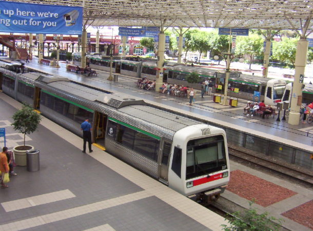
 下図の7番線がフリーマントル線。

Fremantle Line 20190721

https://www.transperth.wa.gov.au/timetablepdfs/Fremantle%20Line%2020190721.pdf

https://www.wikiwand.com/en/Perth_railway_station

パース駅(https://www.wikiwand.com/en/Perth_railway_station)

 9:45、フリーマントル行きに乗り、10:23、到着。

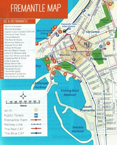
Fremantle CAT

Fremantle CAT

 最初にマーケットに行くと決めていた。その場所は上図「See & DO Fremantle」のにあたる。やはり青CAT(Central Area Transit)を使って、マーケットに行く。


 10:45、マーケットは終わり、11:05、やはりCATを使ってレストラン・シセレローズに行く。フィッシュ&チップスを頼む。量は大きく、でも、味は普通。それだけ。どうして好評だったのか、わからない。


 11:50、昼食が終わり、12:20、駅に。
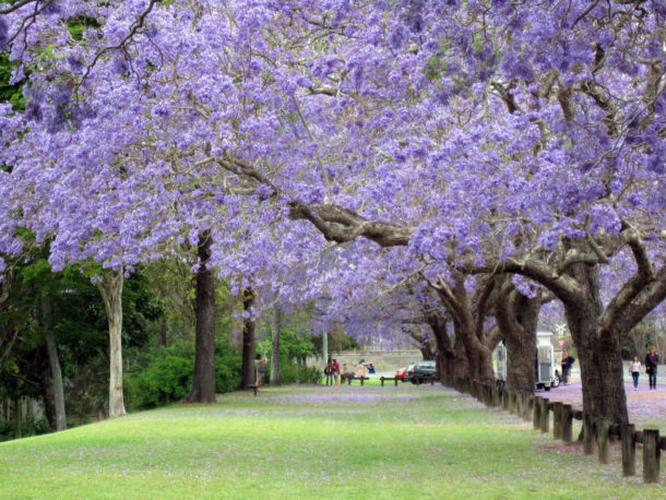
 帰るときに木に紫色の花が咲いていた。これはジャカランダ(Jacaranda)という木だという。


 もともとはボリビア、アルゼンチン、ブラジルなど中南米原産の植物で、木の材質は硬くて重く、木目も美しく、木工家たちから愛されてきたという(www.wood-museum.net/jacaranda.php)。日本でも売っているが、ただし、矮性わいせいといわれて丈が低く、せいぜい1.5mぐらいまでという。春に花が咲く。

https://www.jtb.co.jp/kaigai_guide/report/AU/2014/07/jacaranda.html

https://www.jtb.co.jp/kaigai_guide/report/AU/2014/07/jacaranda.html

 14:05、ホテルに帰り、あとは6:30以内でCレストランに行く予定だけが残っている。

オーストラリア・パース(2019.11.22)Cレストラン

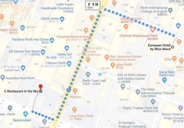
 6:30、Cレストランで夕食。場所は下図。計算では6分かかるが、身障害にとっては12分以上かかる。しかし、ホテルの受付係に「タクシーは近すぎて、ホテルからタクシーを呼ぶのはやめてほしい」といわれ、やむなく徒歩で向かった。実際には25分かかった。

C restaurant

Cレストラン

 Cレストランはこのビルの33階を占める回転展望レストラン。1周するのに約1時間かかる。


C Restaurant Menu

C Restaurant Menu

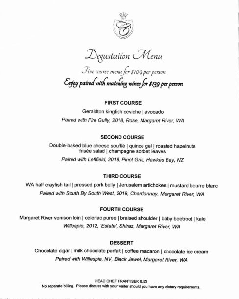
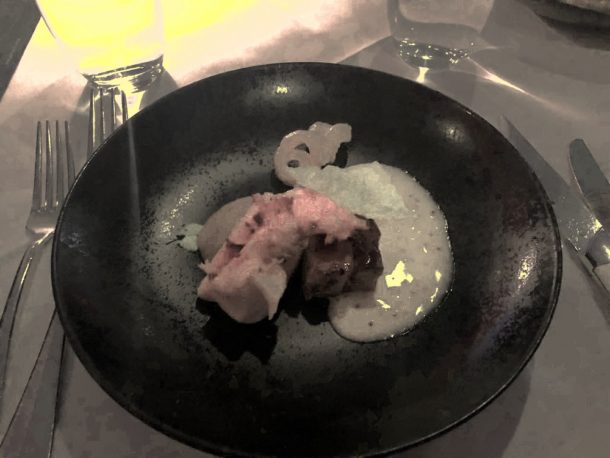
 コースは4皿とデザート。第1皿はヒラマサのマリネ(Geraldton kingfish ceviche)とアボカド。ヒラマサはジェラルトン市で養魚している。(この写真は撮るのを忘れました。すみません。)
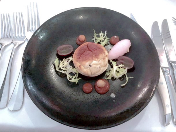
 2皿目は、二度焼きブルーチーズのスフレ(Double-baked blue cheese soufflé)、マルメロ実のゼリー(quince gel)、焼いたヘーゼルナッツ(roasted hazelnuts)、エンダイブのサラダ(frisée salad)、シャンパンシャーベットの葉(champagne sorbet leaves)。矢印を絵の上に動かすと説明がでてきます。

blue cheese souffle

blue cheese souffle

マルメロ実のゼリー マルメロ実のゼリー マルメロ実のゼリー

 3皿目は、西オーストラリアのザリガニ半尾(WA half crayfish tail)、豚バラ肉プレス(pressed pork belly)、キクイモ(Jerusalem artichokes)、辛子ホワイトアスパラガス(mustard beurre blanc)

crayfish tail

crayfish tail

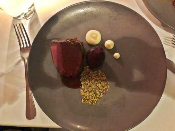
 4皿目はマーガレット川の鹿のサーロイン(Margaret River venison loin)、根セロリのピューレ(celeriac puree)、肩の蒸し煮(braised shoulder)、小型テーブルビート(baby beetroot)、ケール(kale)

venison loin

venison loin

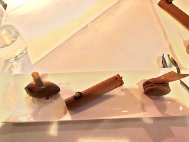
 デザートはチョコレートシガー(Chocolate cigar)、ミルクチョコレートパフェー(milk chocolate parfait)、チョコレートマカロン(coffee macaron)、チョコレートアイスクリーム(chocolate ice cream)。ここでチョコレートアイスクリームの中に小さなチューブでチョコレートパフェーをいれるという。

Chocolate

Chocolate

 私にとっては相当おいしい。すべてオーストラリアでとれた食材だったので、満足でした。一方、妻は塩分が多かったという。8:10、夕食が終わり、8:40、ホテルに帰った。


オーストラリア・パース(2019.11.23)桟橋

 11/23(土)5:45、起床し、7:00、朝食、 7:50、朝食を終え、10:00までTVを見る。
 10:15、CAT(Central Area Transit)バスにから乗り、で降り、で乗り、11:05、で降りる。目的はベル塔(Bell Tower)の上に乗り、昼食を食べること。

Central Area Transit, Perth

Central Area Transit, Perth

 11:10ごろ、ベル塔にはいる。6階建ての小さな……でも、相対的にいえば大きい建物。

 11:35、ベル塔から降りて、12:00、川沿いの建物でランチを取る。確かサラダとハンバーガー。12:25、昼を終わって、12:30、CATバスに乗り、13:30、ホテルで荷物をもらい、13:45、タクシーに乗って、14:05、空港に着く。21:55、全日空のNH882で出発。翌日、予定では08:30着、実際には08:45に到着、

淡路島とうずしおのクルーズ

 グローバルのツアーに行きました。2泊3日(2022/8/18-20)で、2人で44万8000円。参加人数は14人。1人では22万4000円。
 場所は「国生み神話の島」。1日目は兵庫の淡路島で「伊弉諸尊と冉尊」です。入場料はただ。夕食はアナガホテルの「カドー・ド・ラ・メール」でフレンチ。
 翌日、午前中はうずしおのクルーズで、2500円。洗濯機でぐるぐる回ると考えると大間違い。2,3回、多くて数回、表面だけがくるっと回り、あっという間に消えていく。

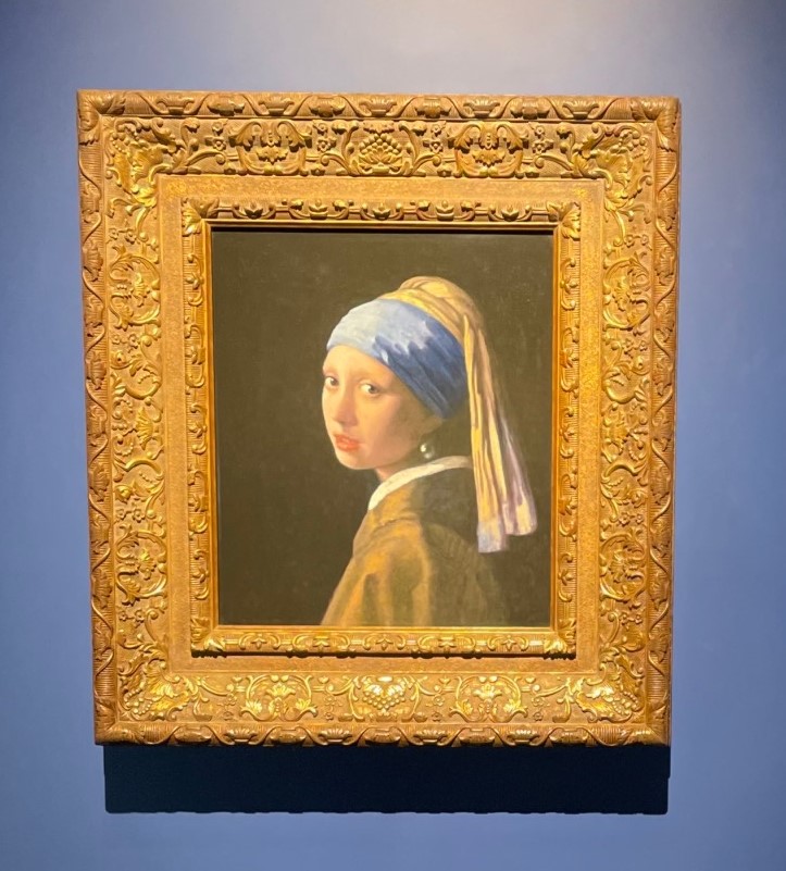
 昼は鳴門のカリフォルニアテーブルで、なんと3,850円。安い。東京は6000円は、する。午後は大塚美術館で3300円。これも印象派が最後で、前衛を走る芸術家はでてこない。しかし、18世紀以前はすごい。はい、私も25歳以降になって勉強しました。

道の駅に少し立ち寄り、ここも値段はただ。
 夜はホテルの「鮨 阿蘇賀」。だたただハモを食べるだけ。鱧の彩、鱧子の玉〆、鱧皮緑酢和え、鱧と新順才、鱧真丈阿蘭陀煮、鱧竜髭菜おかき揚げ、鱧落とし、鱧鍋、鱧の生姜餡かけ、鱧鮨。東京神楽坂では48,000円と高い。ここの高級なホテル1泊と夕飯で5万1900円(ハモ)と6万3150円(フレンチ)。本当は高級な1泊ではなく、私の部屋は部屋が小さい普通の1泊なので、安いはず……しかし、調べても分かりませんでした。なお、ハモづくりは京都1万2000円で、淡路市でも同じ。
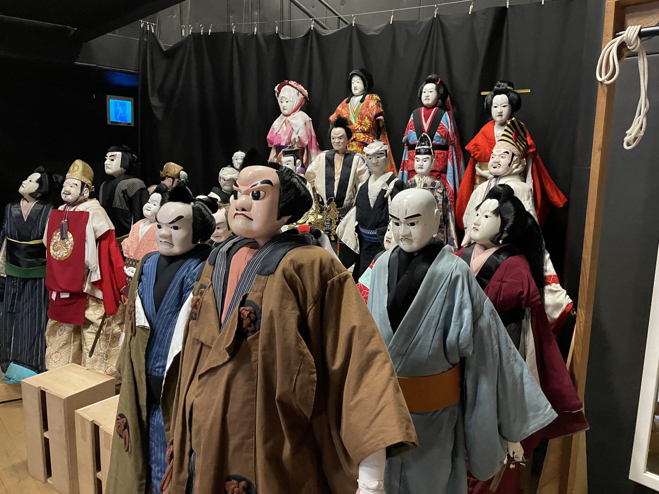
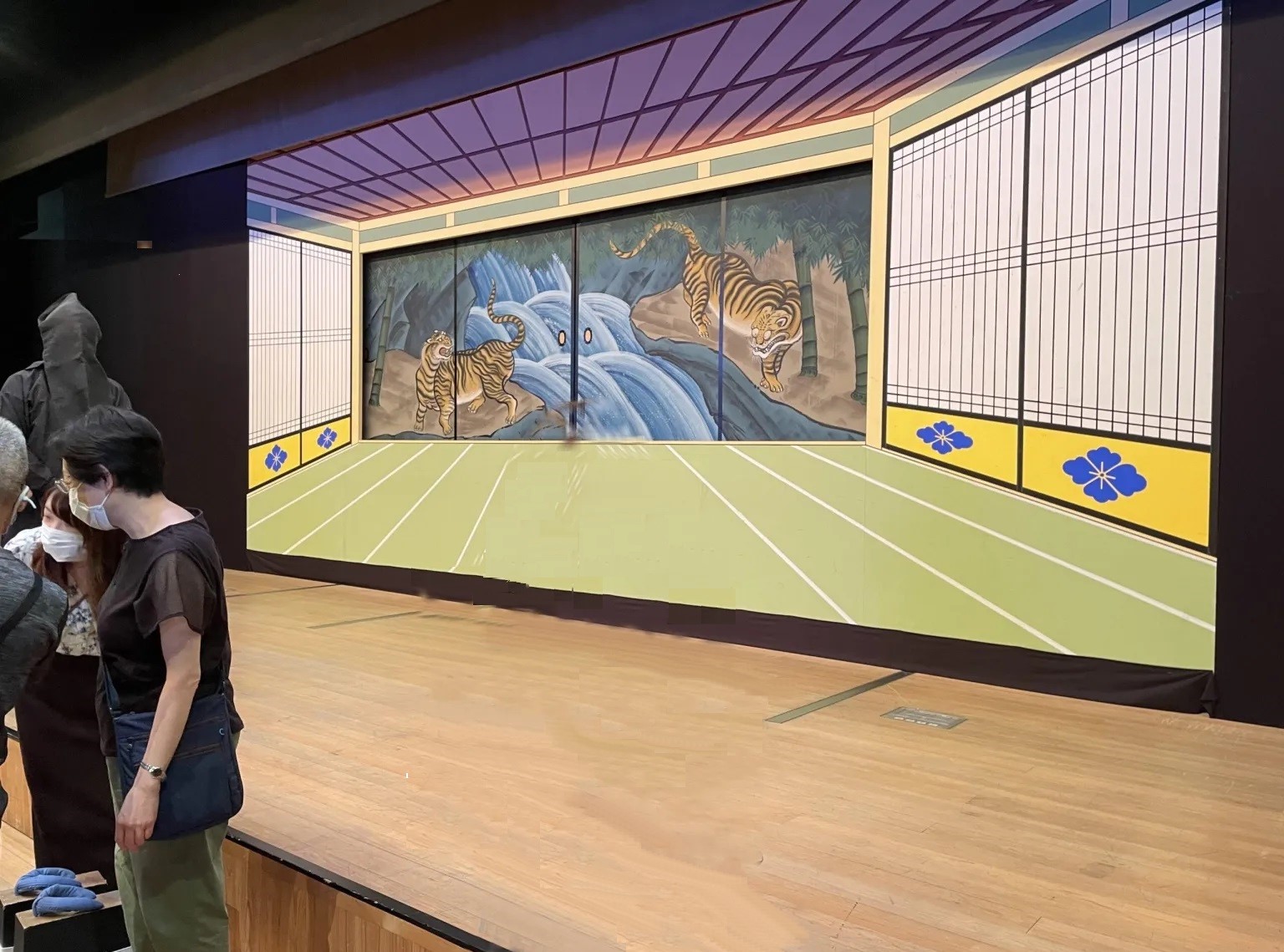
 3日目は人形浄瑠璃を見て、団体は1629円と安い。しかも、これはすごい!と思う。人形の機能が本当によく分かる。


 昼食は神戸市の北野ホテル、調べてみると1泊昼食あり夜食ありは4万円、1泊なしなしで4万円…………ン?……わかりません。まあ、昼は2万円としておくか。
 バスと運転手で最高7万5000円、バスガイドは高く2万円。
 でも、ちょっとゆっくりしすぎる、と同じ乗客の70歳以上の女性、90%は70歳以上。海外旅行は約30前からやっていて、ほぼ全員が北極も南極もいったこともあり、ほとんどの海外の地域に行っている。わたしは海外旅行はもう卒業よという人も複数いました。
 もし今回の旅行が個人旅行だすると、バスと運転手、バスガイドの3点付きで、22万8679円でした。ほとんどツアー代金と変わらない。すごい。ま、3点なしでは15万3679円でしたが。はい、次は買えないなあと、率直に私は思います。

PS. 一週間後、旅の写真1枚と一緒にバースデイカードが来ました。これでまた固定客が増えるんだなぁ。