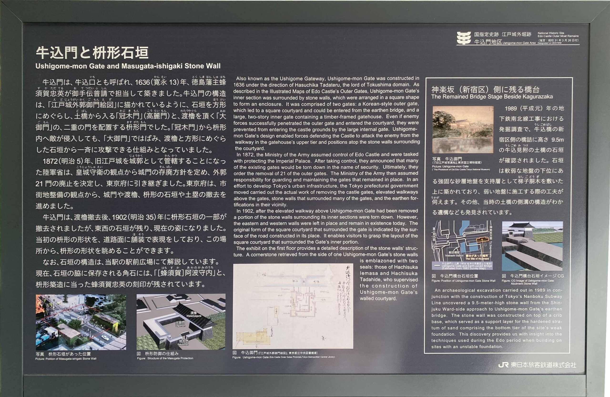
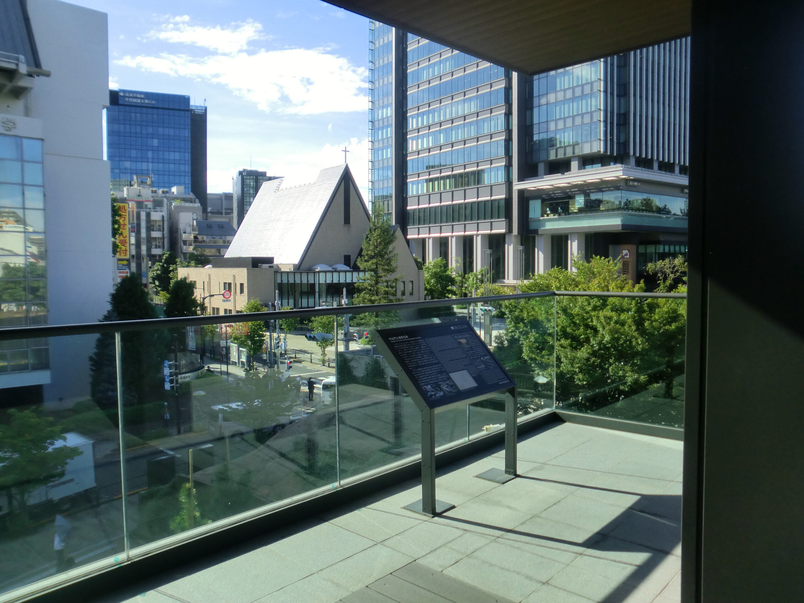
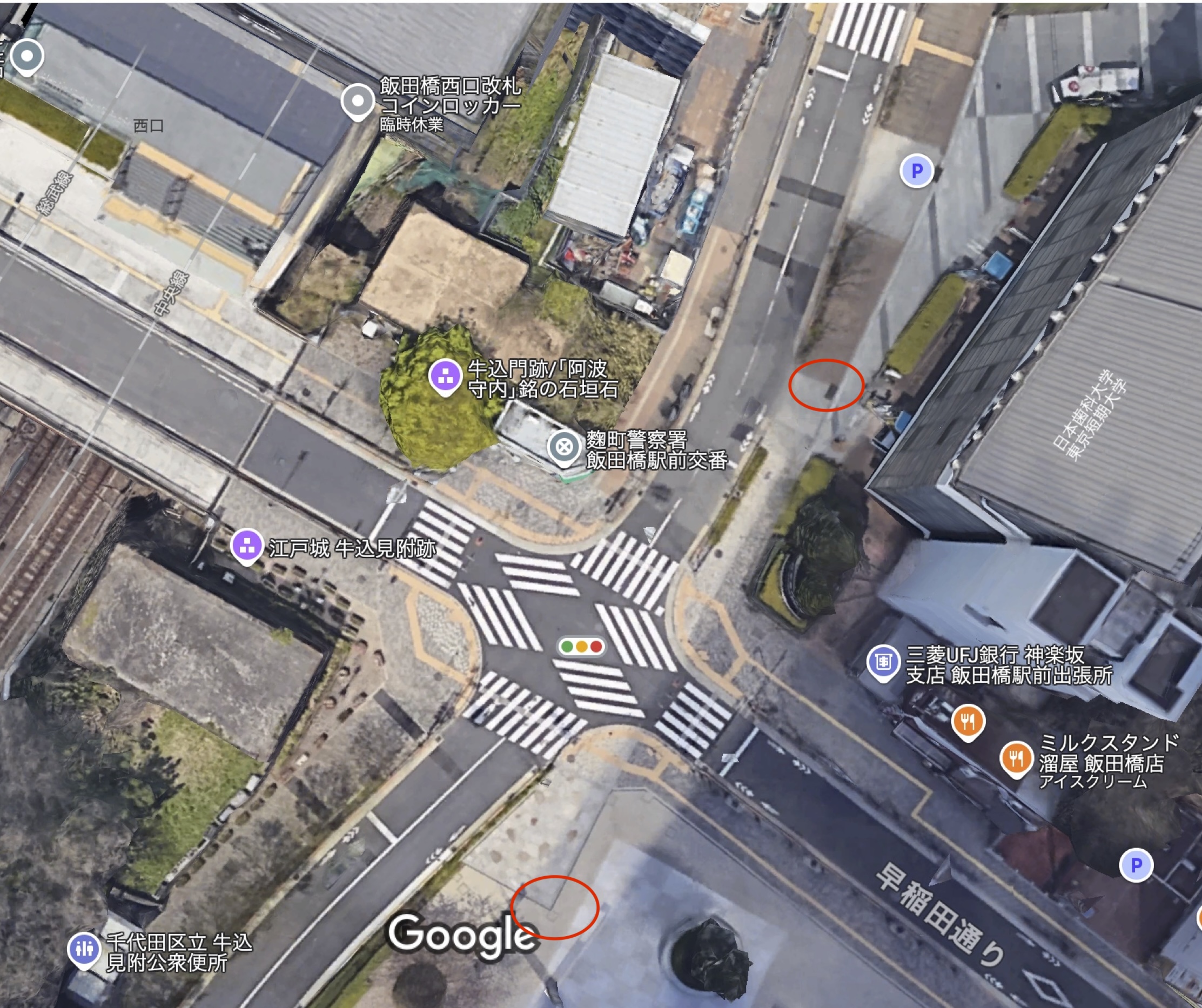
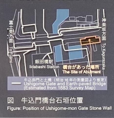
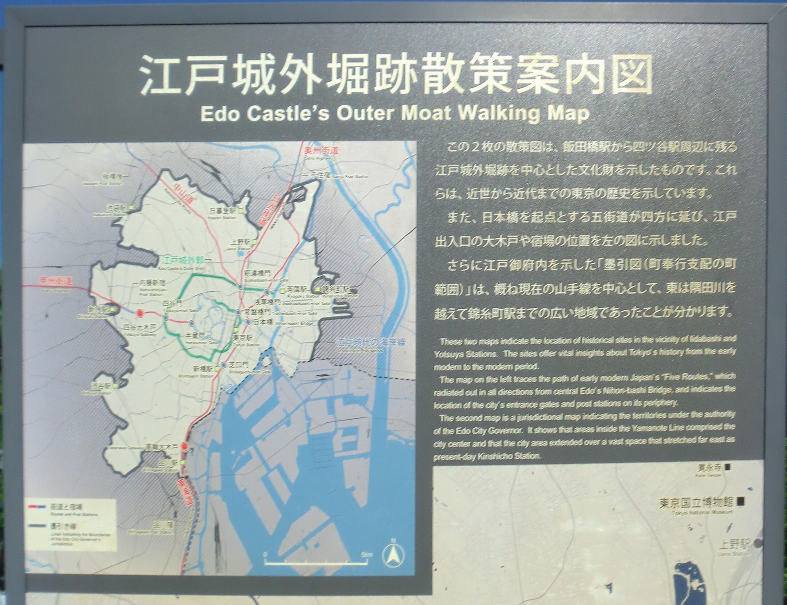
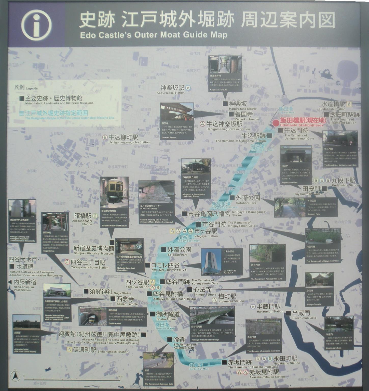
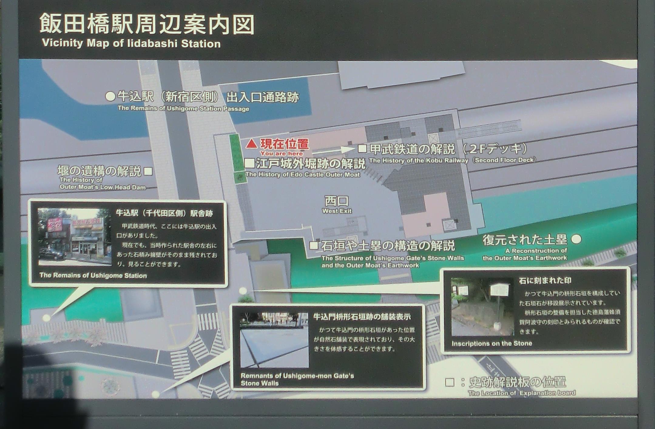
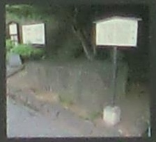
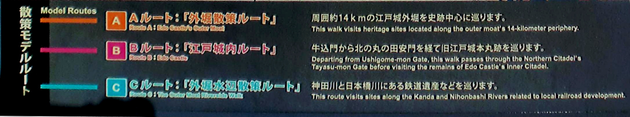
2021年(令和3年)から飯田橋駅西口駅舎の1階に「史跡紹介解説板」、2階には「史跡眺望テラス」と「史跡紹介解説板」ができています(ここでは史跡紹介パネルとしてまとめています)。
1階の西口改札外コンコースでは「外堀を構築する見附石垣・土塁・堰の構造」を取り上げています。パネルA「牛込門枡形石垣の構造」は枡形の石垣、石垣の積み方、その内部構造を、日本語と英語で解説しています。
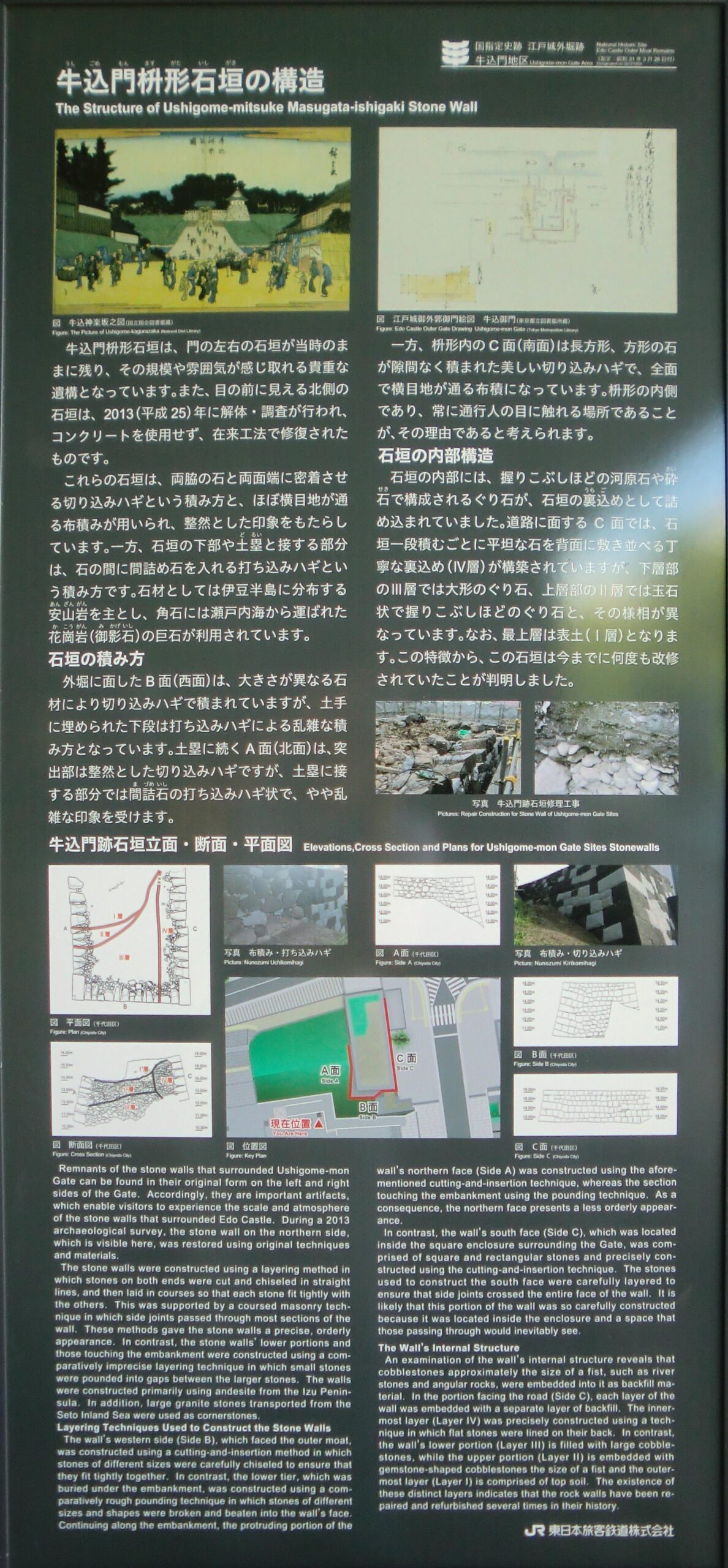
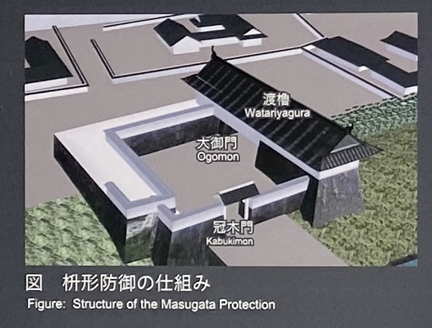
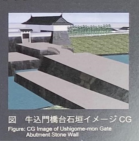
牛込門枡形石垣の構造
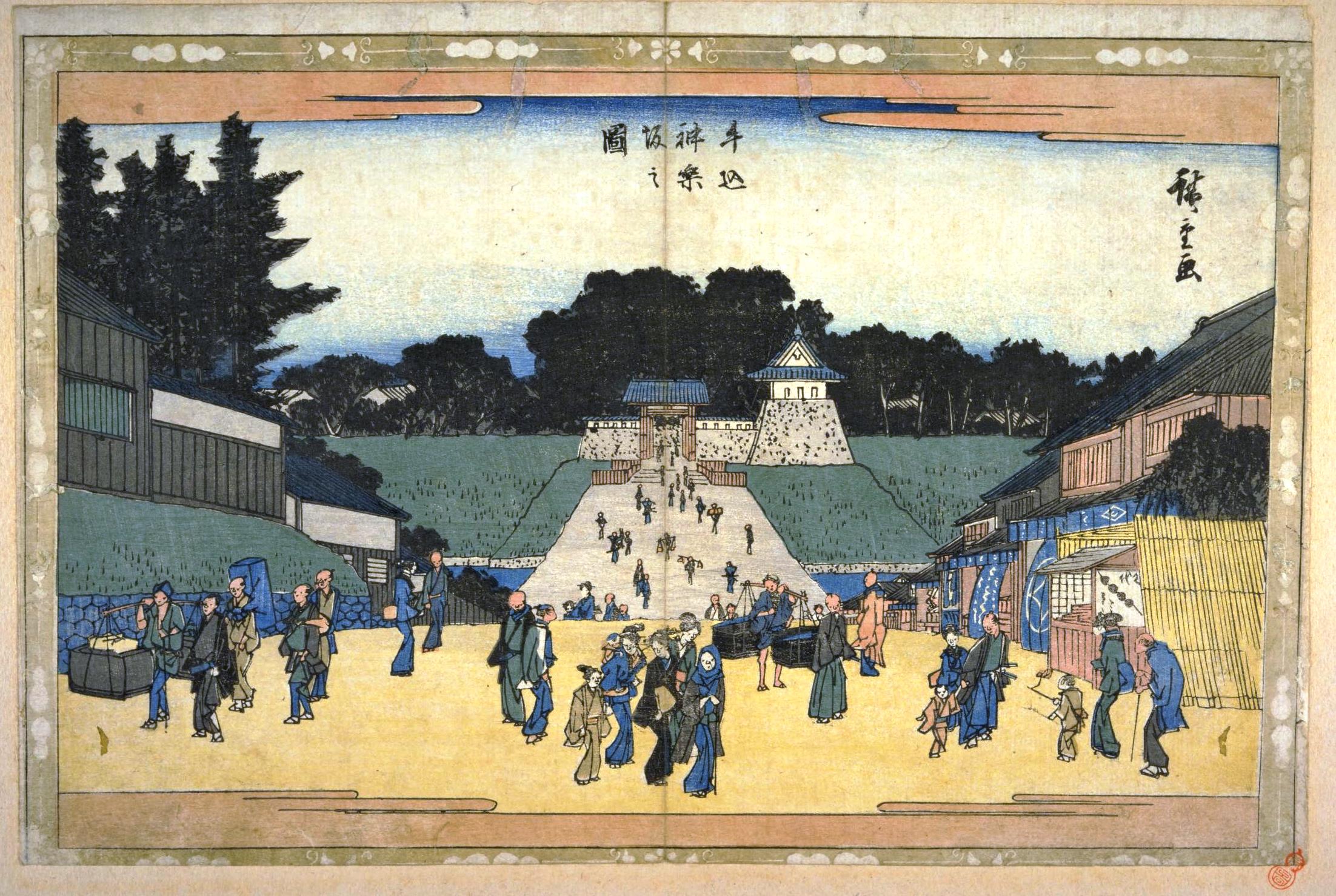
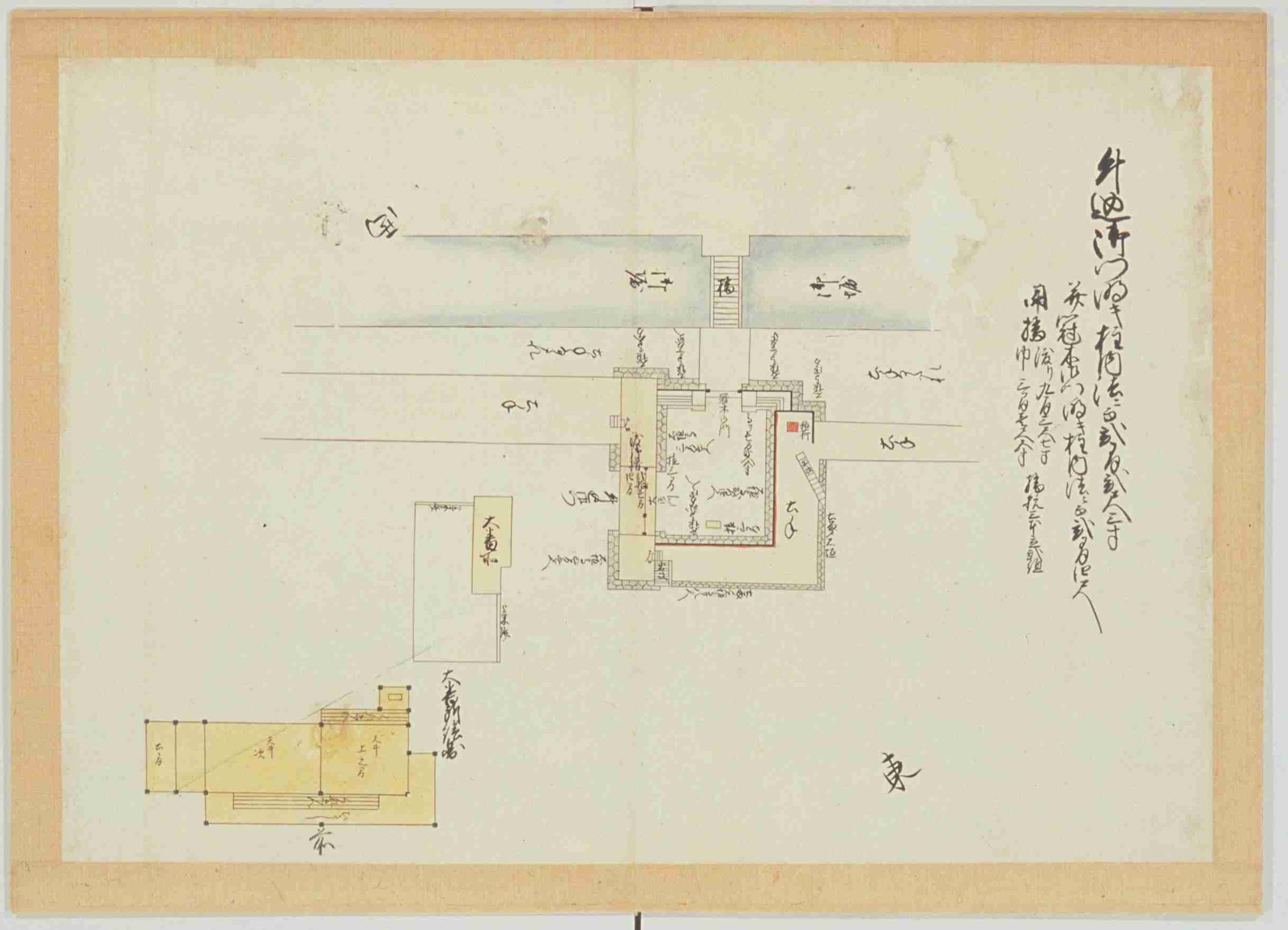
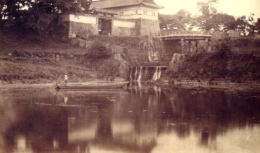
| 牛込門枡形石垣の構造 牛込門枡形石垣は、門の左右の石垣が当時のままに残り、その規模や雰囲気が感じ取れる貴重な遺構となっています。また、目の前に見える北側の石垣は、2013(平成25)年に解体・調査が行われ、コンクリートを使用せず、在来工法で修復されたものです。 これらの石垣は、両脇の石と両面端に密着させる切り込みハギという積み方と、ほぼ横目地が通る布積みが用いられ、整然とした印象をもたらしています。一方、石垣の下部や土塁と接する部分は、石の間に間詰め石を入れる打ち込みハギという積み方です。石材としては伊豆半島に分布する安山岩を主とし、角石には瀬戸内海から運ばれた花崗岩(御影岩)の巨石が利用されています。 |
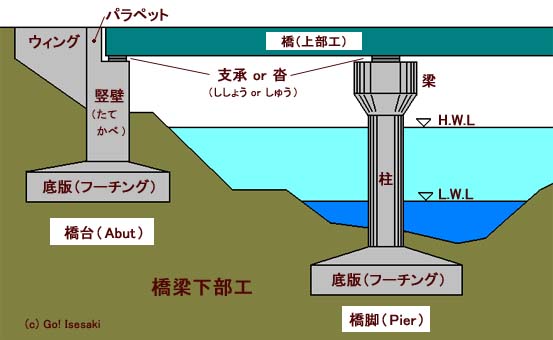
石垣 いしがき。石を積み上げて造った垣。石の塀。防衛や風防、土砂どめ、境界標示のために造る。
解体・調査 加藤建設株式会社の「史跡江戸城外堀跡 牛込門跡石垣修理工事報告」(飯田橋駅西口地区市街地再開発組合・千代田区、2014年)にまとめられています。新宿区の中央図書館と歴史博物館でも読むことができます(しかし、館外利用はできません)。
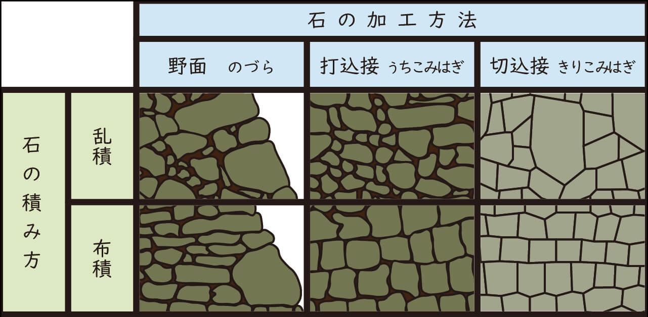
切り込みハギ きりこみはぎ。切込接。切込み接ぎ。切り込みハギ。石垣は土塁の表面を石で固めて強化する。まず大きな石を加工して形を整え、隙間なく積み上げて、すき間のない石垣ができる。この石垣工法を切込み接ぎと呼び,まだすき間のあるものを打込み接と呼ぶ。切込接ぎを採用するには高い財力と技術力が必要。自然な排水はできず、排水口を設ける工夫も必要。
石垣の積み方
横目地 「目地」は石や煉瓦を積み上げたり、タイルなどを貼ったりしたときできる、接着剤が充填された継ぎ目。道路では横断方向が横目地、
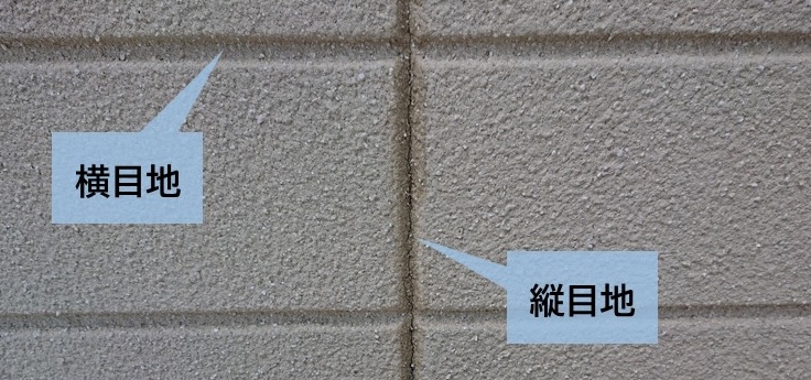
布積み 布積み。ぬのづみ。継ぎ目が横一直線になるように石垣を積む方法。乱積み(らんづみ)は、不規則に積み上げていく。
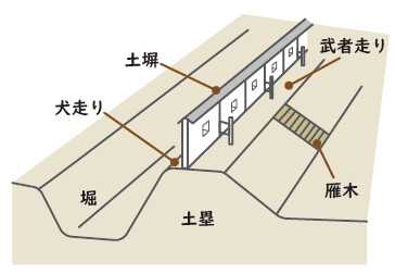
土塁 どるい。土居。敵や動物などの侵入を防ぐため、主に盛土による堤防状の防壁施設。土を盛りあげ土手状にして、城郭などの周囲に築き城壁とした。英語ではembankmentで、土手、堤防、盛り土などがその訳語。
間詰め石 あいづめ石。まづめ石。日本の城の石垣で、大きな石の隙間を埋めるように配置する石。大きな石同士の間に入れやすいよう、小さな石を選ぶ。
打ち込みハギ 石を打ち欠くなどして加工し、石同士の隙間を減らす積み方。加工に手間がかかるが、面積よりも高く急な石垣を造ることができる。
安山岩 日本には大量に分布。美しさや強度の点で花崗岩に及ばず、おもに土木用の割りぐり石や砕石などに利用。
花崗岩 白や淡灰、淡紅の基質に、黒の斑点が散在してみえ、堅牢で、雨や風にも劣化しにく、磨くと光沢が出る。造山帯を特徴づける。
石垣の積み方
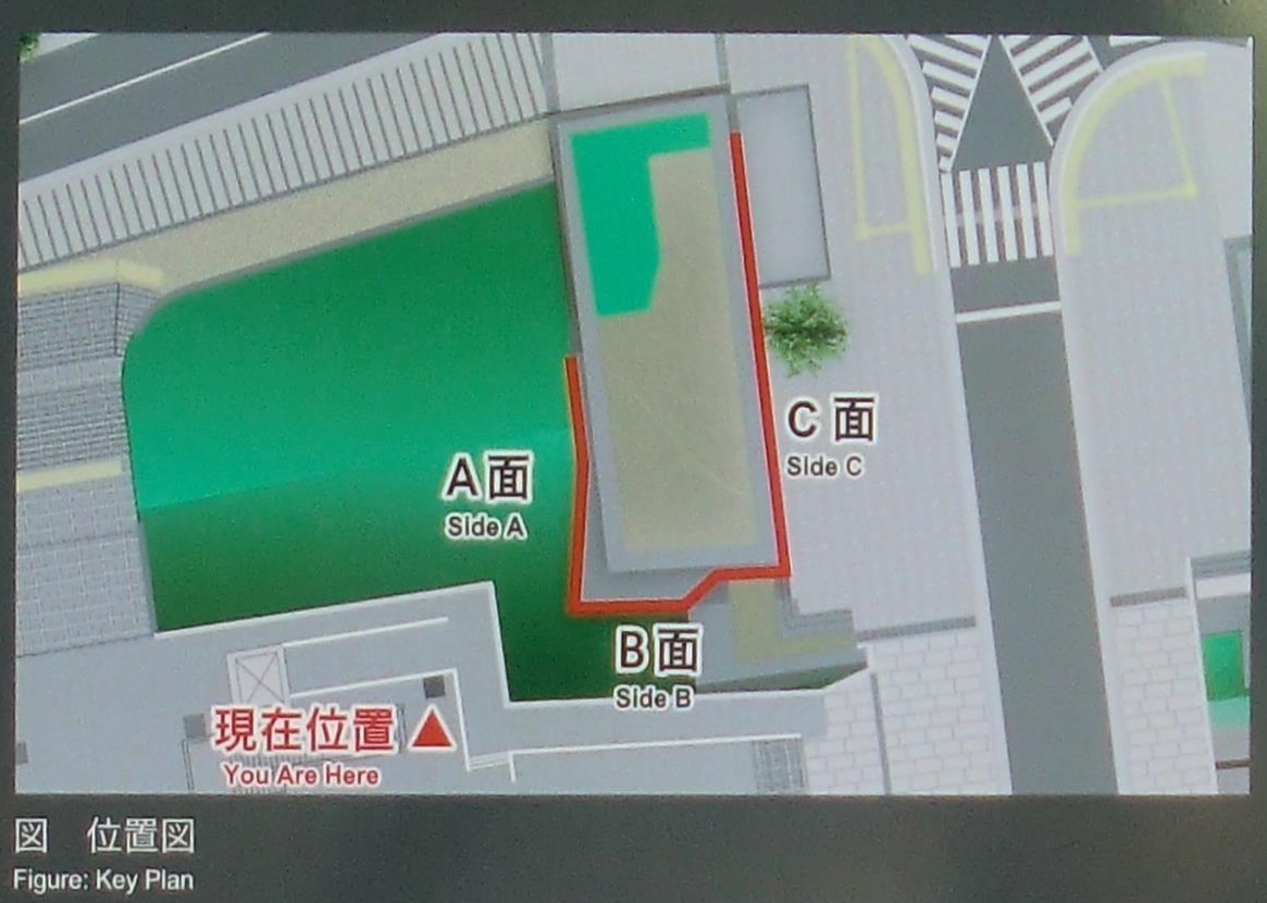 位置図 外堀に面したB面(西面)は、大きさが異なる石材により切り込みハギで積まれていますが、土手に埋められた下段は打ち込みハギによる乱雑な積み方となっています。土塁に続くA面(北面)は、突出部は整然とした切り込みハギですが、土塁に接する部分では間詰石の打ち込みハギ状で、やや乱雑な印象を受けます。 |
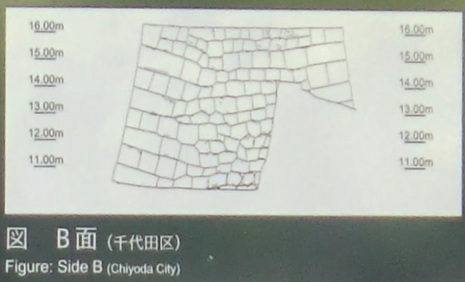
B面
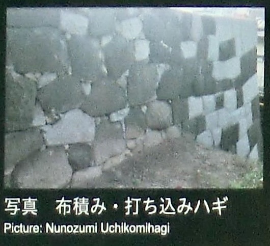
布積み・打ち込みハギ
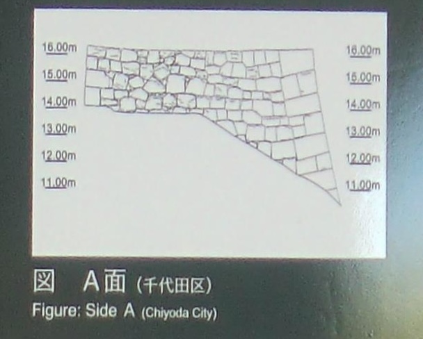
A面
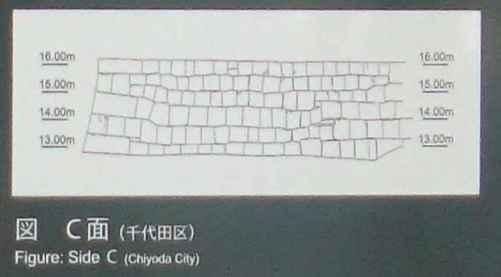
C面
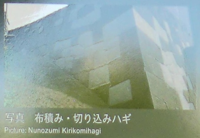
布積み・切り込みハギ
| 石垣の内部構造 石垣の内部には、握りこぶしほどの河原石や砕石で構成されるぐり石が、石垣の裏込めとして詰め込まれていました。道路に面するC面では、石垣一段積むごとに平坦な石を背面に敷き並べる丁寧な裏込め(IV層)が構築されていますが、下層部のⅢ層では大形のぐり石、上層部のⅡ層では玉石状で握りこぶしほどのぐり石と、その様相が異なっています。なお、最上層は表土(Ⅰ層)となります。この特徴から、この石垣は今までに何度も改修されていたことが判明しました。 |
ぐり石 栗石。クリイシ。グリ。「栗石」とは、丸みを持った径が15センチ以下の石。本来は割った物ではない自然な石のことをさす。
裏込め 擁壁などの裏に詰める物。栗石や砂利を詰めることが多い。
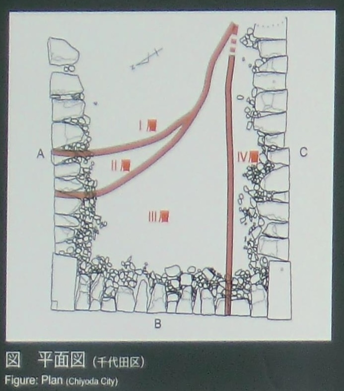
平面図
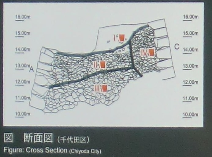
断面図
| Remnants of the stone walls that surrounded Ushigome-mon Gate can be found in their original form on the left and right sides of the Gate. Accordingly, they are important artifacts, which enable visitors to experience the scale and atmosphere of the stone walls that surrounded Edo Castle. During a 2013 archaeological survey, the stone wall on the northern side, which is visible here, was restored using original techniques and materials. The stone walls were constructed using a layering method in which stones on both ends were cut and chiseled in straight lines, and then laid in courses so that each stone fit tightly with the others. This was supported by a coursed masonry technique in which side joints passed through most sections of the wall. These methods gave the stone walls a precise, orderly appearance. In contrast, the stone walls’ lower portions and those touching the embankment were constructed using a comparatively imprecise layering technique in which small stones were pounded into gaps between the larger stones. The walls were constructed primarily using andesite from the Izu Peninsula. In addition, large granite stones transported from the Seto Inland Sea were used as cornerstones. Layering Techniques Used to Construct the Stone Walls The wall’s western side (Side B), which faced the outer moat, was constructed using a cutting-and-insertion method in which stones of different sizes were carefully chiseled to ensure that they fit tightly together. In contrast, the lower tier, which was buried under the embankment, was constructed using a comparatively rough pounding technique in which stones of different sizes and shapes were broken and beaten into the wall’s face. Continuing along the embankment, the protruding portion of the wall’s northern face (Side A) was constructed using the aforementioned cutting-and-insertion technique, whereas the section touching the embankment using the pounding technique. As a consequence, the northern face presents a less orderly appearance. In contrast, the wall’s south face (Side C), which was located inside the square enclosure surrounding the Gate, was comprised of square and rectangular stones and precisely constructed using the cutting-and-insertion technique. The stones used to construct the south face were carefully layered to ensure that side joints crossed the entire face of the wall. It is likely that this portion of the wall was so carefully constructed because it was located inside the enclosure and a space that those passing through would inevitably see. The Wall’s Internal Structure An examination of the wall’s internal structure reveals that cobblestones approximately the size of a fist, such as river stones and angular rocks, were embedded into it as backfill material. In the portion facing the road (Side C), each layer of the wall was embedded with a separate layer of backfill. The innermost layer (Layer IV) was precisely constructed using a technique in which flat stones were lined on their back. In contrast, the wall’s lower portion (Layer III) is filled with large cobble-stones, while the upper portion (Layer Il) is embedded with gemstone-shaped cobblestones the size of a fist and the outermost layer (Layer 1) is comprised of top soil. The existence of these distinct layers indicates that the rock walls have been repaired and refurbished several times in their history. |