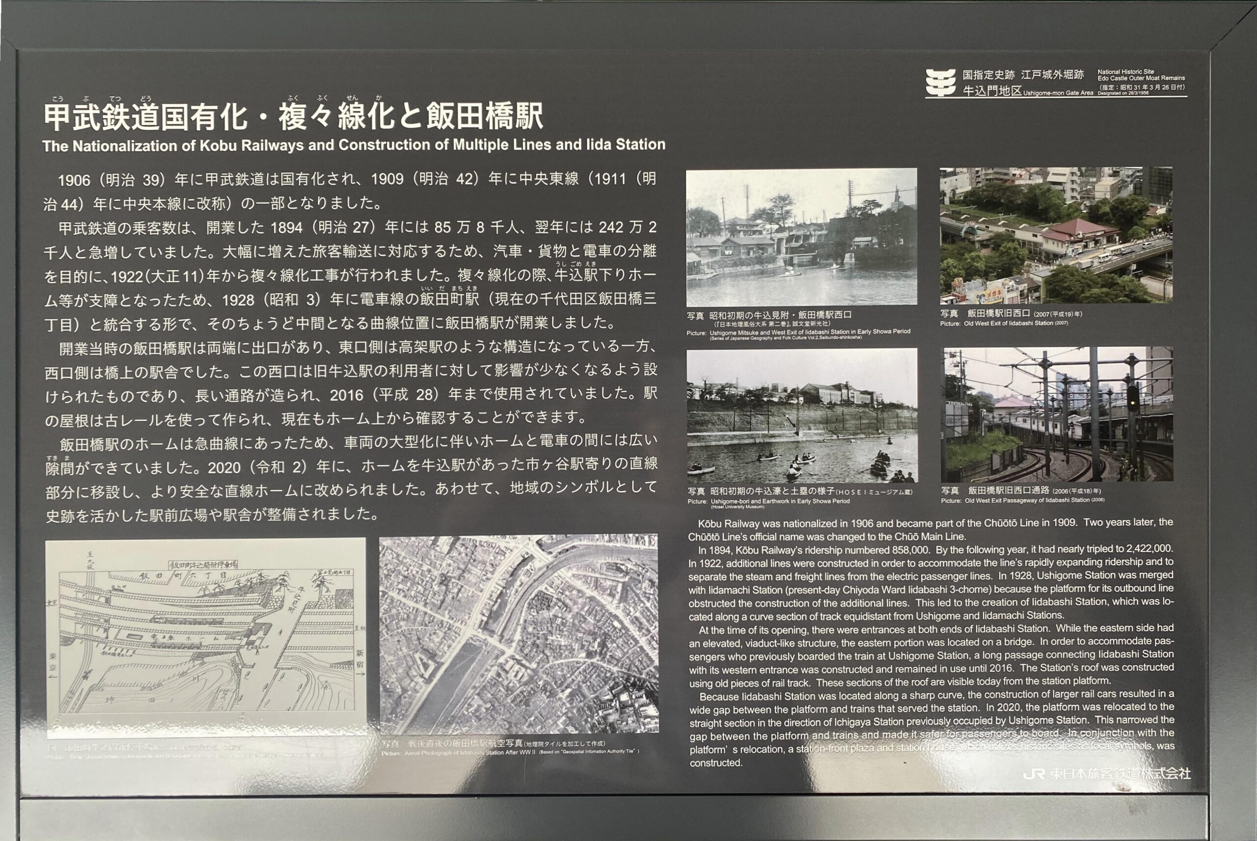
2021年(令和3年)に飯田橋駅西口駅舎の2階に「史跡眺望テラス」ができ、「史跡紹介解説板」もできています。2階の主要テーマは「牛込門から牛込駅へ(鉄道の整備)」で、テラス東側にパネルが4枚(左から①、②、③、④)、さらに単独パネル(⑤)があります。これとは別に1階にも江戸城や外濠の「史跡紹介解説板」などができています。
パネル④は「牛込門・牛込駅周辺の変遷」です。写真3枚と図2枚を掲載し、日本語と英語で解説しています。
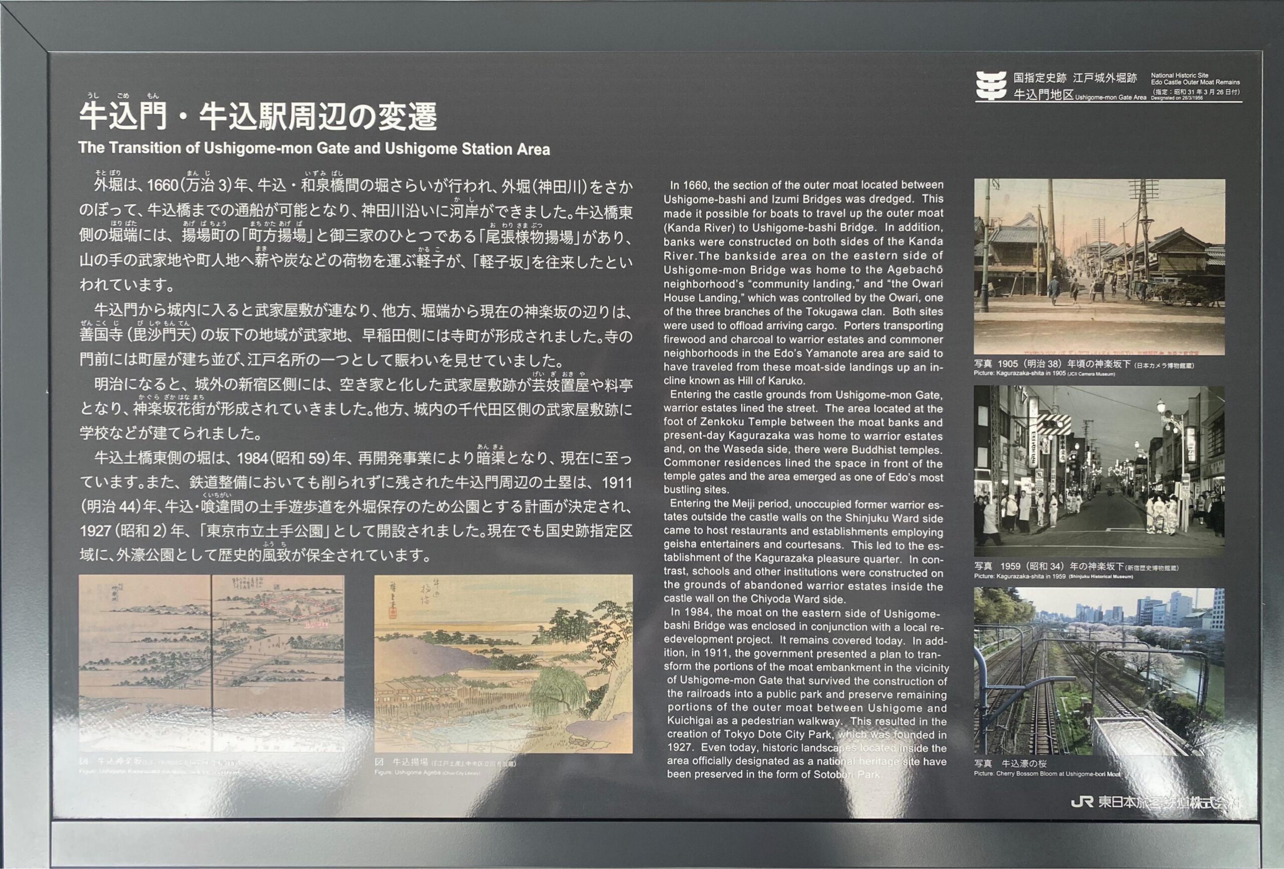
牛込門・牛込駅周辺の変遷
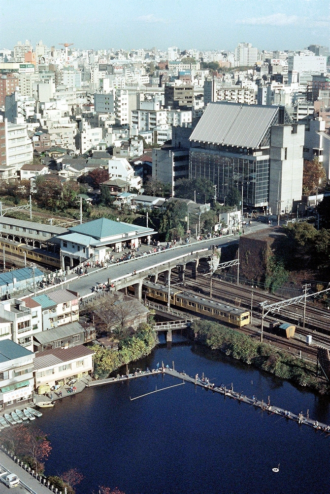
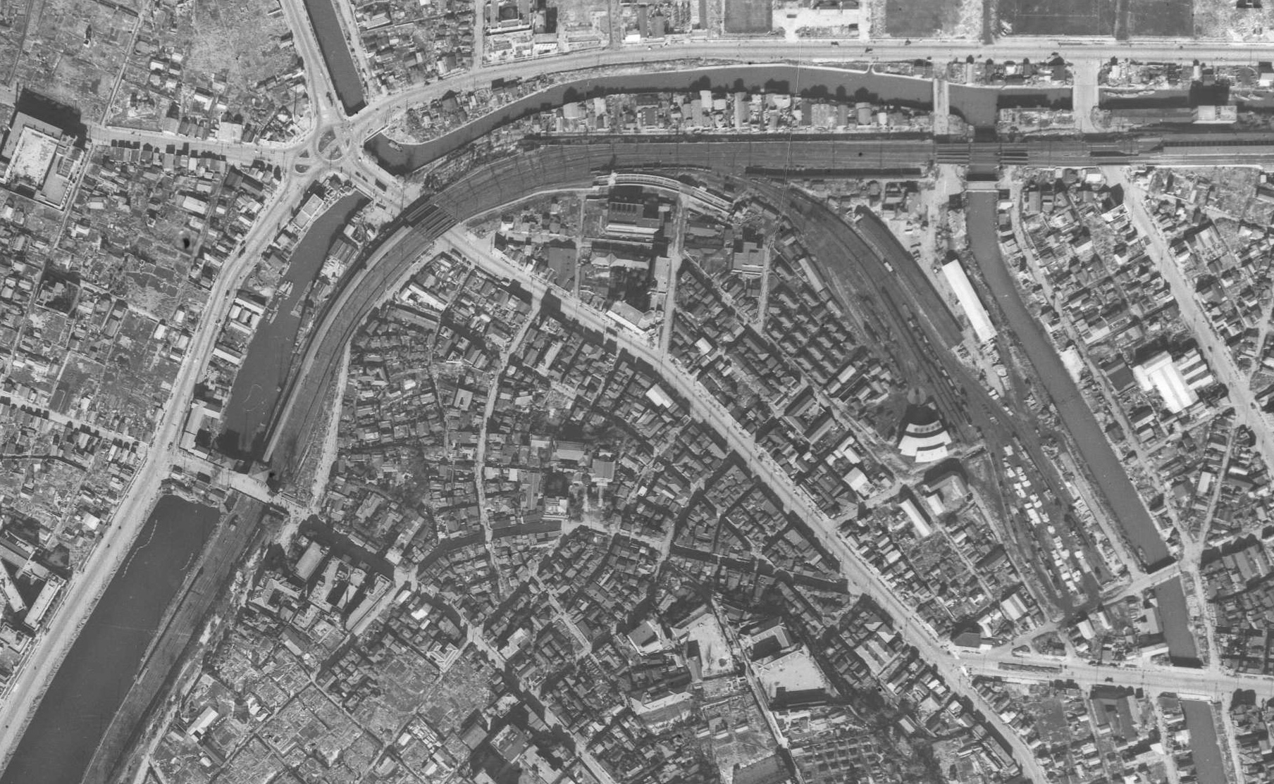
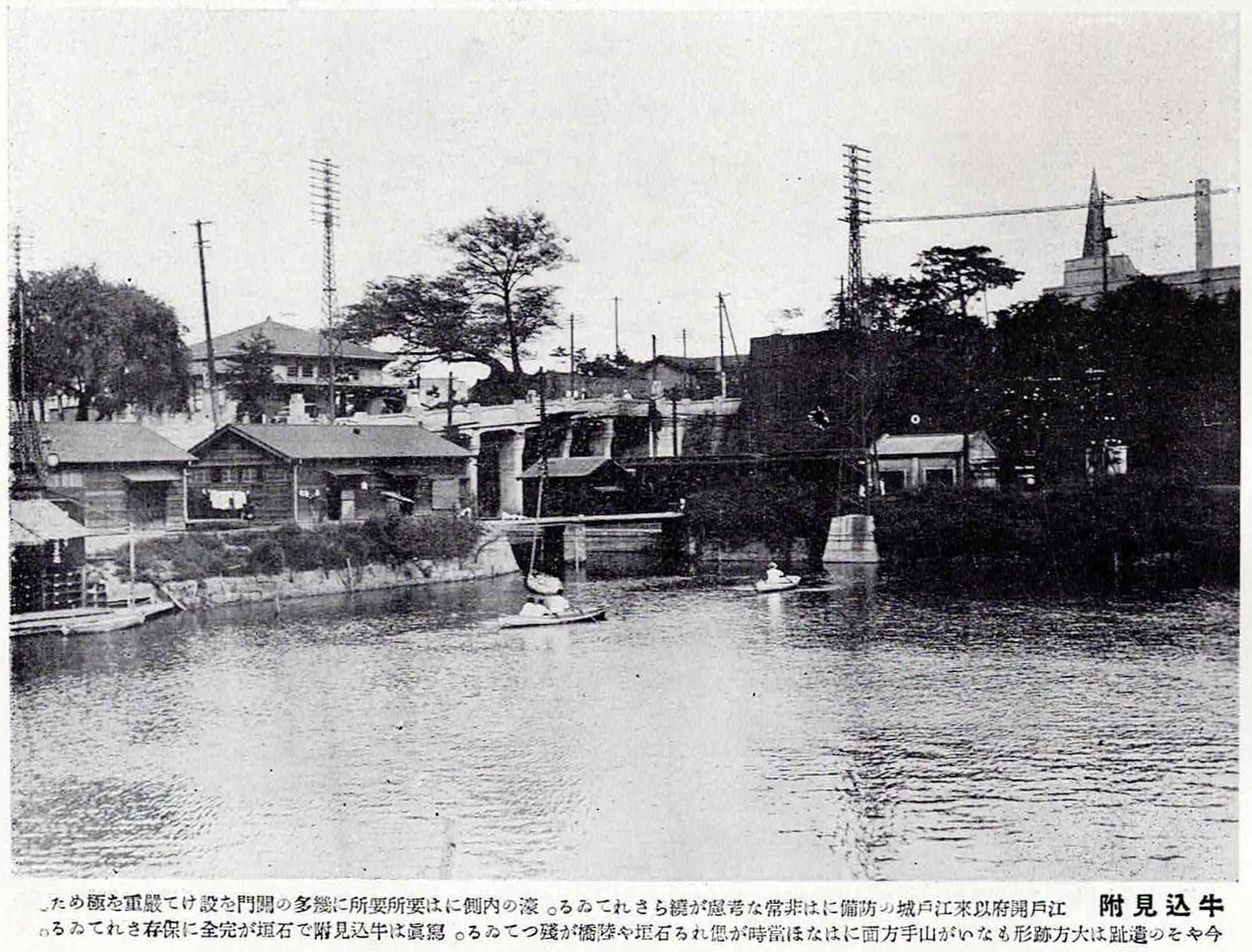
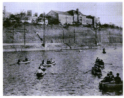
| 牛込門・牛込駅周辺の変遷 The Transition of Usigome-mon Gate and Ushigome Station Areas 外堀は、1660(万治3)年、牛込・和泉橋間の堀さらいが行われ、外堀(神田川)をさかのぼって、牛込橋までの通船が可能となり、神田川沿いに河岸ができました。牛込橋東側の堀端には、揚場町の「町方揚場」と御三家のひとつである「尾張様物揚場」があり、山の手の武家地や町人地へ薪や炭などの荷物を運ぶ軽子が、「軽子坂」を往来したといわれています。 牛込門から城内に入ると武家屋敷が連なり、他方、堀端から現在の神楽坂の辺りは、善国寺(毘沙門天)の坂下の地域が武家地、早稲田側には寺町が形成されました。寺の門前には町屋が建ち並び、江戸名所の一つとして賑わいを見せていました。 明治になると、城外の新宿区側には、空き家と化した武家屋敷跡が芸妓置屋や料亭となり、神楽坂花街が形成されていきました。他方、城内の千代田区側の武家屋敷跡に学校などが建てられました。 牛込土橋東側の堀は、1984(昭和59)年、再開発事業により暗渠となり、現在に至っています。また、鉄道整備においても削られずに残された牛込門周辺の土塁は、1911(明治44)年、牛込・喰違間の土手遊歩道を外堀保存のため公園とする計画が決定され、1927(昭和2)年、「東京市立土手公園」として開設されました。現在でも国史跡指定区域に、外濠公園として歴史的風致が保全されています。 |
堀さらい 水路清掃のため堀の土砂・ごみなどを取り除くこと
河岸 江戸時代に河川や湖沼の沿岸にできた川船の港
堀端 堀のほとり。堀の岸
町方揚場 「町方」は江戸時代の用語で,村方・山方・浦方などの地方(じかた)や、武家方・寺社方に対する語。「揚場」とは船荷を陸揚げする場所。
軽子 魚市場や船着き場などで荷物運搬を業とする人足。縄を編んで畚のようにつくった軽籠と呼ばれる運搬具を用いた。
毘沙門天 多聞天。サンスクリット名はVaiśravaṇa。仏法を守護する天部の神。
寺町 寺院が集中して配置された地域。寺院や墓地を市街の外縁にまとめ、敵襲に際して防衛線とする意図があった。
芸妓置屋 芸妓を抱えておく家。揚屋、茶屋、料亭などの迎えに応じて芸妓の斡旋を業とする。置屋。
花街 はなまち。かがい。遊女屋・芸者屋などの集まっている地域。
暗渠 地下に埋設したり、ふたをかけたりした水路。暗溝。
土橋 どばし。城郭の構成要素の一つで、堀を掘ったときに出入口の通路部分を掘り残し、橋のようにしたもの。転じて、木などを組んでつくった上に土をおおいかけた橋。水面にせり出すように土堤をつくり、横断する。牛込御門の場合は土橋に接続した牛込橋で濠と鉄道を越える。つちばし。牛込門。
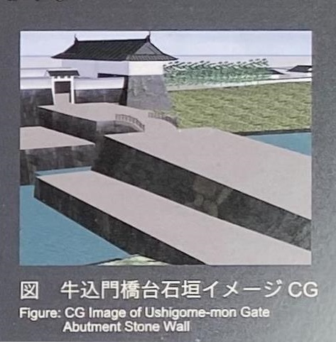
牛込門橋台石垣イメージ
土塁 どるい。敵や動物などの侵入を防ぐために築かれた、主に盛土による堤防状の防壁
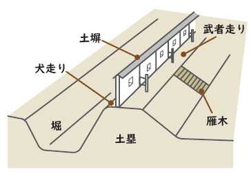
喰違 喰違見附。江戸城外郭門で唯一の土塁の虎口(城郭の出入り口)。紀尾井ホールの筋向かいにある。
土手公園 昭和2年8月31日「東京市立土手公園」として開園。当初は新見附から牛込見附までの長さ300間(約550m)(大日本山林会報)の公園だった。
外濠公園 昭和7年12月17日、「土手公園」を「外濠公園」と改称。(都市計画東京地方委員会議事速記録)。区域も変更し、牛込見附から赤坂見附までの細長い公園に。現在は、JR中央線飯田橋駅付近から四ツ谷駅までに。
風致 自然の風景などのもつおもむき。味わい。
| In 1660, the section of the outer moat located between Ushigome-bashi and Izumi Bridges was dredged. This made it possible for boats to travel up the outer moat (Kanda River) to Ushigome-bashi Bridge. In addition, banks were constructed on both sides of the Kanda River. The bankside area on the eastern side of Ushigome-mon Bridge was home to the Agebachō neighborhood’s “community landing,” and “the Owari House Landing,” which was controlled by the Owari, one of the three branches of the Tokugawa clan. Both sites were used to offload arriving cargo. Porters transporting firewood and charcoal to warrior estates and commoner neighborhoods in the Edo’s Yamanote area are said to have traveled from these moat-side landings up an incline known as Hill of Karuko. Entering the castle grounds from Ushigome-mon Gate, warrior estates lined the street. The area located at the foot of Zenkoku Temple between the moat banks and present-day Kagurazaka was home to warrior estates and, on the Waseda side, there were Buddhist temples. Commoner residences lined the space in front of the temple gates and the area emerged as one of Edo’s most bustling sites. Entering the Meiji period, unoccupied former warrior estates outside the castle walls on the Shinjuku Ward side came to host restaurants and establishments employing geisha entertainers and courtesans. This led to the establishment of the Kagurazaka pleasure quarter. In contrast, schools and other institutions were constructed on the grounds of abandoned warrior estates inside the castle wall on the Chiyoda Ward side. In 1984, the moat on the eastern side of Ushigome-bashi Bridge was enclosed in conjunction with a local reedevelopment project. It remains covered today. In addition, in 1911, the government presented a plan to transform the portions of the moat embankment in the vicinity of Ushigome-mon Gate that survived the construction of the railroads into a public park and preserve remaining portions of the outer moat between Ushigome and Kuichigai as a pedestrian walkway. This resulted in the creation of Tokyo Dote City Park, which was founded in 1927. Even today, historic landscapes located inside the area officially designated as a national heritage site have been preserved in the form of Sotobori Park. |
図 牛込神楽坂
画讃は「月毎の 寅の日にハ 参詣夥しく 植木等の 諸商人市を なして賑へり」と読めます。
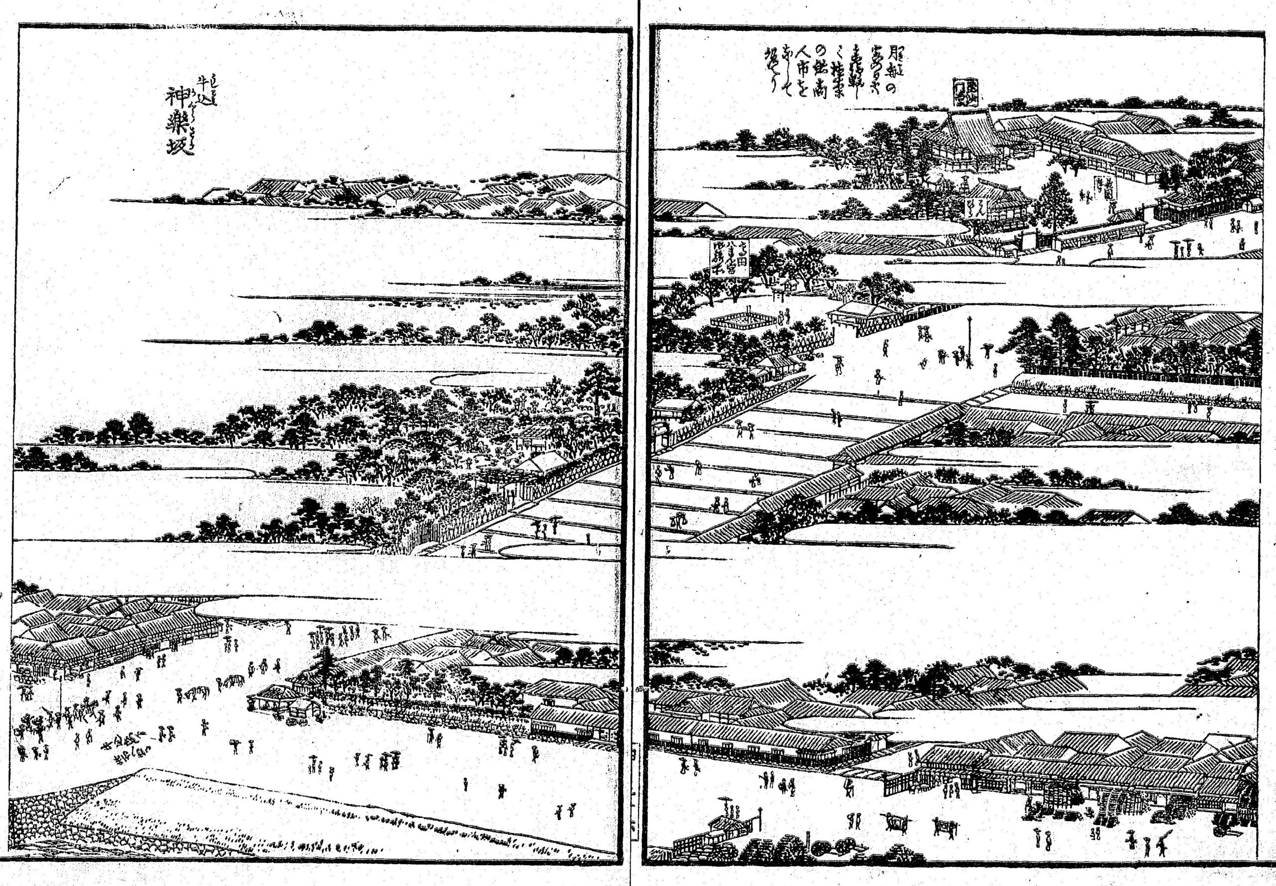
図 牛込揚場(江戸土産)
牛込御門外北の方 船河原橋より南のかた町武の第宅軒を並べ 東南の方は御堀にて材木および米噌はさらなり 酒醤油始め諸色を載てここに集へり 船丘をなせり 故に揚場名は負けらし これより四谷赤坂辺まで運送す 因てこの所の繁華山の手第一とせり
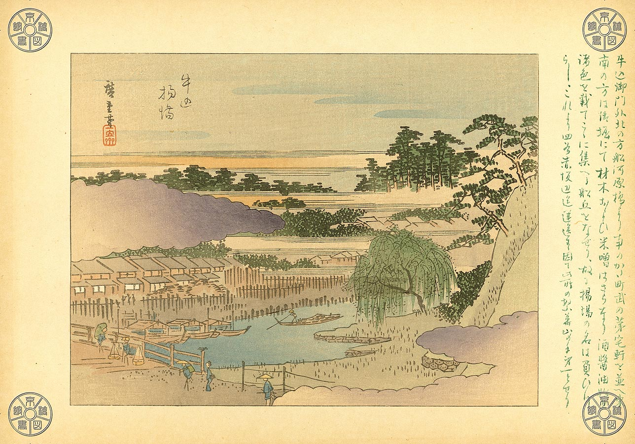
写真 1905年頃の神楽坂下
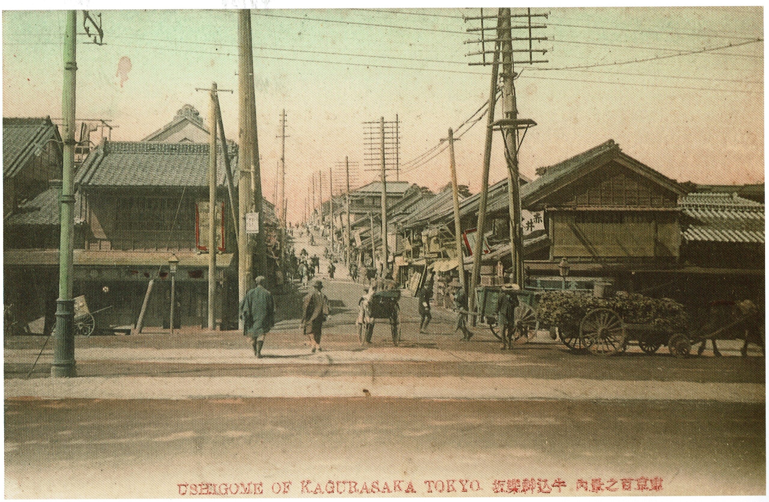
牛込神楽坂。明治35~39年頃。石黒敬章編集『明治・大正・昭和東京写真大集成』(新潮社、2001年)
写真 1959年の神楽坂下
神楽坂入口から坂上方向夜景、着物の女性たち(やらせ? 他にも色々な論争が発生しています)
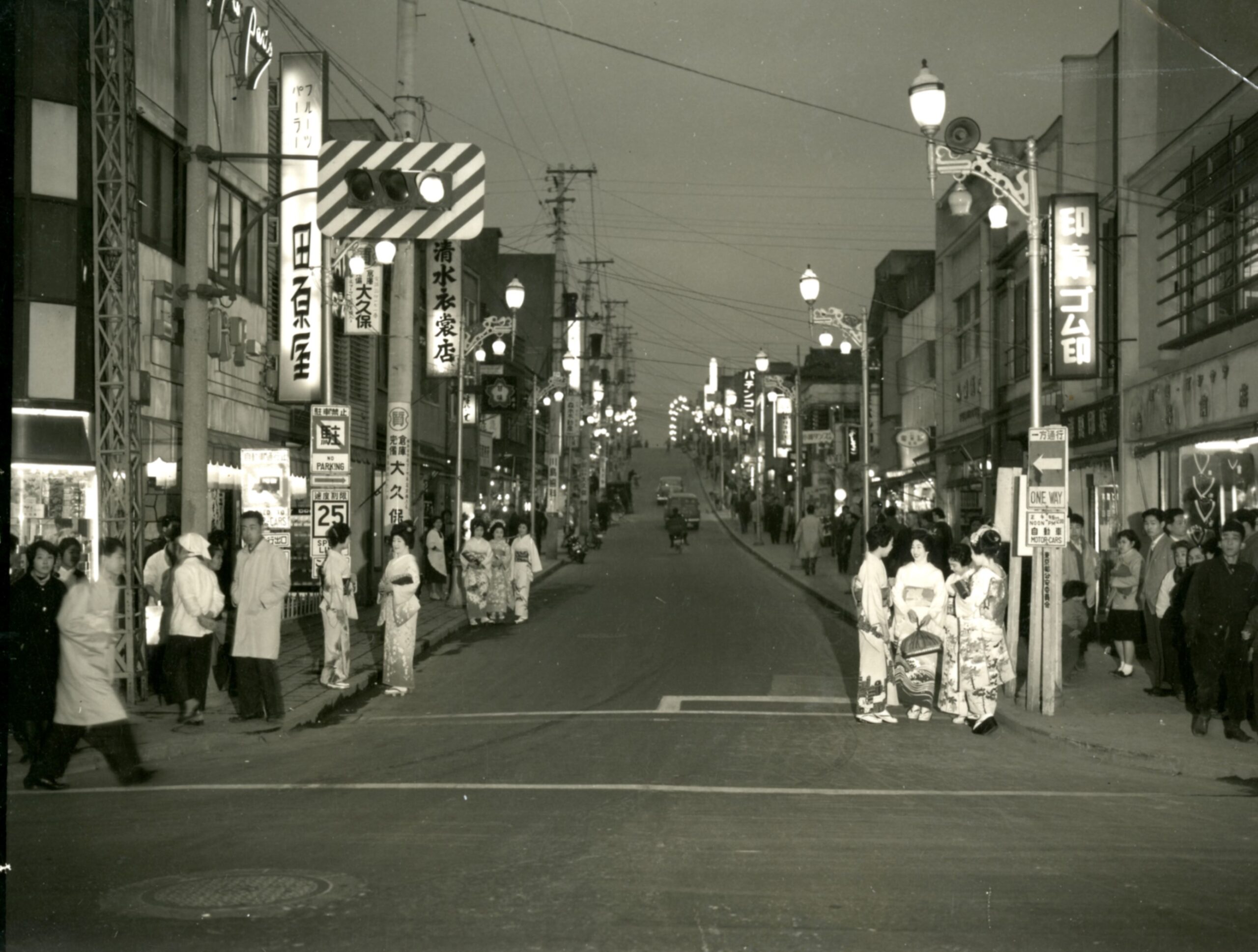
新宿歴史博物館「データベース 写真で見る新宿」ID 31 神楽坂入口から坂上方向夜景、着物の女性たち
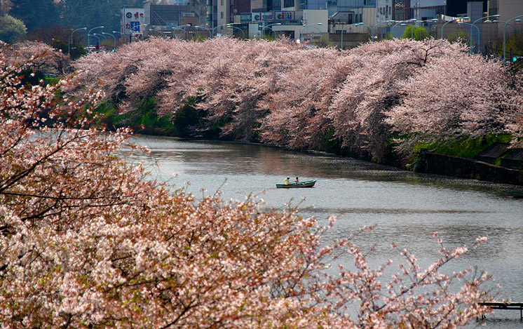
写真 牛込濠の桜
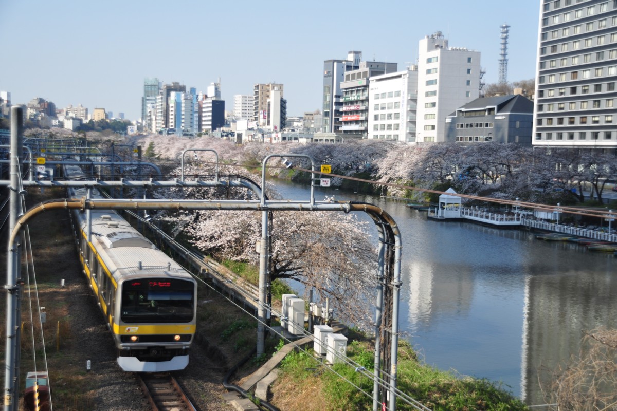
鉄道写真と飛行機写真の撮影紀 トーキョー春爛漫