2021年(令和3年)から飯田橋駅西口駅舎の1階に「史跡紹介解説板」、2階には「史跡眺望テラス」と「史跡紹介解説板」ができています(ここでは史跡紹介パネルとしてまとめています)。
1階の中型パネル4枚(1、2、3、4)の4枚目は「外堀の変遷」です。外堀は江戸城の防御が本来の役目ですが、他にも浮世絵の背景、舟船の輸送路、さらに江戸城がなくなっても、甲武鉄道と外堀の絵葉書として登場します。さらに明治では、新しい「新見附橋」もできています。
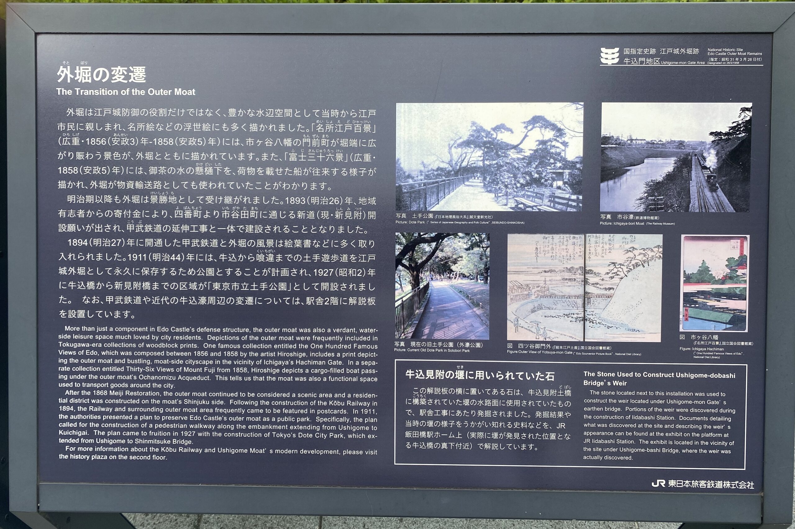
外堀の変遷
| 外堀の変遷 The Transition of the Outer Moat 外堀は江戸城防御の役割だけではなく、豊かな水辺空間として当時から江戸市民に親しまれ、名所絵などの浮世絵にも多く描かれました。「名所江戸百景」(広重」・1856(安政3)年—1858(安政5)年)には、市ヶ谷八幡の門前町が堀端に広がり賑わう景色が、外堀とともに描かれています。また、「富士三十六景」(広重・1858(安政5)年)には、御茶の水の懸樋下を、荷物を載せた船が往来する様子が描かれ、外堀が物資輸送路としても使われていたことがわかります。 明治期以降も外堀は景勝地として受け継がれました。1893(明治26)年、地域有志者からの寄付金により、四番町より市谷田町に通じる新道(現・新見附)開設願いが出され、甲武鉄道の延伸工事と一体で建設されることとなりました。 1894(明治27)年に開通した甲武鉄道と外堀の風景は絵葉書などに多く取り入れられました。1911(明治44)年には、牛込から喰違までの土手遊歩道を江戸城外堀として永久に保存するため公園とすることが計画され、1927(昭和2)年に牛込橋から新見附橋までの区域が「東京市立土手公園」として開設されました。なお、甲武鉄道や近代の牛込濠周辺の変遷については、駅舎2階に解説板を設置しています。 |
景勝地 景色がすぐれている土地。勝地、行楽地、観光地、保養地、避暑地、リゾート
甲武鉄道 明治22年(1889年)4月11日、大久保利和氏が新宿—立川間に蒸気機関として開業。8月11日、立川—八王子間、明治27年10月9日、新宿—牛込、明治28年4月3日、牛込—飯田町が開通。明治37年8月21日に飯田町—中野間を電化。明治37年12月31日、飯田町—御茶ノ水間が開通。明治39年10月1日、鉄道国有法により国有化。中央本線の一部になりました。
| More than just a component in Edo Castle’s defense structure, the outer moat was also a verdant, waterside leisure space much loved by city residents. Depictions of the outer moat were frequently included in Tokugawa-era collections of woodblock prints. One famous collection entitled the One Hundred Famous Views of Edo, which was composed between 1856 and 1858 by the artist Hiroshige, includes a print depicting the outer moat and bustling, moat-side cityscape in the vicinity of Ichigaya’s Hachiman Gate. In a separate collection entitled Thirty-Six Views of Mount Fuji from 1858, Hiroshige depicts a cargo-filled boat passing under the outer moat’s Ochanomizu Acqueduct. This tells us that the moat was also a functional space used to transport goods around the city. After the 1868 Meiji Restoration, the outer moat continued to be considered a scenic area and a residential district was constructed on the moat’s Shinjuku side. Following the construction of the Köbu Railway in 1894, the Railway and surrounding outer moat area frequently came to be featured in postcards. In 1911, the authorities presented a plan to preserve Edo Castle’s outer moat as a public park. Specifically, the plan called for the construction of a pedestrian walkway along the embankment extending from Ushigome to Kuichigai. The plan came to fruition in 1927 with the construction of Tokyo’s Dote City Park, which extended from Ushigome to Shinmitsuke Bridge. For more information about the Kōbu Railway and Ushigome Moat’s modern development, please visit the history plaza on the second floor. |
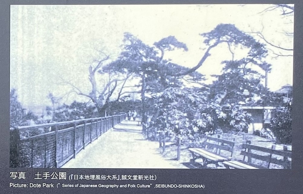 写真 土手公園 この写真は「日本地理風俗大系 II」(新光社、昭和6年)でも「日本地理風俗大系 第1改訂版」(誠文堂新光社、昭和11年)でもありませんでした。
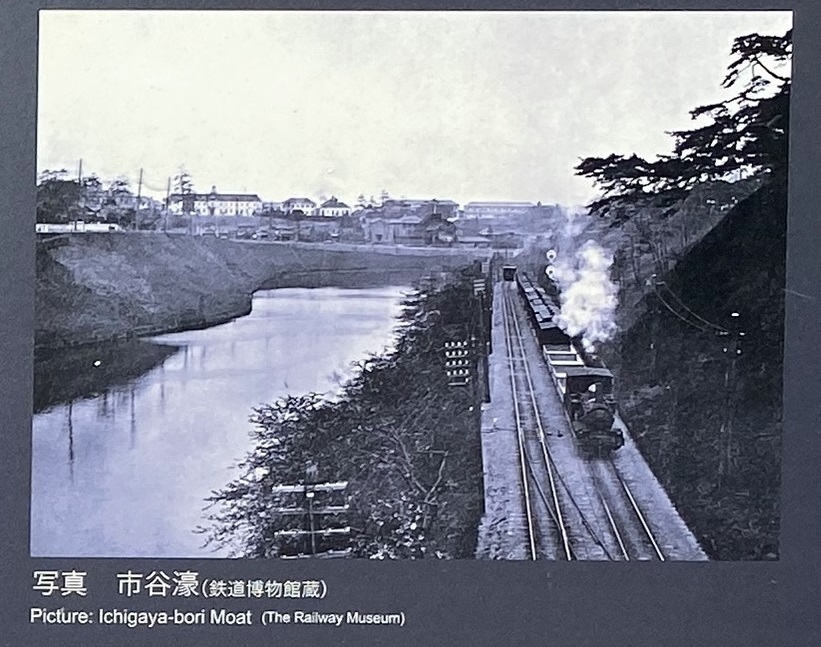 写真 市谷濠
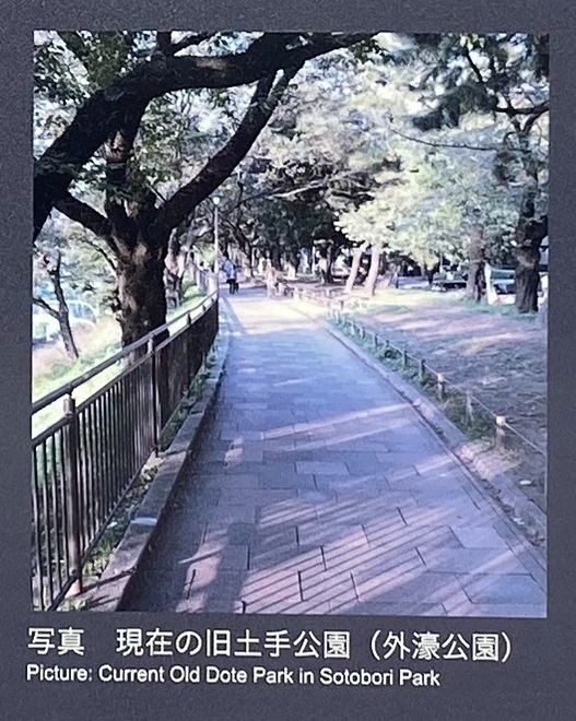 写真 現在の旧土手公園
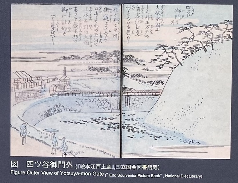 図 四ツ谷御門外 大城堅固に して外に万戸の 商客住む事 何れの口も異なら ねど、別て甲州 街道より入るの 口にして、かの玉河の 上水を引の大樋 あり。千歳不朽の 御仁計仰ぐ べし尊むべし
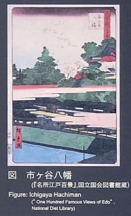 図 市ヶ谷八幡
| 牛込見附の堰に用いられていた石 この解説板の横に置いてある石は、牛込見附土橋に構築されていた堰の水路面に使用されていたもので、駅舎工事にあたり発掘されました。発掘結果や当時の堰の様子をうかがい知れる史料などを、JR飯田橋駅ホーム上(実際に堰が発見された位置となる牛込橋の真下付近)で解説しています。 |
堰 せき。河川の流水を制御し、水を取り入れるために、川の流れをさえぎって造る構造物。水力発電用ダムや堤防の機能はない。
オーストラリア・ニューサウスウェールズ州の堰。低いダム
| The Stone Used to Construct Ushigome-dobashi Bridge’s Weir The stone located next to this installation was used to construct the weir located under Ushigome-mon Gate’s earthen bridge. Portions of the weir were discovered during the construction of lidabashi Station. Documents detailing what was discovered at the site and describing the weir’ s appearance can be found at the exhibit on the platform at JR lidabashi Station. The exhibit is located in the vicinity of the site under Ushigome-bashi Bridge, where the weir was actually discovered. |
