菊池寛氏の「心の日月」は雑誌「キング」の昭和5年1月号から6年12月号まで連載されれた長編小説です。岡山県に住む皆川麗子が主人公で、親が決めた結婚相手がいましたが、彼に対する嫌悪感は強く、家を飛び出し、同じ岡山県の学生磯村晃と東京の飯田橋駅で待合せをします。
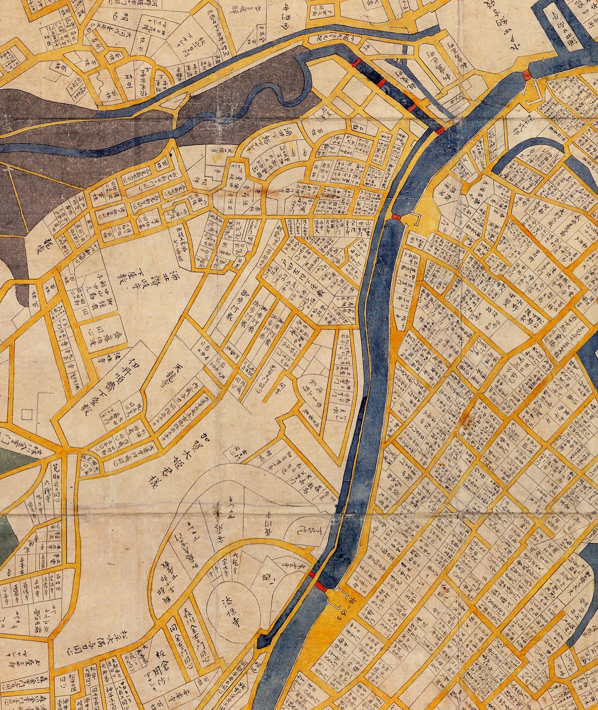
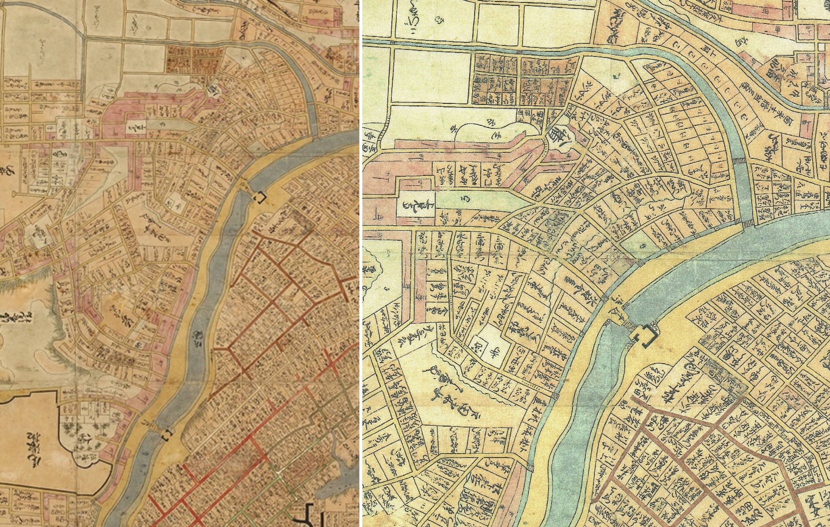
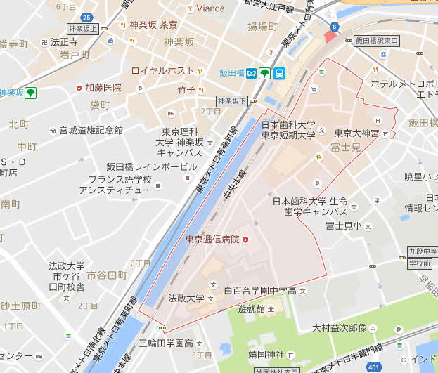
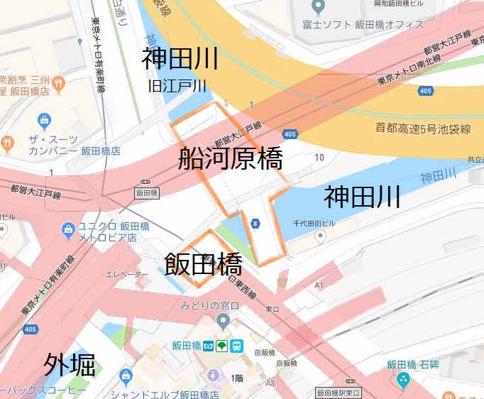
| 磯村は、牛込市ケ谷に近い寄宿舎にゐた。そこは、キリスト教と関係のある寄宿舎で、監督が可なり厳重だと云ふことをきいてゐた。経営者が岡山県人なので岡山県人も、沢山居ると云ふ話だつた。そんな寄宿舎へ麗子がいきなり訪ねて行くことは、相手にどんな迷惑をかけることか分らなかつた。それに、麗子の顔を見知つてゐる学生でもゐたら、自分の東京にゐることが、自分の家に知れることになるかも知れないと思つた。 で、麗子は、牛込に着いたら、とにかく電話で容子を訊いて見ようと思つた。 「ね、もし。」 彼女は、運転手に話しかけた。 「何です。」 「まだ牛込へ来ませんの。」 「いゝえ。もうすぐ牛込ですよ。そこの橋が飯田橋で、茲を渡れば牛込ですよ。」 「こゝから、市ヶ谷は近いでせうか。」 「えゝ。もう、三四町です。」 「ぢや、わたし一寸茲で、おろして貰ひたいわ。」 「はい。」 運転手は、すぐ橋の左側の袂に車をとめた。見るとそこに、その往来を横ぎつて高架線があり、道の直ぐ左側にその高架線の停車場があつた。飯田橋駅とかいてあつた。麗子が、運転手に賃銀を払ふとき、数台、連結した電車が、麗子の頭上を轟々と通りすぎた。 「この電車は、どこへ行きますの。」 「これですか、これは省線ですよ。」 麗子は、なるほどこれが、新聞でよく知つてゐる省線電車だなと思つた。 麗子は、車から降りると公衆電話をさがした。公衆電話は橋向うにあつた。麗子はすぐ、電話の所へ行つた。もう、一分の中には磯村の声がきかれるかと思ふと、麗子は胸が、踊り始めた。でも、公衆電話には。五十近い老婆が、は入つて居り、麗子は三四分の間いら/\しながら、待つてゐた。 「お待遠さま。」 老婆は麗子に挨拶して出て行つた。麗子は、急いでその小さい六角の建物の中には入ると、電話帳をくり出した。割合に早く牛込四八〇五番と云ふ番号が出て来た。 五銭の白銅を入れると、それは麗子の胸を、おどろかしたほどの高いひゞきを出した。 「あなたは、牛込の四千八百五番ですの。ぢや、聖陽学舎でございますの。磯村さんは、いらつしやるでせうか。」 麗子は、おづ/\しながら訊いた。 「一寸お待ちなさい!」 麗子は、自分の名前を訊き返されたりするのではないかと、ビク/\してゐたが、そんなことはちつとも、訊かれないので、ホツとした。もう、今度声が聴かれると、それが磯村の声だと思ふと、麗子は全身の血潮が受話器を当てゝゐる左の耳に、奔騰して来る思ひがした。 「もし、もし、僕磯村です。あなたは。」 それは、たしかに磯村のなつかしい声だつた。 「わたくし、皆川です。」 「皆川?」 磯村には、麗子が東京へ来てゐるなどとは、夢にも思ひつかぬらしかつた。 「皆川ですの。岡山の。」 「まあ! 麗子さんですか。」 電話口に於ける磯村の驚きが、ハツキリ感ぜられた。 「えゝ。」 |
容子 様子。容子。外から見てわかる物事のありさま。状況。状態。
茲 ここ。ほかに此処、此所、此、是、爰も「ここ」
三四町 1町は約109m。3~4町は327~436mで、約400m
袂 たもと。そば。きわ。
省線 鉄道省の電車の通称。汽車と省線電車の2つに分かれた。
くり出す 順々に引き出す。事実を探り出す。
白銅 5銭白銅貨幣。大正5(1916)年に制定。昭和9年では1銭はおおむね現在の250円(https://ameblo.jp/kouran3/entry-12069419540.html)
血潮 ちしお。体内を潮のように流れる血。激しい情熱や感情。
奔騰 ほんとう。非常な勢いで高くあがること。勢いよくかけのぼること
| 「東京へいらしつたのですか。」 「えゝ。」 「今どこです。今どこに居るのですか。」 「飯田橋駅の前ですの。」 「飯田橋駅ですか、ぢや、すぐ此方へいらつしやいませんか。」 「でも、私を知つてゐる方がいらつしやるでせう。こちらへ来て下さいませんか。」 「行きます。すぐ行きます。飯田橋駅ですね。」 「さうですの。飯田橋駅の入口のところにゐます。牛込の方から橋を渡つて来るとすぐ駅の入口があるでせう。」 「えゝ分りました。すぐ行きます。今から十分位に行きます。」 「ぢや、どうぞ。」 麗子は、急に嬉しくなつてしまつた。もう十五分もすれば、磯村に会へると思ふと、胸が躍りつづけるのだつた。 麗子は、公衆電話を出るとすぐ橋を渡つて、駅の入口のところへ引き返して来た。そして、駅の時計と自分の腕時計が、二三分違つてゐるのを訂してから、ぢつと自分の腕時計を見ながら待ち始めた。 磯村とは、手紙でこそ、可なり親しくなつてゐるが。打ちとけて話し合つたことは、殆んどないと云つてもいゝので、麗子はうれしさの中にも、多少の不安があつた。でも、二言三言話せば、すぐ凡てを打ちあけられる人に違ひないと思つてゐた。十分は、すぐ経つた。麗子は橋の袂まで行つて、牛込から渡つて来る人を、一人一人磯村でないかと、目をみはつてゐた。そのうちに、また五分過ぎた。十分位と、おつしやつても支度に五分位は、かゝるに違ひないと思つてゐた。そのうちに、また五分経つた。 でも、十分とおつしやつたのは、私に勇気づけて下さるための好意で、ほんたうは三十分位かゝるかも知れない。麗子は、さう思つて、心の中に芽ぐんで来る不安の感じを、ぢつと抑へつけてゐた。だが、その中に到頭三十分になつた。麗子は、堪らなくなつて、駅の売店の十四五の女の子に訊いた。 「茲から、市ケ谷へ行くのは何分かゝるでせうかしら。」 「市ケ谷なら、十分もあれば行けますよ。」 「そんなに近いのですか。」 「電車で、二停留場ですもの、歩いたつて、十分とはかゝりませんわ。」 麗子は、それをきくとだん/\不安になつて来た。なぜ/\来て下さらないのでせう。自分が、上京したことを、迷惑にお考へになつて、来て下さらないのかしら、麗子は磯村に対する不安と疑間とが、心の中に芽ぐんで行くのをどうすることも出来なかつた。その内に、時間が、泥濘の中を、きしり行く車輪のやうに、重くるしくうごいて、また十分たつた。初から、云へば四十分経つた。麗子は、気持が真暗になり、目をとぢると、涙が浮びさうにさへなつた。一分一分、いらくした不安のために、胸がズタ/\に刻まれて行くやうだつた。また、その内に五分経ち、十分経つた、麗子は、もうぢつとして待つわけには行かなかつた。彼女は、また橋を渡つて、以前の公衆電話をかけて見る気になつた。牛込の四八〇五番は、すぐ出た。 「もし、もし、あの磯村さんは、いらつしやいませんでせうか。」 「磯村さんは、先刻お出かけになりましたよ。」 「まあ! 何時間位、前でせうか。」 「さうですね。もう、一時間前ですよ。」 麗子は、何だか打ち倒されたやうな気がした。茲へ来てくれないで、阿処へ行つたのだらう。麗子は、駅の入口まで引き返して来ると、改めて入口の上の白壁に、黒字で書いてある飯田橋駅と云ふ字を見直した。決して、自分は云ひ間違ひをしてゐない、それに磯村さんは、どこへ行かれたのだらう。あの方も、結局遊戯的な紙上恋愛で、いざそれが実際問題になると、かうも薄情に自分から逃げて行かれるのだらうか。麗子の感情は、水をかけられたやうになつてしまつた。彼女の美しい眼は血走り、色は青ざめ、飯田橋の橋の欄干に身をよせたまゝ、そこに取りつけられた塑像のやうに立つてゐた。 重くるしい鉛のやうな時間は、それでもハツキリと経つて、一時問、一時間二十分、一時間三十分、いくら待つても、磯村の姿は見えなかつた。 |
泥濘 でいねい。泥が深いこと。土がぬかるんでいること。
きしる 軋る。堅い物が強くすれ合って音を立てる。きしむ。
重くるしい 重苦しい。おもくるしい。押さえつけられるようで、息苦しい。気分が晴れ晴れしない。
欄干 らんかん。てすり。人が落ちるのを防ぎ装飾とするもの
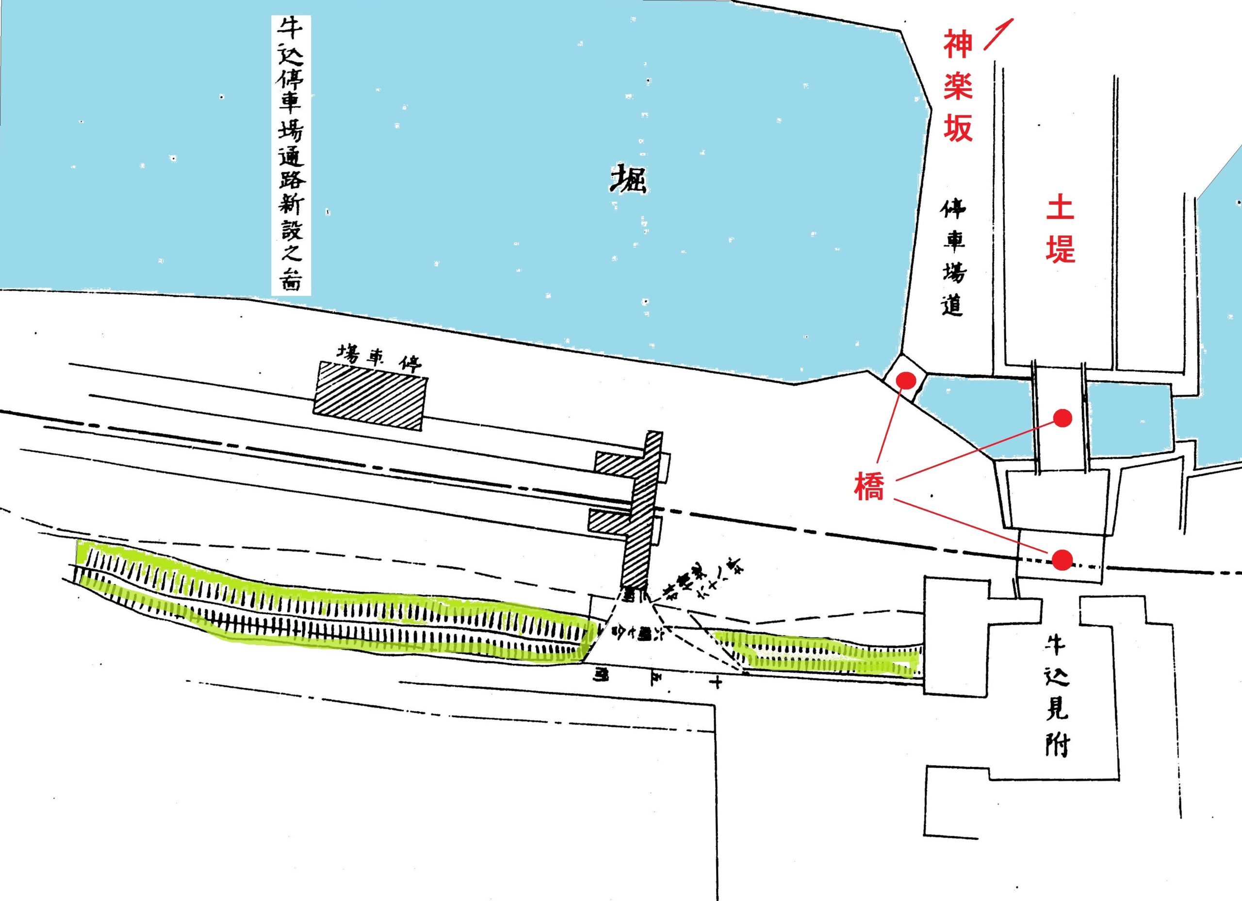
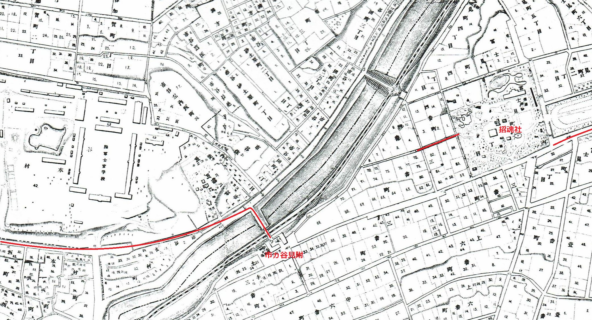
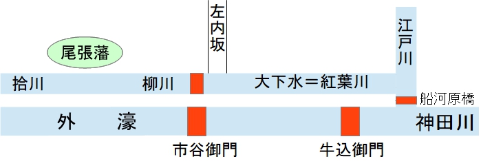
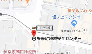
| 待てども来らず 磯村は、麗子の電話をきくと、先づ驚駭した。しかし、麗子がそれほど思ひ切つた態度に出てくれたと思ふと、急に自分も勇気が湧いて来た。(麗子さんが、そんな大決心をしてくれる以上、俺もどんなことでもやるぞ)彼はさう、心に誓ふと電話室を飛び出して、自分の部屋へ帰つた。そして、袴をはいて帽子を被ると、寄宿舎の門を出て、砂土原町の坂を牛込のお濠端へと馳け下つた。 彼は、牛込見附の橋を渡つて、飯田橋駅の前へ出た。お濠端を通つてゐるとき、麗子の姿が、駅の入口の中央の鏡を入れた壁の前辺りに見えないかと注意したが見えなかつた。牛込見附の土橋の上を登り切つて、駅の前に立つたが、麗子の姿は見えなかつた。磯村は、省線に乗つたことは、一二度しかなく、この頃省線の駅が改築され、飯田橋駅は、牛込見附と飯田橋との両方に入口があることを知らなかつた。まして、麗子が牛込見附ではない、飯田橋の方の入口に自分を待つて居ようとは夢にも思ひ及ばなかつた。 (あ、麗子さんは、その辺りで何か買物でもしてゐるんたな) さう思つて、麗子がひょつくり現はれるのを待つてゐた。 |
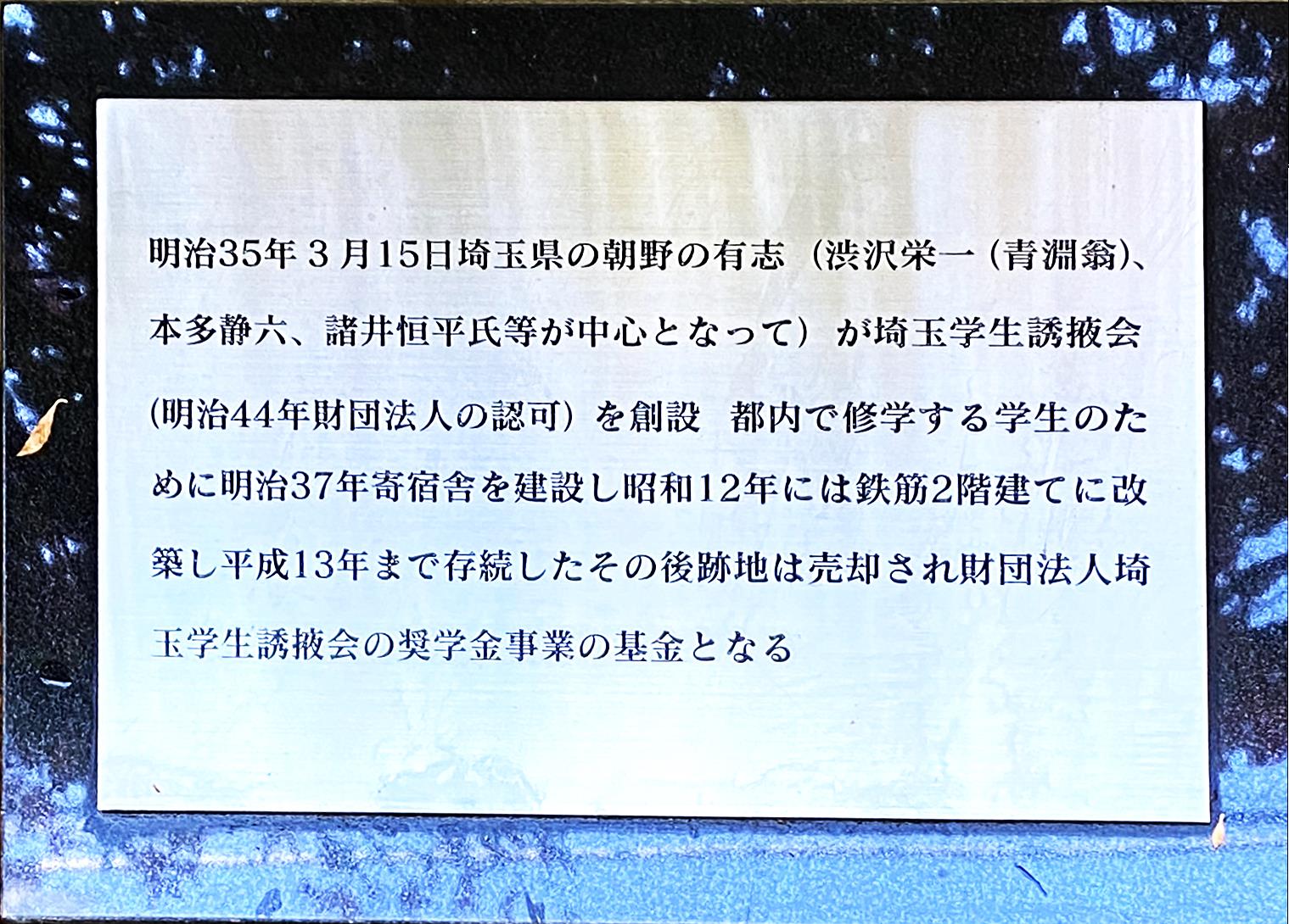
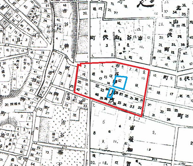
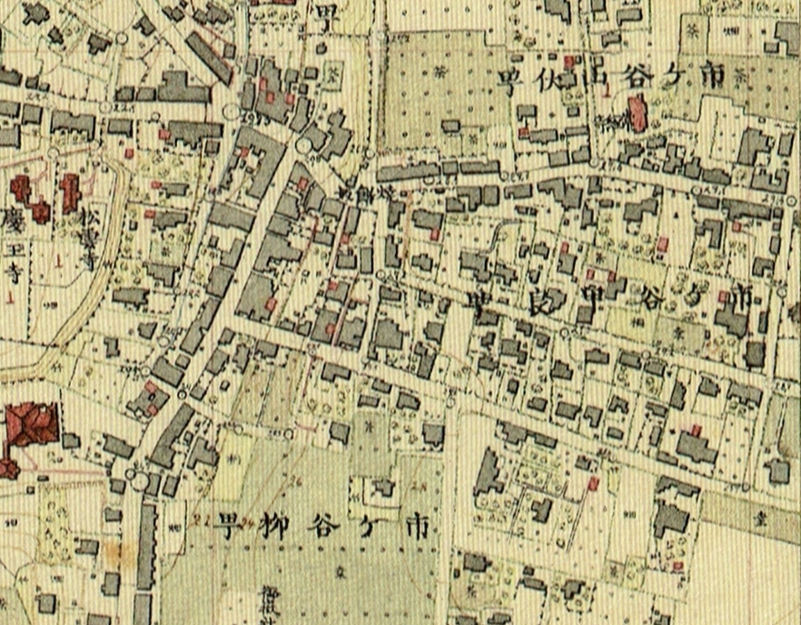
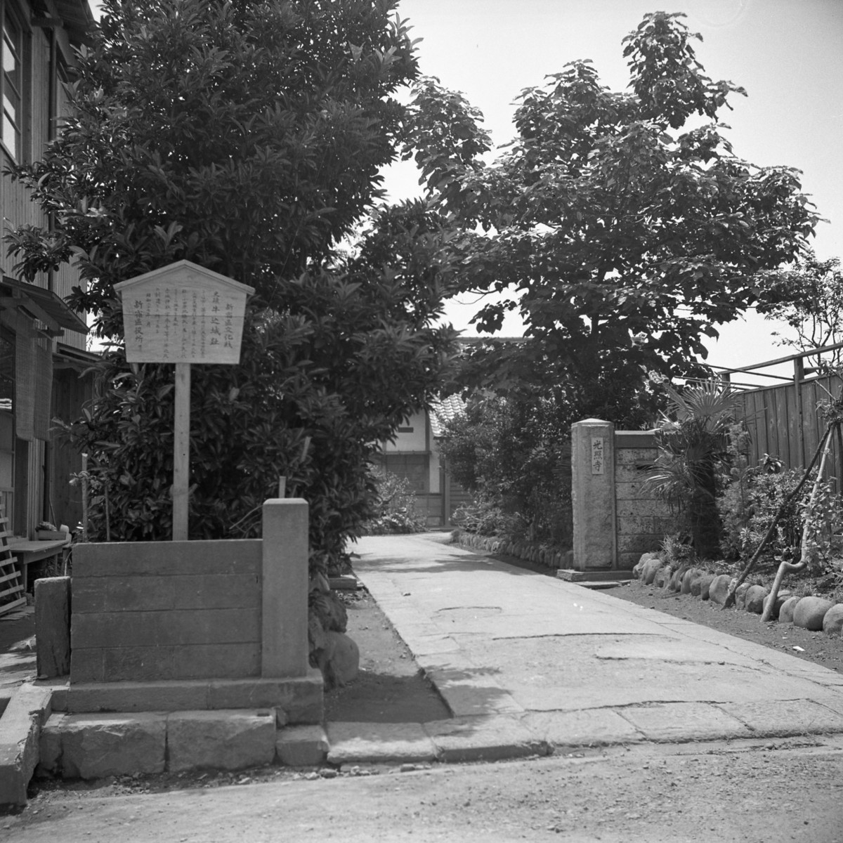
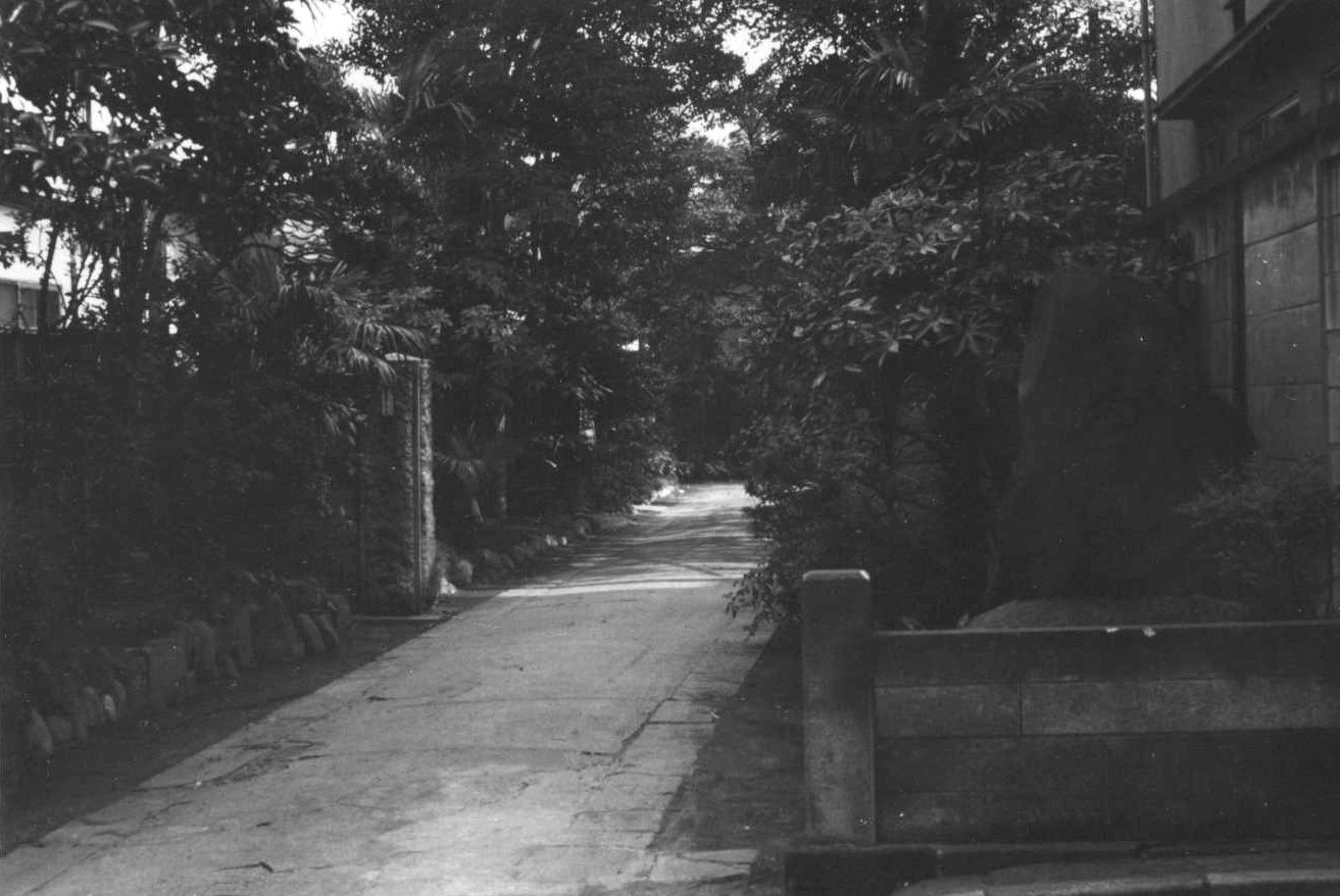
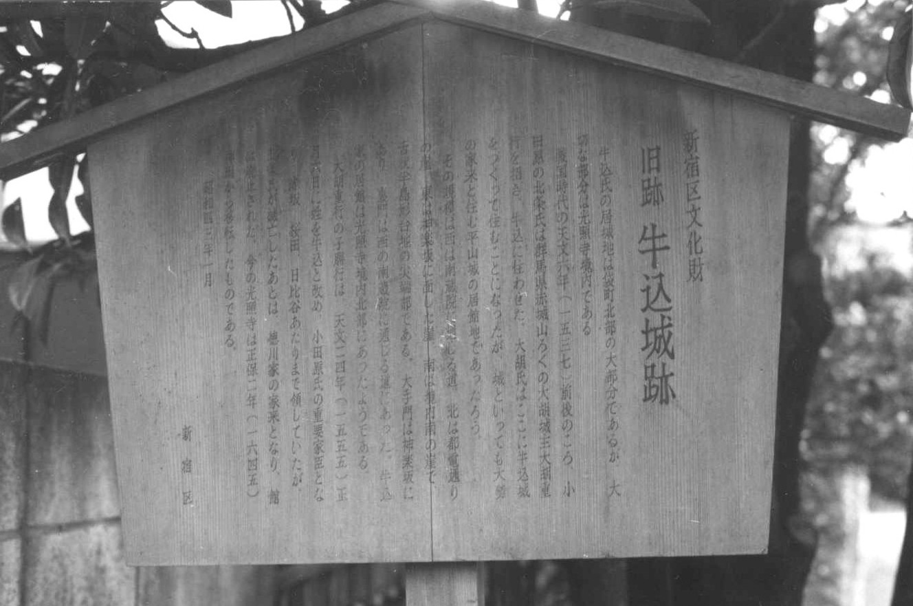
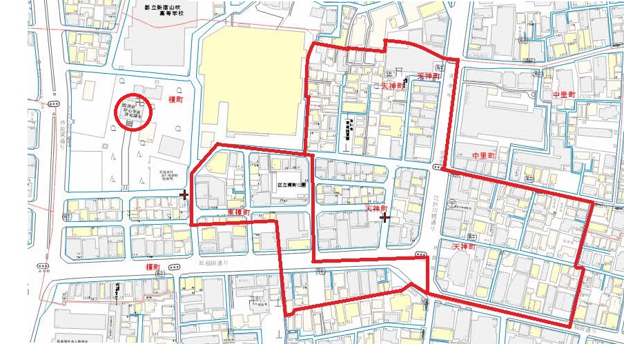
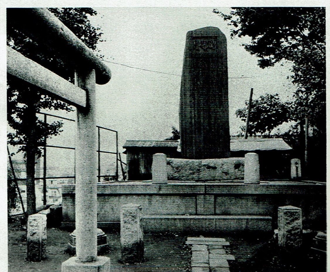
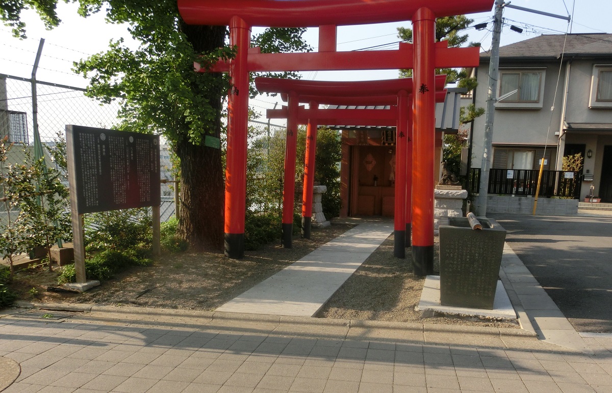
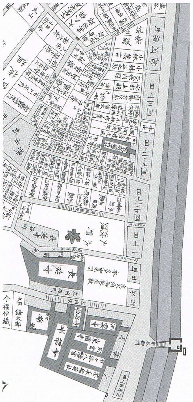
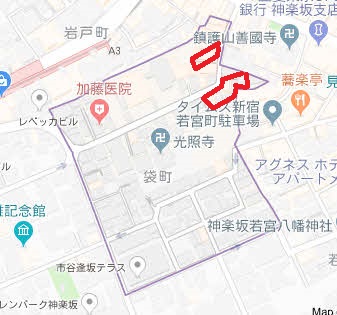
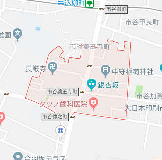
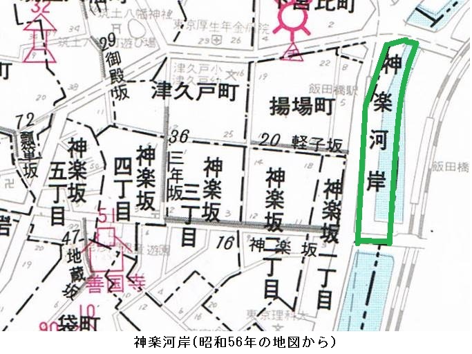
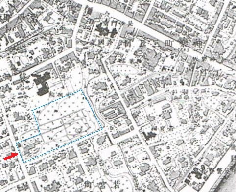
寄宿舎 この寄宿舎は「門を出て、砂土原町の坂」を下るとお濠に出る場所だといいます。これは埼玉学生誘掖会でしょう。これは1902(明治35)年、渋沢栄一氏らが発起人になって創立。埼玉県出身の学生を支援し、砂土原町3丁目21の寄宿舎の運営と奨学金の貸与を行いました。誘掖は「導いて助けること」。しかし、寄宿舎は減少する入寮者と老朽化で2001年3月末をもって取り壊し、跡地はマンションに。
碑文 埼玉学生誘掖会
埼玉学生誘掖会
| 明治35年3月15日埼玉県の朝野の有志(渋沢栄一(青淵爺)、本多静六、諸井恒平氏等が中心となって)が埼玉学生誘掖会(明治44年財団法人の認可)を創設 都内で修学する学生のために明治37年寄宿舎を建設し昭和12年には鉄筋2階建てに改築し平成13まで存続した その後跡地は売却され財団法人埼玉学生誘掖会の奨学金事業の基金となる |
砂土原町 市谷砂土原町一丁目から市谷砂土原町三丁目。本多佐渡守正信の別邸があって「佐渡原」と呼び、富裕層が多く住み、高級住宅街です。
坂 おそらく逢坂でしょう。
土橋 つちはし。どばし。木などを組んでつくった上に土をおおいかけた橋
両方に入口 昭和3年11月15日、牛込見附と飯田橋との両方に入口がある飯田橋駅が開業。同時に牛込駅は廃止。

 娯んで 楽しい、愉しい、娯しい、たのしい。